Strong Storms Continue Across South Alabama; Dry Tomorrow
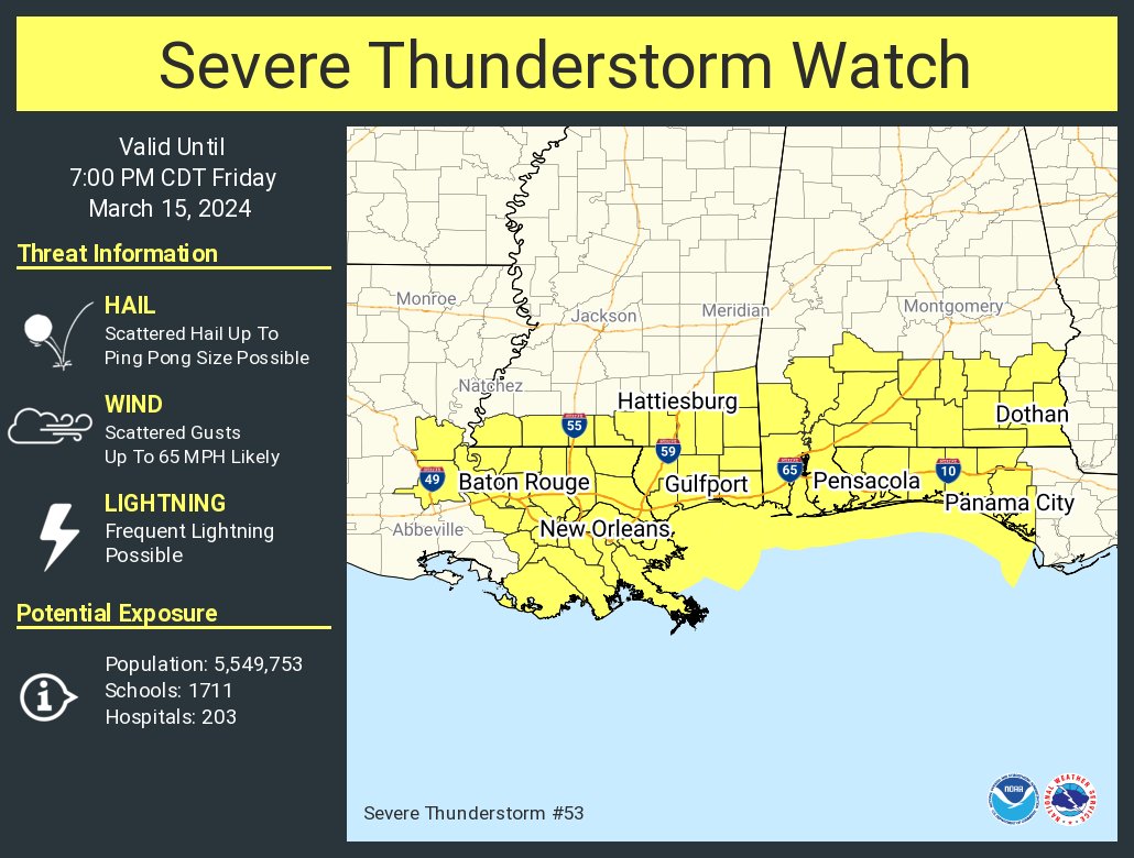
RADAR CHECK: Rain and strong thunderstorms continue to push through South Alabama this afternoon; heavier storms there are capable of producing hail and strong winds. A severe thunderstorm watch is in effect for the southern third of the state until 7p CT.
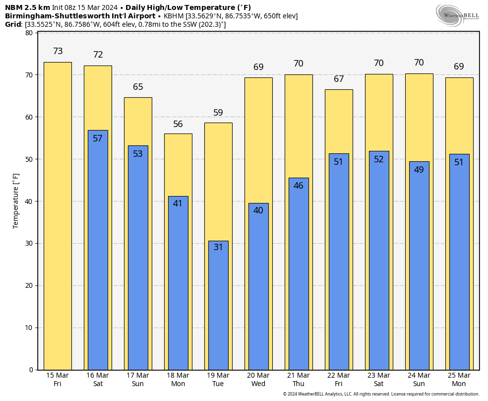
THE ALABAMA WEEKEND: Most of the state will be rain-free tomorrow with potential for some sun; the high will be in the low 70s. Showers return Sunday, with potential for a few stronger thunderstorms near the Gulf Coast. It won’t rain all day Sunday, and rain amounts will be under 1/2 inch.
NEXT WEEK: Dry and colder air arrives Monday, and another late season freeze is likely by daybreak Tuesday morning over the northern half of the state, with lows in the 25-32 degree range likely. Frost is possible down into South Alabama. Showers will likely return Thursday night or Friday; for now it doesn’t look like a severe thunderstorm situation. See the video briefing for maps, graphics, and more details.
ON THIS DATE IN 1938: A tornado hit McPaul, Iowa, while moving from southeast to northwest. Another tornado raced through Batesville, Illinois, at 60 to 65 mph. Another tornado causing F4 damage killed 10 and injured 12 in St. Clair County, Missouri. This tornado was part of an outbreak that produced four different tornadoes and was responsible for 11 deaths and 42 injuries.
Look for my next video briefing here by 6:00 a.m. Monday… enjoy the weekend!
Category: Alabama's Weather, ALL POSTS, Weather Xtreme Videos
About the Author (Author Profile)
James Spann is one of the most recognized and trusted television meteorologists in the industry. He holds the AMS CCM designation and television seals from the AMS and NWA. He is a past winner of the Broadcast Meteorologist of the Year from both professional organizations.Subscribe
If you enjoyed this article, subscribe to receive more just like it.


