Radar and Weather Update at 230 pm
A mesoscale convective system, or complex of thunderstorms, is moving northeast across South Alabama and the Florida Panhandle this afternoon.
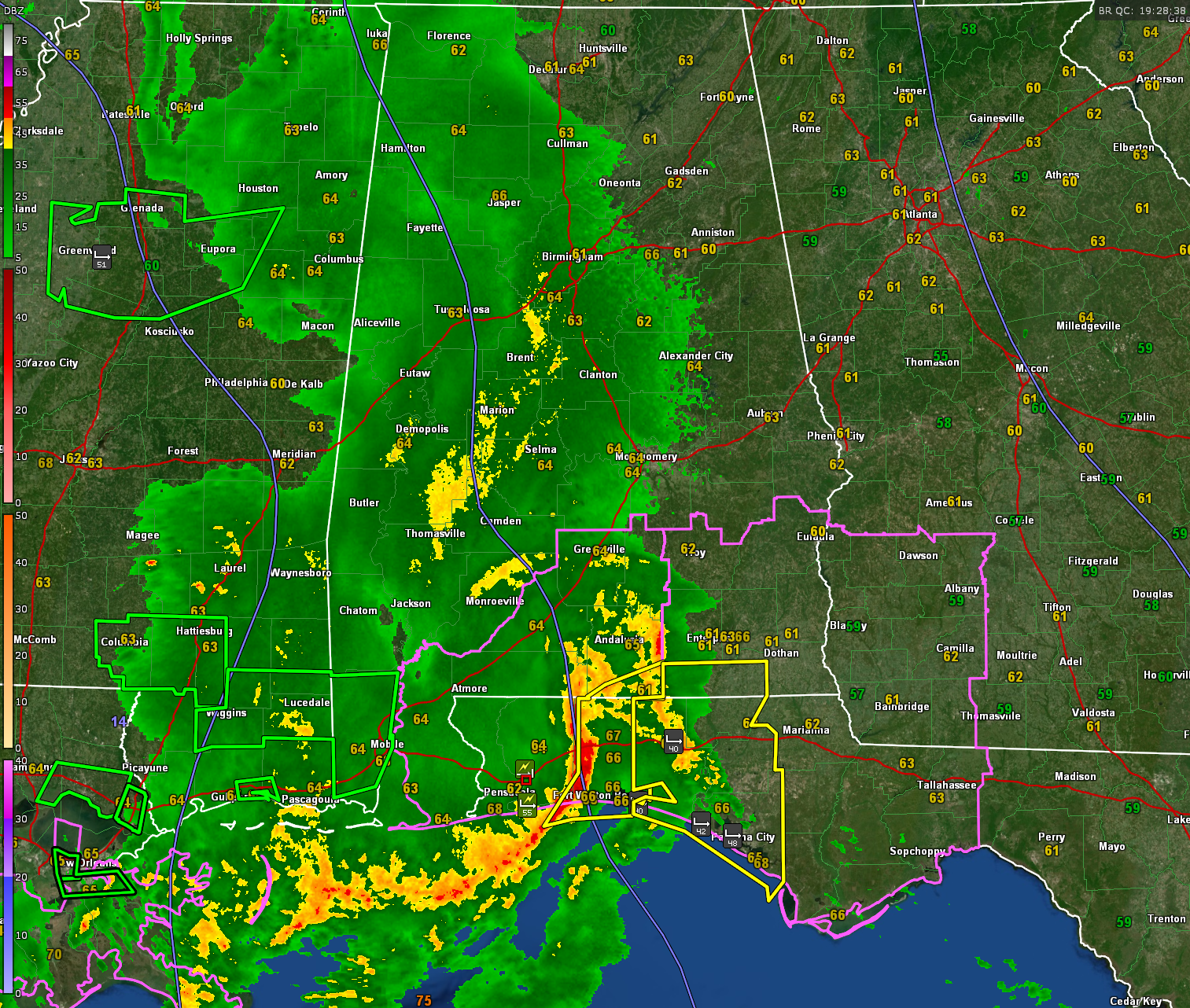
A bow echo is located from near Brewton to east of Milton to Navarre Beach. Strong winds are occurring with this line of storms. Winds just gusted to 55 mph at Oriole Beach in Santa Rosa County, Florida. Even out ahead of the line, winds just gusted to 42 mph in Bay County near Sunnyside.
At Destin, southeasterly winds are averaging 30 gusting to 40 mph. Fort Walton is gusting to 40 mph.
The NWS in Mobile has a severe thunderstorm warning for parts of Escambia and Covington Counties in Alabama and parts of Okaloosa, Santa Rosa, and Escambia Counties in Florida. A new severe thunderstorm warning just came out for Geneva (AL), and Bay, Walton, Holmes, and Washington in NW Florida.
Damaging winds are likely along this bow echo as it moves east at 35-40 mph. It should be out of southeastern Alabama by 630 pm and over to Tallahassee in the Panhandle a short time after that.
There could also be a tornado or two along the apex of the bow. A tornado watch is in effect until 5 pm CDT for South Alabama, the Florida Panhandle and southwestern Georgia. That watch extends as far north as Butler, Crenshaw, Pike, and Barbour Counties in Alabama. It goes until 5 pm for Butler and Crenshaw counties south and west and until 8 pm CDT for southeastern Alabama. Lowndes County was just cleared from the watch.
Across the rest of Central Alabama. moderate to heavy rain covers much of this region of the state, with moderate rain over Northwest Alabama.
There is some lightning across the Central part of the state, but severe weather does not look likely. There is just insufficient instability in the rain cooled airmass with lower dewpoints.
Additional rain and storms will cross south and southeastern Alabama through the evening. Some of these could be strong to severe this evening in southeastern Alabama.
Additional rain and storms will form over western and Northwestern Alabama tonight, spreading across the state ahead of a cold front. But this activity will not be severe either.
Winds will gust to 40-50 mph across Alabama outside of thunderstorms as a wake low forms on the back of the area of precipitation. Winds just gusted to 51 mph at Greenwood MS.
Flash flood watches remain in effect for the southwestern two thirds of Alabama through tonight.
We will continue to monitor the situation through the afternoon and overnight.
Category: Alabama's Weather, ALL POSTS, Severe Weather
About the Author (Author Profile)
Bill Murray is the President of The Weather Factory. He is the site's official weather historian and a weekend forecaster. He also anchors the site's severe weather coverage. Bill Murray is the proud holder of National Weather Association Digital Seal #0001 @wxhistorianSubscribe
If you enjoyed this article, subscribe to receive more just like it.


