Midday Nowcast: Quiet, Late April Weather
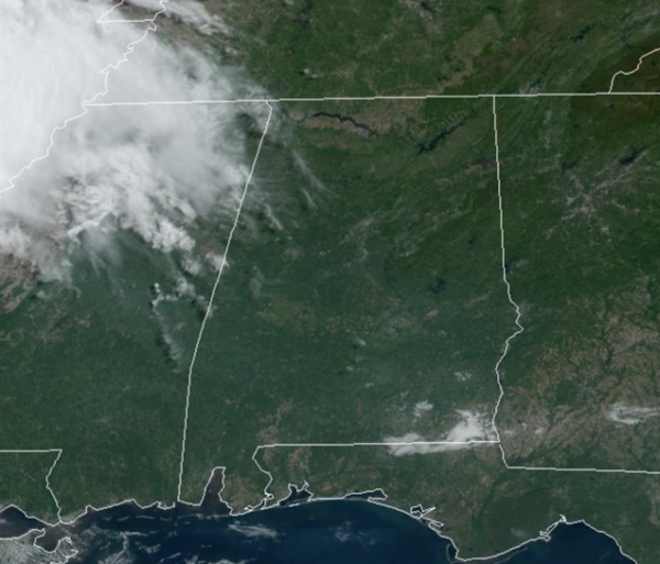
TODAY/TOMORROW: It has been mainly sunny through the morning hours across Alabama, but we are stating to see some clouds increase from the west. For the rest of today, expect a mix of sun and clouds with afternoon highs in the low 80s. Rain chances are very low, but not zero, so a stray shower or two is possible. Tomorrow will be a near repeat of today, expect generally sunny conditions with highs in the low to mid 80s.
BIRMINGHAM ALMANAC: For April 22nd, the average high for Birmingham is 77° and the average low is 55°. The record high is 88° set in 2009, while the record low is 33° set in 1910. We average 0.17” of precipitation on this date, and the record value is 2.10” set in 1980.
ACROSS THE USA: Severe thunderstorms, excessive rainfall, critical fire weather are all in the outlook today and into this last weekend of April. Very large hail, severe wind gusts, and a couple strong tornadoes will all be possible across the central and southern Plains today. Flash flooding also possible for portions of the Plains and Mississippi Valley. Critical fire weather conditions for Southern High Plains.
WARM WEEKEND WEATHER: The weather stays warm and generally dry through the weekend with partly sunny days and highs in the low to upper 80s across the state. Rain chances are not zero through the weekend, but generally less than 10% both days.
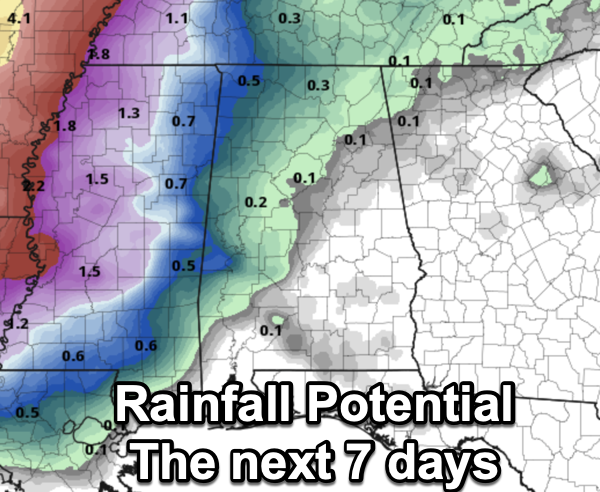
NEXT WEEK: A weakening front will bring the chance of showers to Alabama Monday, and possibly Tuesday, but severe storms are not expected with the main dynamic support passing far to the north. The weather looks dry Wednesday through Friday and the week will be warm with highs in the 80s. Still no sign of any high impact weather event (flooding, severe storms, etc) for Alabama for the next seven to ten days and let’s be extremely thankful for that. Rainfall potential the next seven days across Alabama, is near zero for most of the state.
BEACH FORECAST CENTER: Get the latest weather and rip current forecasts for the beaches from Fort Morgan to Panama City on our Beach Forecast Center page. There, you can select the forecast of the region that you are interested in visiting.
WORLD TEMPERATURE EXTREMES: Over the last 24 hours, the highest observation outside the U.S. was 117.0F at Tillabery, Niger. The lowest observation was -96.7F at Concordia, Antarctica.
CONTIGUOUS TEMPERATURE EXTREMES: Over the last 24 hours, the highest observation was 103F at Castolon, TX. The lowest observation was 1F at Mount Washington, NH.
Category: Alabama's Weather, ALL POSTS
About the Author (Author Profile)
Macon, Georgia Television Chief Meteorologist, Birmingham native, and long time Contributor on AlabamaWX. Stormchaser. I did not choose Weather, it chose Me. College Football Fanatic. @Ryan_StinnetSubscribe
If you enjoyed this article, subscribe to receive more just like it.


