EXPIRED Severe T-Storm Warning — Parts of Clount, Cherokee, Etowah Co. Until 5:15 am
The National Weather Service in Birmingham has issued a Severe Thunderstorm Warning for Eastern Blount County, Etowah County, and Cherokee County in central and northeastern Alabama. This warning is in effect until 5:15 AM CDT.
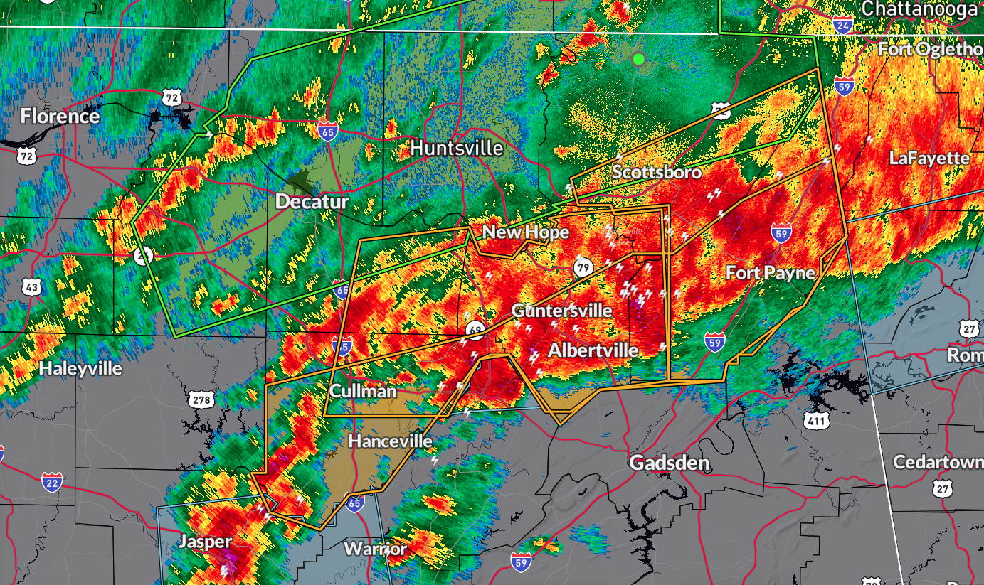
At 4:12 AM CDT, severe thunderstorms were located along a line extending from 8 miles northeast of Little River Falls to near Holly Pond, moving southeast at 40 mph. The hazard includes 60 mph wind gusts and quarter-size hail, with the source being radar indicated. The impact of these storms is expected to cause hail damage to vehicles and wind damage to roofs, siding, and trees.
Locations impacted by these severe thunderstorms include Gadsden, Rainbow City, Oneonta, Attalla, Hokes Bluff, Centre, Cedar Bluff, Blountsville, Cleveland, Little River Canyon National Preserve, Forney, Centre Municipal Airport, Glencoe, Sardis City, Steele, Leesburg, Altoona, Snead, Susan Moore, and Walnut Grove.
PRECAUTIONARY/PREPAREDNESS ACTIONS:
Move to an interior room on the lowest floor of a building for your protection.
Category: Alabama's Weather, ALL POSTS, Severe Weather
About the Author (Author Profile)
Scott Martin is an operational meteorologist, professional graphic artist, musician, husband, and father. Not only is Scott a member of the National Weather Association, but he is also the Central Alabama Chapter of the NWA president. Scott is also the co-founder of Racecast Weather, which provides forecasts for many racing series across the USA. He also supplies forecasts for the BassMaster Elite Series events including the BassMaster Classic.Subscribe
If you enjoyed this article, subscribe to receive more just like it.


