Storms Becoming More Numerous In Coming Days; Not As Hot
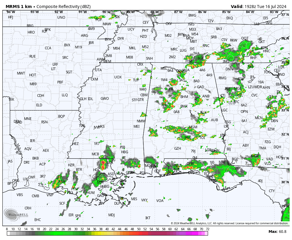
RADAR CHECK: We have another day of scattered summer soakers across Alabama. Storms are producing very heavy rain, frequent lighting, and gusty winds as they move to the east. Where rain is falling temperatures are in the 70s and 80s, away from the storms we have low to mid 90s. Showers and storms will fade late tonight after sunset.
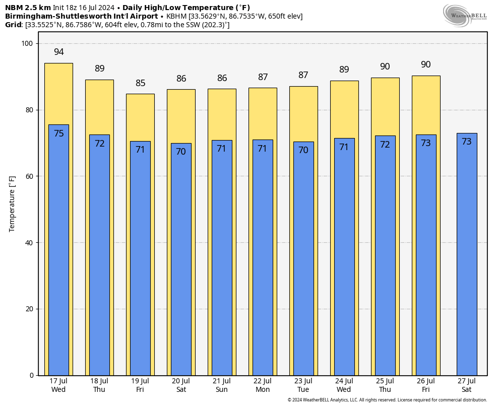
Scattered showers and storms will become more numerous tomorrow and Thursday as the ridge continues to weaken over the Deep South. Heat levels will trend lower with highs in the low 90s in most places tomorrow, followed by upper 80s Thursday.
FRIDAY AND THE WEEKEND: A relatively wet, unsettled pattern is setting up for Alabama on these three days with occasional showers and thunderstorms likely. Not a total wash-out, but rain is likely at times with a few downpours involved. Beneficial rain is a good possibility, and daytime temperatures will be well below average with highs only in the mid 80s.
NEXT WEEK: The pattern won’t change much; we expect numerous showers and thunderstorms on daily basis with highs only in the mid to upper 80s on most days. While rain distribution on summer days is always not very even, average rain amounts for the next 7 days will be in the 2-3 inch range. No sign of any excessive heat issues (upper 90s or triple digits) for the rest of July… See the video briefing for maps, graphics, and more details.
TROPICS: The Atlantic basin remains very quiet, and tropical storm formation is not expected for at least the next seven days.
ON THIS DATE IN 1979: The most damaging tornado in Wyoming history touched down 3 miles west-northwest of the Cheyenne airport. This strong tornado moved east or east-southeast across the northern part of Cheyenne, causing $22 million in damage and one fatality.
ON THIS DATE IN 1997: – A tropical depression developed south of the Louisiana coast on July 16, 1997. This depression would later become Hurricane Danny, making landfall on the Alabama coast just after midnight on July 18.
Look for the next video briefing here by 6:00 a.m. tomorrow…
Category: Alabama's Weather, ALL POSTS, Weather Xtreme Videos
About the Author (Author Profile)
James Spann is one of the most recognized and trusted television meteorologists in the industry. He holds the AMS CCM designation and television seals from the AMS and NWA. He is a past winner of the Broadcast Meteorologist of the Year from both professional organizations.Subscribe
If you enjoyed this article, subscribe to receive more just like it.


