1245pm CDT: Severe Weather Update
This line of storms from east of Ider to Rainsville down to Albertville continues to produce damaging winds. There have been numerous reports of trees and power lines down. One of those reports from emergency management in Jackson County: Two large trees downed on County Rd 67 near Langston.
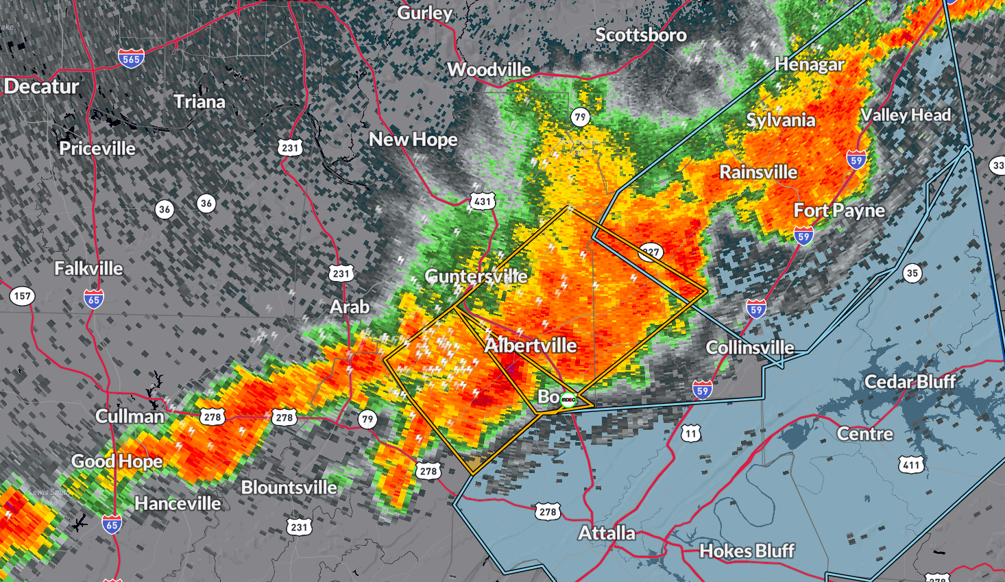
Here are the latest warnings as of 1245pm CDT from the NWS Huntsville:
…A SEVERE THUNDERSTORM WARNING REMAINS IN EFFECT UNTIL 100 PM CDT
FOR SOUTHEASTERN MARSHALL AND SOUTHWESTERN DEKALB COUNTIES…
At 1243 PM CDT, a severe thunderstorm was located near Albertville,
moving southeast at 30 mph.
HAZARD…60 mph wind gusts and quarter size hail.
SOURCE…Trained weather spotters.
IMPACT…Hail damage to vehicles is expected. Expect wind damage to
roofs, siding, and trees.
Locations impacted include…
Albertville, Boaz, Guntersville, Crossville, Geraldine, McVille,
Hopewell, Skirum, Lake Guntersville St Park, and Hustleville.
* Severe Thunderstorm Warning for…
Southeastern Marshall County in northeastern Alabama…
* Until 115 PM CDT.
* At 1240 PM CDT, a severe thunderstorm was located near McLarty, or
near Albertville, moving southeast at 30 mph.
HAZARD…60 mph wind gusts and quarter size hail.
SOURCE…Radar indicated.
IMPACT…Hail damage to vehicles is expected. Expect wind damage
to roofs, siding, and trees.
* Locations impacted include…
Albertville, Boaz, Guntersville, Douglas, High Point, Horton, and
Hyatt.
Category: Alabama's Weather, ALL POSTS, Severe Weather
About the Author (Author Profile)
Owner of Tornado Talk. Radio broadcast meteorologist with The Storm Report. WeatherBrains Panelist. B.S. Meteorology from Penn State University.Subscribe
If you enjoyed this article, subscribe to receive more just like it.


