Severe Thunderstorm Warning for portions of Calhoun, Etowah and St. Clair Counties until 230pm CDT
A severe thunderstorm was located over Rainbow City moving east at 25 mph. 60 mph winds possible. This is radar indicated. Please be weather aware. The line of storms pushing through have had a history of producing tree damage and downing power lines.
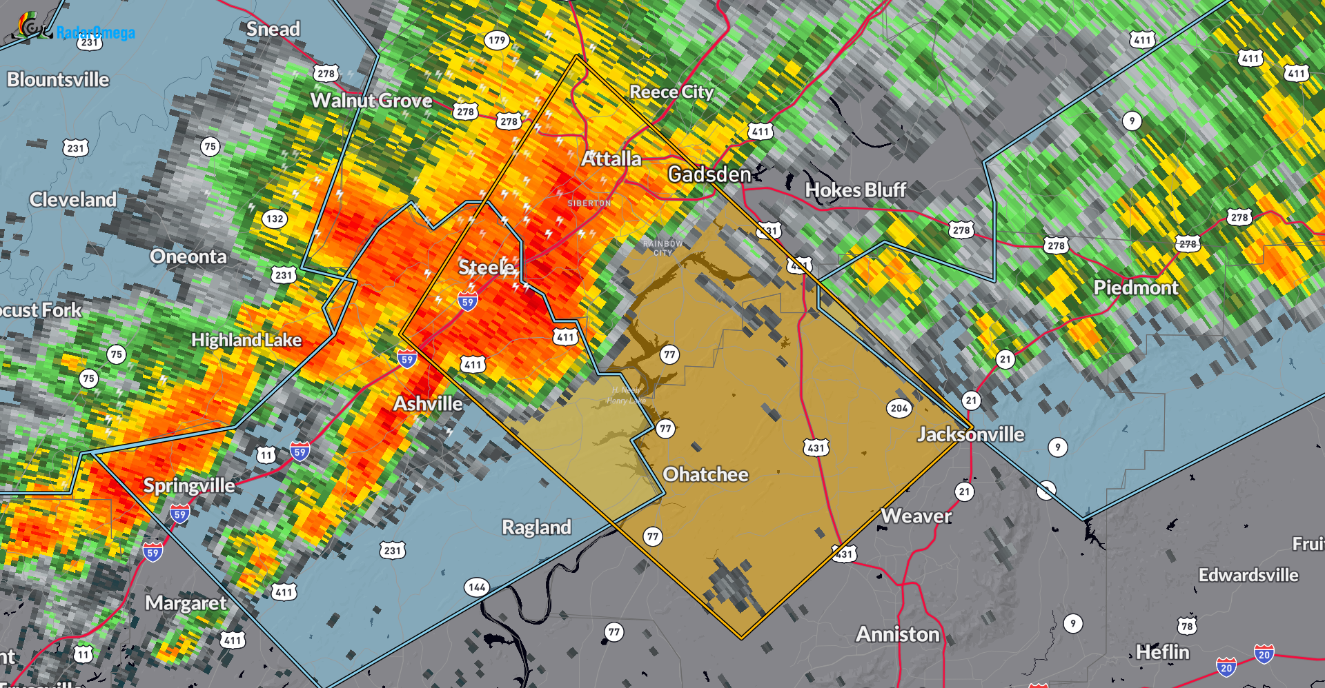
The National Weather Service in Birmingham has issued a
* Severe Thunderstorm Warning for…
Northwestern Calhoun County in east central Alabama…
South central Etowah County in northeastern Alabama…
Northeastern St. Clair County in central Alabama…
* Until 230 PM CDT.
* At 147 PM CDT, a severe thunderstorm was located over Rainbow City,
moving southeast at 25 mph.
HAZARD…60 mph wind gusts.
SOURCE…Radar indicated.
IMPACT…Expect damage to roofs, siding, and trees.
* Locations impacted include…
Gadsden, Jacksonville, Rainbow City, Attalla, Saks, Glencoe,
Weaver, Ashville, Ragland, Ohatchee, Steele, Reece City,
Alexandria, Jacksonville State University, Gadsden Mall, Neely
Henry Lake, Southside, Alabama International Dragway, Rockledge,
and Cobb City.
Category: Alabama's Weather, ALL POSTS, Severe Weather
About the Author (Author Profile)
Owner of Tornado Talk. Radio broadcast meteorologist with The Storm Report. WeatherBrains Panelist. B.S. Meteorology from Penn State University.Subscribe
If you enjoyed this article, subscribe to receive more just like it.


