Severe Thunderstorm Warning until 3pm CDT for portions of Talladega, Calhoun and St. Clair Counties
Emergency management has observed damaging winds with this cluster of storms pressing from Pell City to Anniston. Multiple reports of trees down. The storms are moving to the southeast at 30mph. Please stay indoors, away from winds until these storm pass on.
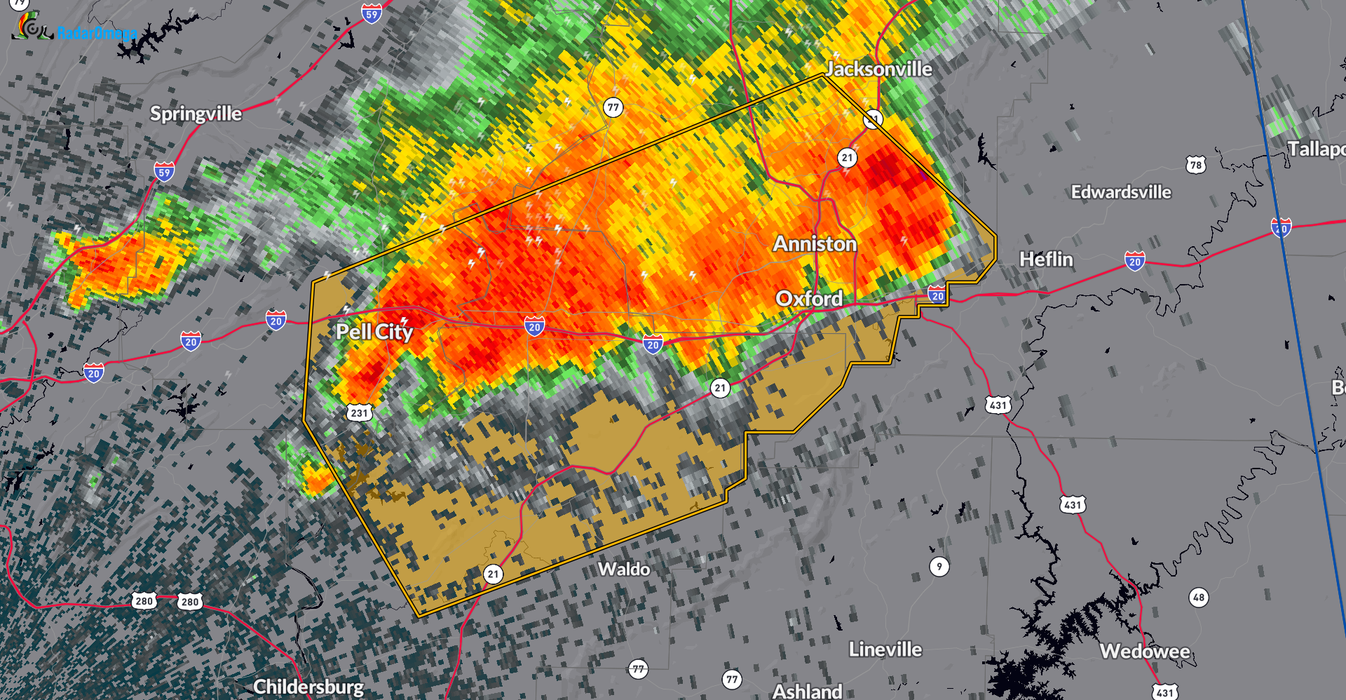
...A SEVERE THUNDERSTORM WARNING REMAINS IN EFFECT UNTIL 300 PM CDT
FOR NORTHEASTERN TALLADEGA...SOUTHERN CALHOUN AND SOUTHEASTERN ST.
CLAIR COUNTIES...

At 237 PM CDT, severe thunderstorms were located along a line
extending from Fort McClellan to Talladega Municipal Airport to near
Pell City, moving southeast at 30 mph.

HAZARD...60 mph wind gusts.

SOURCE...Emergency management.

IMPACT...Expect damage to roofs, siding, and trees.

Locations impacted include...
Anniston, Oxford, Talladega, Pell City, Cobb Town, West End-Cobb
Town, Fort McClellan, Saks, Lincoln, Weaver, Riverside, Munford,
Hobson City, Waldo, Alpine Bay Resort, Talladega Superspeedway,
Anniston Regional Airport, Blue Mountain, Harrisburg, and Alexandria.
Category: Alabama's Weather, ALL POSTS, Severe Weather
About the Author (Author Profile)
Owner of Tornado Talk. Radio broadcast meteorologist with The Storm Report. WeatherBrains Panelist. B.S. Meteorology from Penn State University.Subscribe
If you enjoyed this article, subscribe to receive more just like it.


