7pm CDT Tropical Update: Disturbance looking better organized…
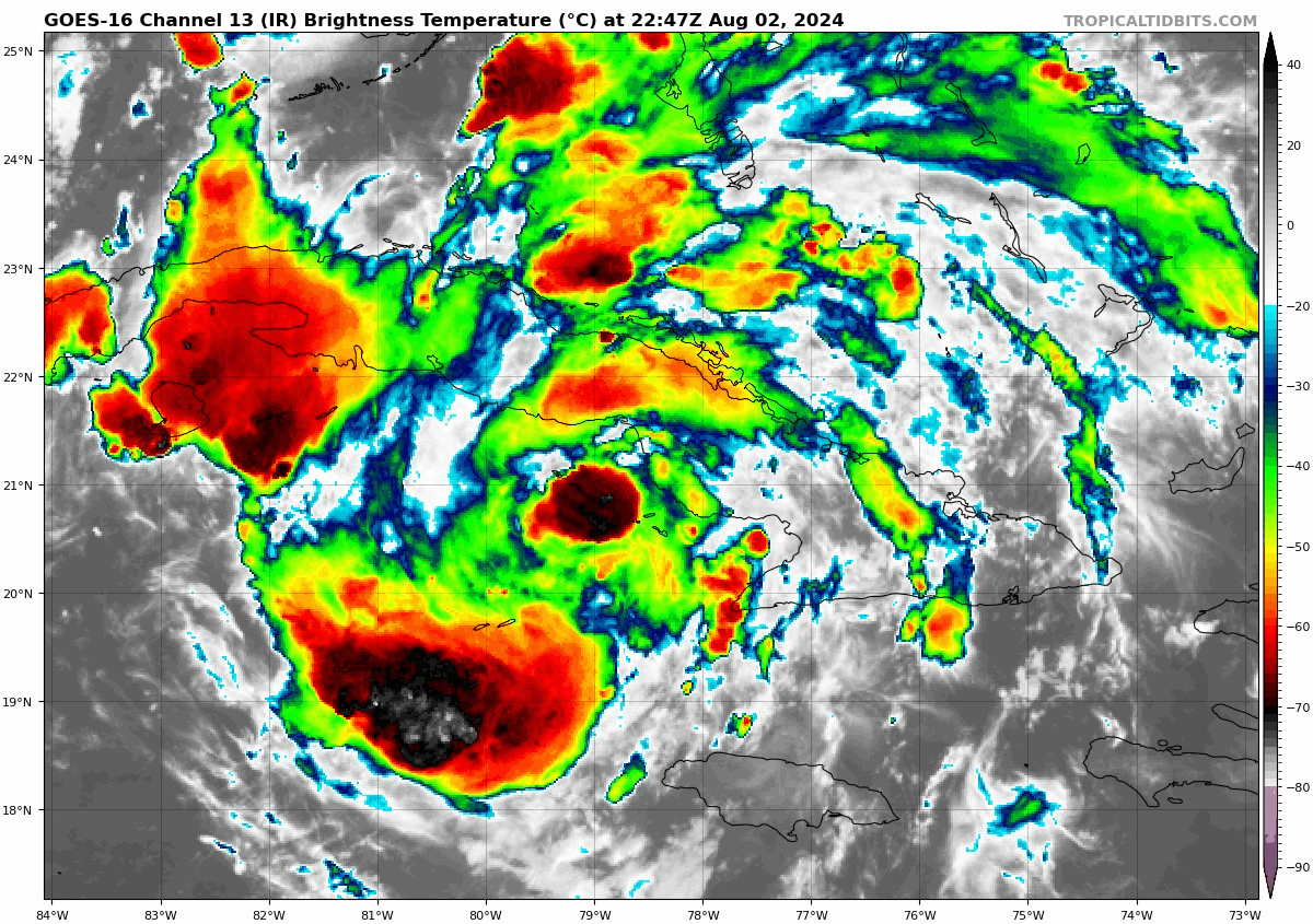
Infrared Satellite Image of Potential Tropical Cyclone Four via Tropical Tidbits:
———————————————-
Here is the Latest from the National Hurricane Center on the Potential Tropical Cyclone….
SUMMARY OF 800 PM EDT…0000 UTC…INFORMATION
———————————————-
LOCATION…21.4N 78.9W
ABOUT 70 MI…110 KM W OF CAMAGUEY CUBA
ABOUT 285 MI…460 KM SE OF KEY WEST FLORIDA
MAXIMUM SUSTAINED WINDS…30 MPH…45 KM/H
PRESENT MOVEMENT…WNW OR 290 DEGREES AT 16 MPH…26 KM/H
MINIMUM CENTRAL PRESSURE…1010 MB…29.82 INCHES
———————————————-
No changes in the advisories for Florida from the 4pm CDT update. The system is still crossing Cuba causing squally weather. It is moving to the west-northwest at 16 mph. A project turn to the northwest with a slower speed is still forecast and that will occur tonight into Saturday. On Sunday, more of a north track should begin.
This wave could strengthen to a tropical depression tonight or early Saturday. We may have Tropical Storm Debby by Saturday night once the system hits the very warm waters of the Florida Straits.
This will be a huge rainmaker for especially the Florida Peninsula. The combination of storm surge and tide will cause
normally dry areas near the coast to be flooded by rising waters moving inland from the shoreline. Water heights could range from 2-4 feet for places like Tampa Bay and Charlotte Harbor.
The bigger NHC update will be out at 10pm CDT and we will pass that your way!
Category: Alabama's Weather, ALL POSTS, Tropical
About the Author (Author Profile)
Owner of Tornado Talk. Radio broadcast meteorologist with The Storm Report. WeatherBrains Panelist. B.S. Meteorology from Penn State University.Subscribe
If you enjoyed this article, subscribe to receive more just like it.


