Update at 744pm CDT: Severe Thunderstorm Warning portions of Tuscaloosa, Pickens, Greene and Hale Counties until 8pm CDT
Update 744pm CDT: Pickens County removed from this warning. Continues for Green, Hale and Tuscallosa until 8pm.
——————————-
Original Post:
A line of storms from 8 miles east of Jena to Knoxville to Benevola were sliding southeasterly at 35 mph and have the potential of producing damaging winds to 60mph. Frequent cloud to ground lightning with this line and torrential rain. Another severe storm is trying to move in from Noxubee and Lowndes Counties in MS. That storm over Bigbee Valley is moving southeast at 35 mph as well.
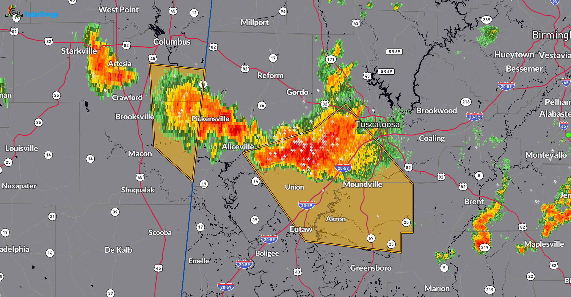
The National Weather Service in Birmingham has issued a
* Severe Thunderstorm Warning for…
Southwestern Tuscaloosa County in west central Alabama…
Southeastern Pickens County in west central Alabama…
Northeastern Greene County in west central Alabama…
Northern Hale County in west central Alabama…
* Until 800 PM CDT.
* At 708 PM CDT, severe thunderstorms were located along a line
extending from 8 miles east of Jena to near Knoxville to near
Benevola, moving southeast at 35 mph.
HAZARD…60 mph wind gusts.
SOURCE…Radar indicated.
IMPACT…Expect damage to roofs, siding, and trees.
* Locations impacted include…
Eutaw, Moundville, Coker, Akron, Union, Benevola, Shelton State
Community College, Wedgeworth, Mantua, Jena, Knoxville, Evansville,
Snoddy, Englewood, Ralph, Little Sandy, Maxwell, Moundville
Airport, Eutaw Municipal Airport, and Fosters Boat Landing.
Category: Alabama's Weather, ALL POSTS, Severe Weather
About the Author (Author Profile)
Owner of Tornado Talk. Radio broadcast meteorologist with The Storm Report. WeatherBrains Panelist. B.S. Meteorology from Penn State University.Subscribe
If you enjoyed this article, subscribe to receive more just like it.


