Updated as of 748pm CDT: Not done in Northern Alabama: Severe Thunderstorm Warning portions of Marshall and Madison Counties until 8pm CDT
Update at 748pm CDT: Madison County has been removed from this warning. Continues for Marshall County until 8pm CDT.
—————————-
Original Post:
A storm near Owens Cross Roads has strengthened and could produce damaging winds to 60 mph. It is moving VERY slowly to the southeast at 10 mph. Nickel size hail also possible. Be weather aware in Arab, Morgan City, Union Grove, Eddy and Columbus City.
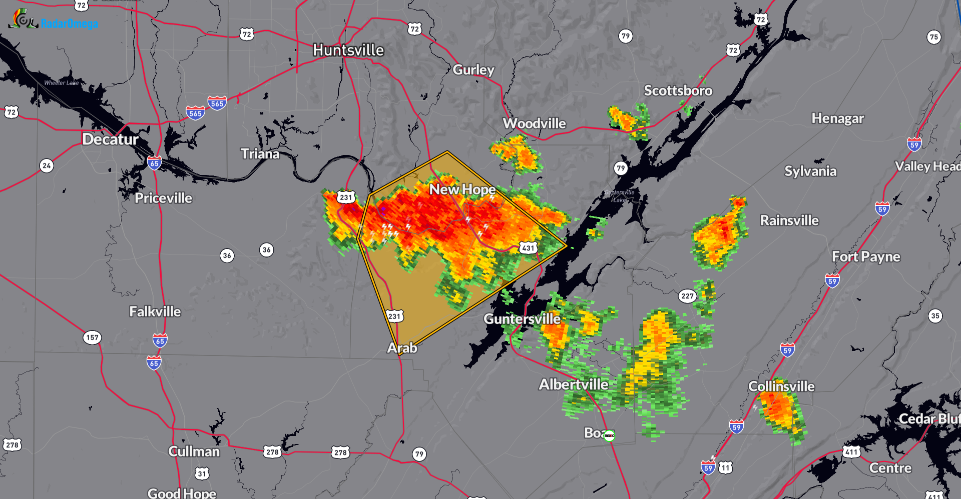
The National Weather Service in Huntsville Alabama has issued a
* Severe Thunderstorm Warning for…
Northwestern Marshall County in northeastern Alabama…
South central Madison County in north central Alabama…
* Until 800 PM CDT.
* At 725 PM CDT, a severe thunderstorm was located near Owens Cross
Roads, or 12 miles north of Arab, moving southeast at 10 mph.
HAZARD…60 mph wind gusts and nickel size hail.
SOURCE…Radar indicated.
IMPACT…Expect damage to roofs, siding, and trees.
* Locations impacted include…
Arab, Owens Cross Roads, Morgan City, Union Grove, Eddy, and
Columbus City.
Category: Alabama's Weather, ALL POSTS, Severe Weather
About the Author (Author Profile)
Owner of Tornado Talk. Radio broadcast meteorologist with The Storm Report. WeatherBrains Panelist. B.S. Meteorology from Penn State University.Subscribe
If you enjoyed this article, subscribe to receive more just like it.


