720am CDT Update: Debby To Rapidly Strengthen; Heavy Rain Swiping the SW FL Coast
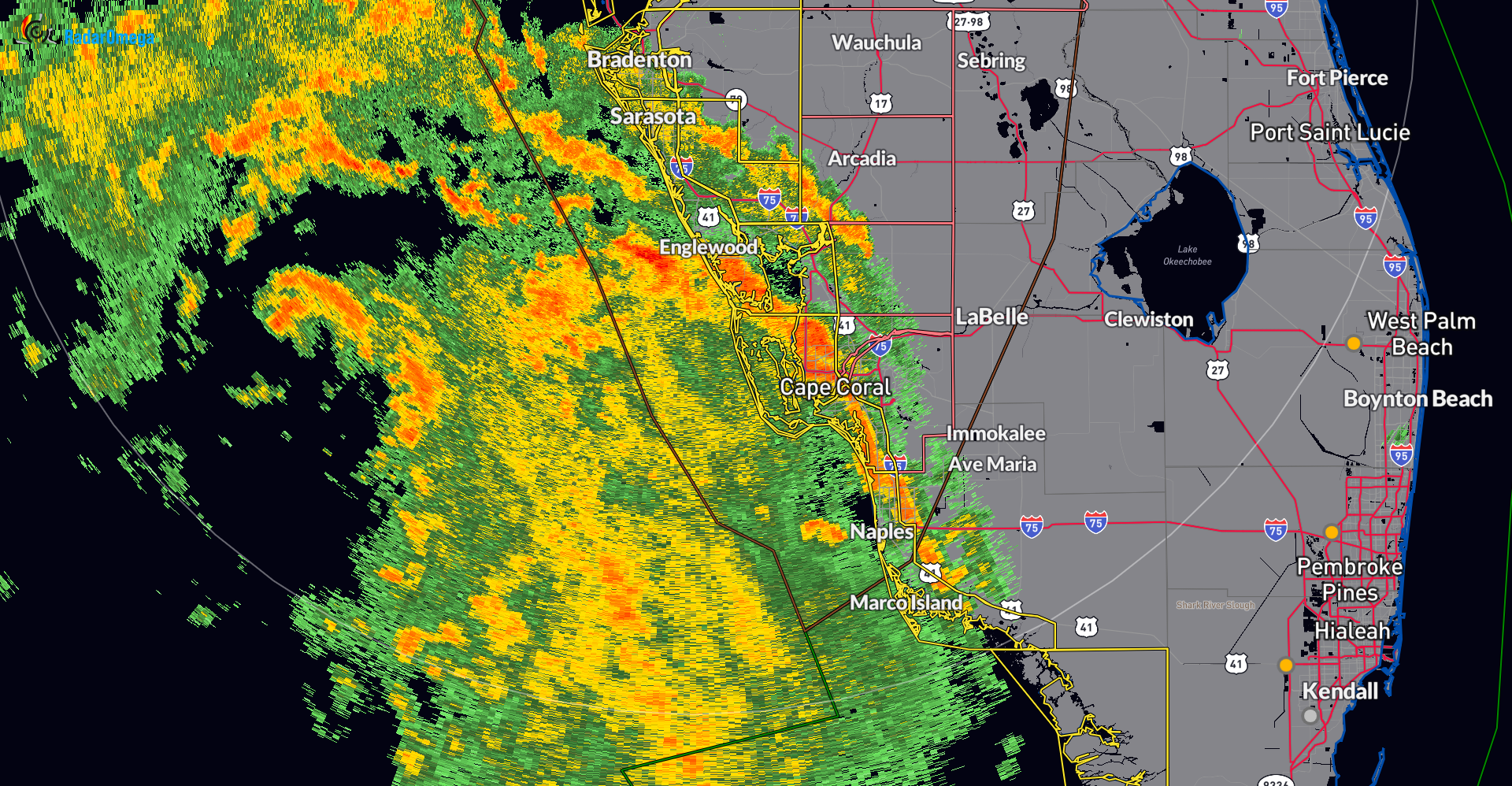
Bands of heavy rain has been occurring along portions of southwest Florida from Marco Island up to Sarasota as Debby continues to move north-northwest.
Feeder bands in East Naples #debby #naplesfl pic.twitter.com/TMk2s3qnHr
— Joey Waves (@joeywaves) August 4, 2024
———————-
Here are the most current stats from the National Hurricane Center as of 7am CDT:
LOCATION…26.3N 84.2W
ABOUT 155 MI…255 KM SW OF TAMPA FLORIDA
ABOUT 205 MI…330 KM SSW OF CEDAR KEY FLORIDA
MAXIMUM SUSTAINED WINDS…60 MPH…95 KM/H
PRESENT MOVEMENT…NNW OR 330 DEGREES AT 13 MPH…20 KM/H
MINIMUM CENTRAL PRESSURE…1001 MB…29.56 INCHES
———————–
One change with the watches and warnings: The Tropical Storm Watch and Storm Surge Watch have been extended northward along the Georgia and South Carolina coast to the South Santee River.
A list of all current watches and warnings found here.
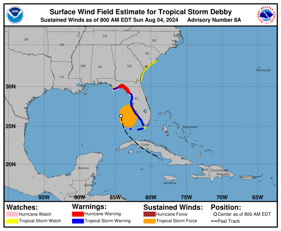
Wind speeds near the center of Debby have increased now to 60 mph with higher gusts. Debby is forecast to become a hurricane tonight before reaching the Florida Big Bend Coast. The current NHC forecast has sustained winds of 90 mph at the time of landfall.
The tropical storm winds are extending about 140 miles from the center of Debby. Reports of gusts over 55 mph across portions of the Florida Keys.
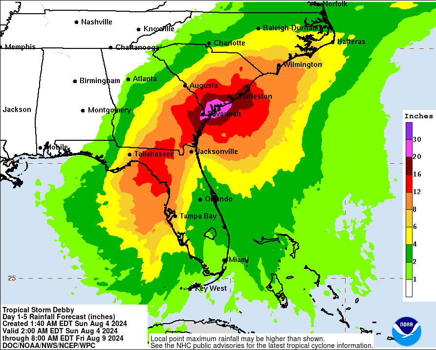
We will be monitoring the progress of Debby throughout its entirety. For today, all eyes on Florida as Debby brings in torrential rains, life threatening storm surge, and the risk of tornadoes. We then turn our attention early next week to north Florida, southeast GA and into South Carolina. A still projected slowing Debby could bring in copious amounts of rain and a huge threat for flooding (possibly historic) to this area. There is the potential of 10-20 inches of rain or more across parts of SE GA and SC through the week.
About the Author (Author Profile)
Owner of Tornado Talk. Radio broadcast meteorologist with The Storm Report. WeatherBrains Panelist. B.S. Meteorology from Penn State University.Subscribe
If you enjoyed this article, subscribe to receive more just like it.


