Morning Notes on Tropical Storm Debby: Max Winds 60 mph
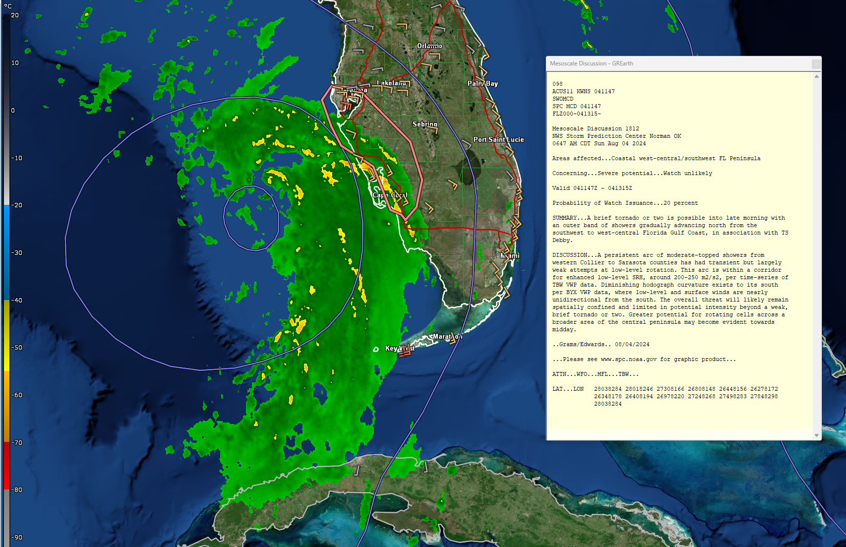
The system is still not very organized this morning. There is still a lot of deep convection east of the ill-defined center. But all it will take is for that convection to start wrapping around the center.
The Air Force and NOAA Hurricane Hunters (there are two planes out there right now) have found higher winds on that eastern side. The NOAA plane found 60 mph flight level winds and estimated surface winds of 58 mph.
There is not much change in the intensity guidance and the official forecast makes it a hurricane before landfall late Monday morning to around noon. The SHIPS guidace still shows a 56% chance of Debby intensifying into a 75 knot hurricane within 36 hours.
The ensemble guidance track is a little more spread than earlier, but not of a concern for now.
NHC forecast now calling for over 20 inches of rain near Savannah. This is extremely concerning. They are calling it potentially historic.
Here are the watches and warnings and track:
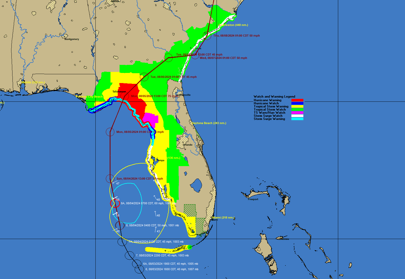
Outer bands are affecting the Florida Peninsula at this hour. Top winds could reach 50-60 mph in the Tampa area with possible tornadoes.
Scroll down to read Jen’s recent post on the storm including its impacts on the west coast of Florida. Frequent updates throughout the next 36 hours and this week ahead.
About the Author (Author Profile)
Bill Murray is the President of The Weather Factory. He is the site's official weather historian and a weekend forecaster. He also anchors the site's severe weather coverage. Bill Murray is the proud holder of National Weather Association Digital Seal #0001 @wxhistorianSubscribe
If you enjoyed this article, subscribe to receive more just like it.


