Reports from the Nature Coast
This beautiful part of Florida has taken a beating this morning from Hurricane Debby, but is still standing.
The center is rotating around in this around but not really moving. It is definitely filling, indicating weakening. Steering currents are weak and the future track is a little uncertain.
Power is out in my location in Perry, although we were fortunate it stayed on until 7 a.m. The wind has certainly been impressing, roaring for hours. There are reports of numerous trees and power lines down across Perry.
We were in the western eyewall for a long time, just briefly getting a bit of a break from the roaring winds. Winds here in Perry at KFPY gusted to 62 mph. Winds have now dropped to sustained 28 mph gusting to 45 mph.
My barometer has bottomed out at 29.10 so far. 1.64 inches of rain fell in one hour between 6-7 a.m. A total of 4.60 inches fell in 6 hours. Storm total so far is 7.01.
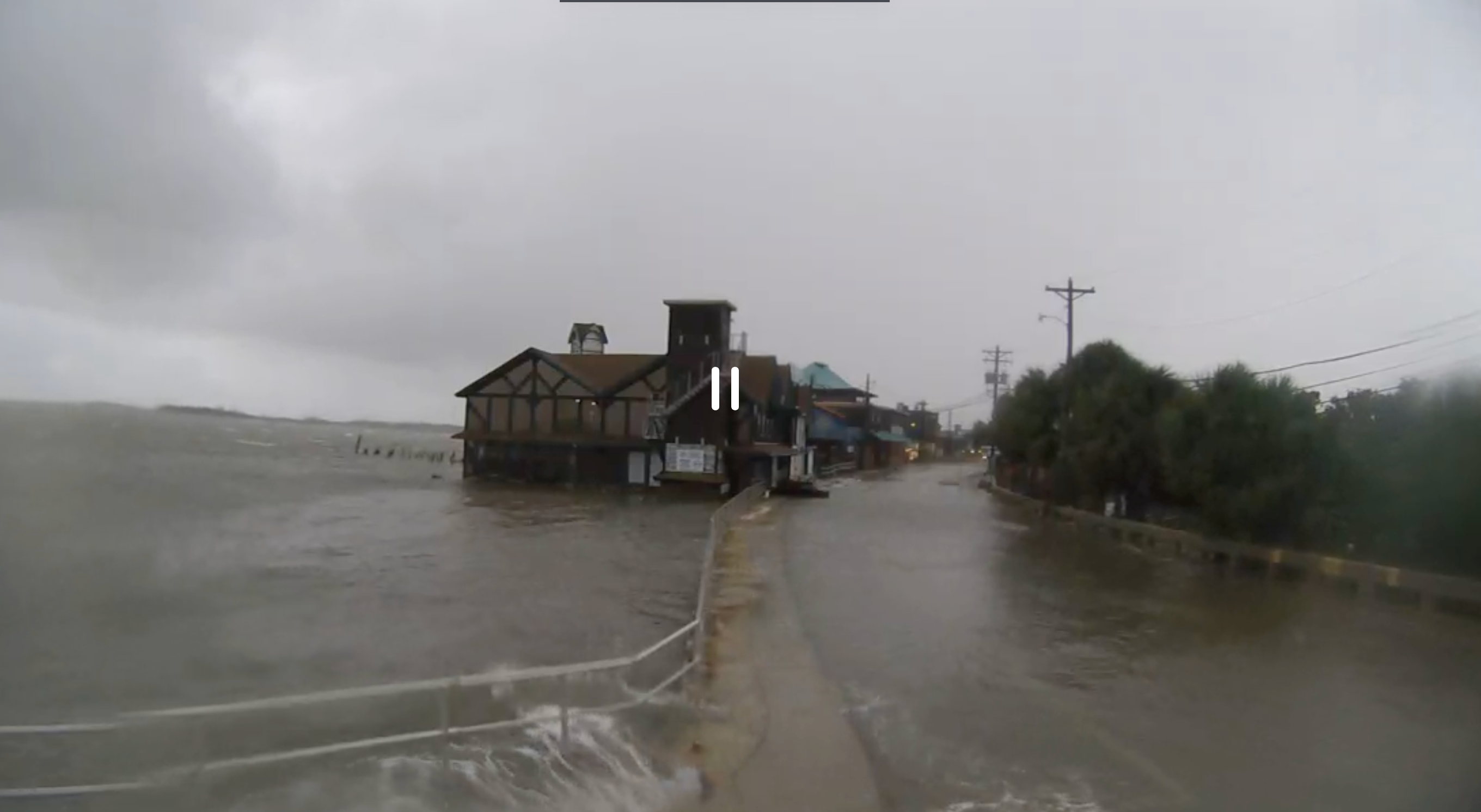
Surge has been a big problem along the west coast of Florida. Water rescues had to be performed last night in Largo, FL from apartment buildings. The surge at Cedar Key peaked at 5.82 feet. Here is a screen grab from Mark Sudduth’s Hurricane Track camera:
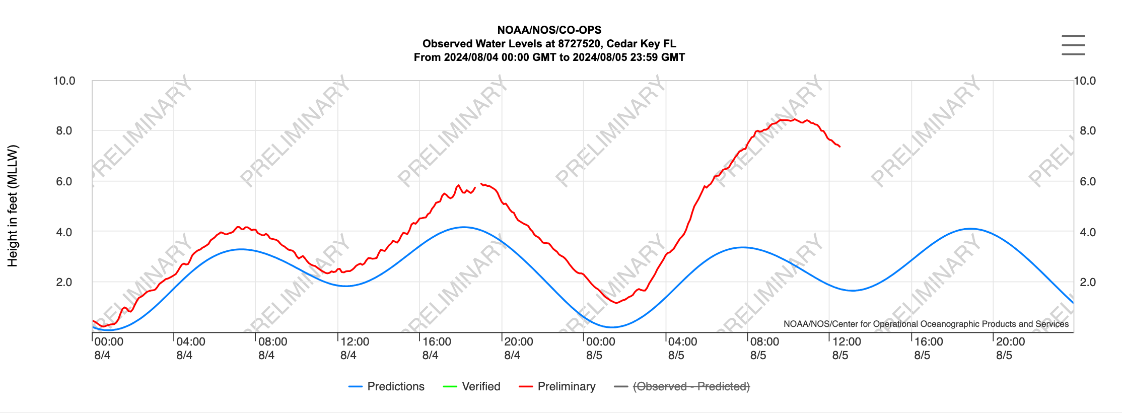
Here was the tide gauge trace from Cedar Key:
There is a tornado warning for parts of Orange County, Florida for areas west of Orlando. This is in the feeder band activity southeast of the hurricane center.
A tornado watch is in effect until 4 pm EDT.
Numerous flash flood warnings are in effect all the way from th enorthern side of Fort Myers, Florida to Valdosta, Georgia.
About the Author (Author Profile)
Bill Murray is the President of The Weather Factory. He is the site's official weather historian and a weekend forecaster. He also anchors the site's severe weather coverage. Bill Murray is the proud holder of National Weather Association Digital Seal #0001 @wxhistorianSubscribe
If you enjoyed this article, subscribe to receive more just like it.


