Debby is Inland; We Now Brace for Major Flooding
The National Hurricane Center 7am CDT update is out and want to run down where we are and where we are going with Hurricane Debby.
Stats Summary:
LOCATION…29.9N 83.4W
ABOUT 60 MI…95 KM NNW OF CEDAR KEY FLORIDA
MAXIMUM SUSTAINED WINDS…75 MPH…120 KM/H
PRESENT MOVEMENT…NNE OR 20 DEGREES AT 10 MPH…17 KM/H
MINIMUM CENTRAL PRESSURE…979 MB…28.91 INCHES
Watches and Warnings:
Changes with this advisory: The Storm Surge Watch from the middle of Longboat Key to Englewood
Florida has been discontinued.
Full list of current advisories here.
Current scenario:
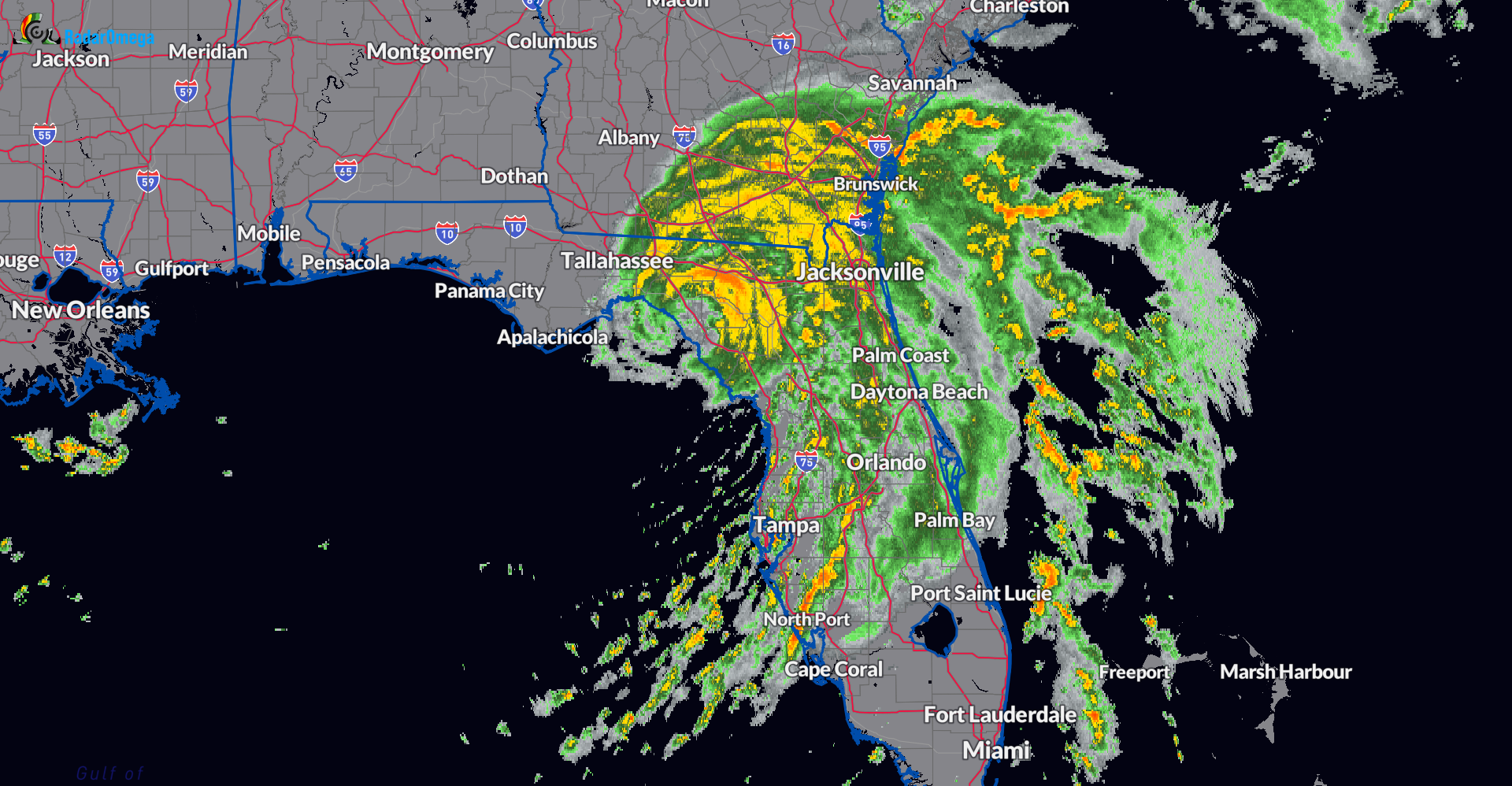
Now that Debby is onshore, the max winds near the center will continue to decrease. High end tropical storm/low end hurricane strength gusts will continue in the near term. Potent rainband from just north of Perry, FL to Live Oak and Lake City. The rain extends to Valdosta, GA to Waycross. Storms are just off shore the Georgia coast as well.
Rainbands extend up and down the Florida peninsula and the threat for tornadoes continues. Radar snapshot as of 720am CDT.
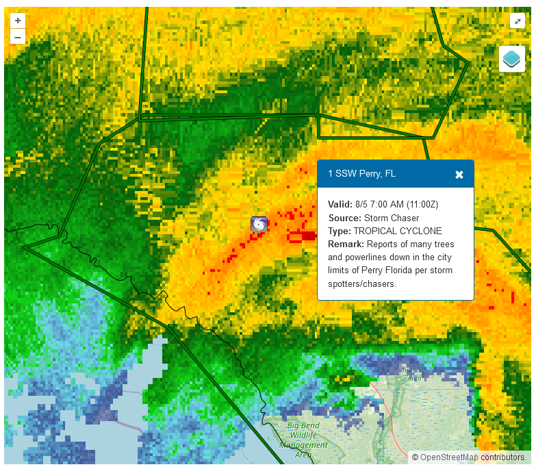
Local storm report from storm spotters/chasers of numerous trees/powerlines down in Perry, FL. These types of reports will be typical over the next few hours as Debby churns inland. At 635 am CDT, Perry-Foley airport Mesonet clocked a wind gust of 59 mph.
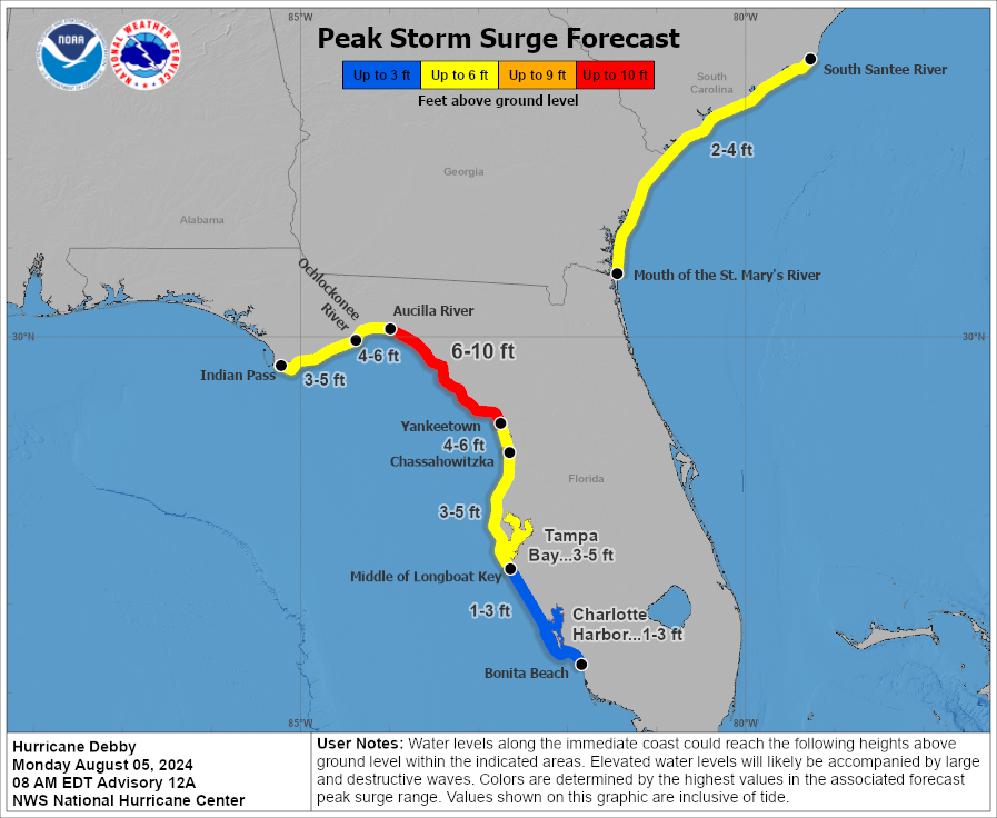
There is still a major storm surge threat across portions of the Florida Gulf Coast through the morning.
What’s next:
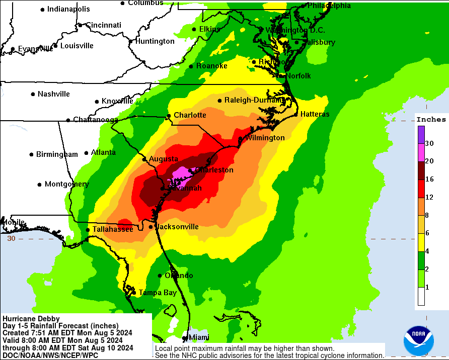
Debby is forecast to stay as a tropical storm as it slowly moves through north Florida, into southeast GA and possibly back out into the Atlantic before turning back into the Carolinas. High confidence of significant flooding over the next week across this area. It is impossible to nail down who will receive the greatest amount of rainfall this week. So much is dependent on the exact track of Debby, where will the bands set up, how will the onshore flow set up. All areas in the elevated flood threat zone need to take necessary precautions to protect life and property. Here is the latest rainfall graphic from the WPC. 20-30 inches of rain is still possible across parts of the SE Coast.
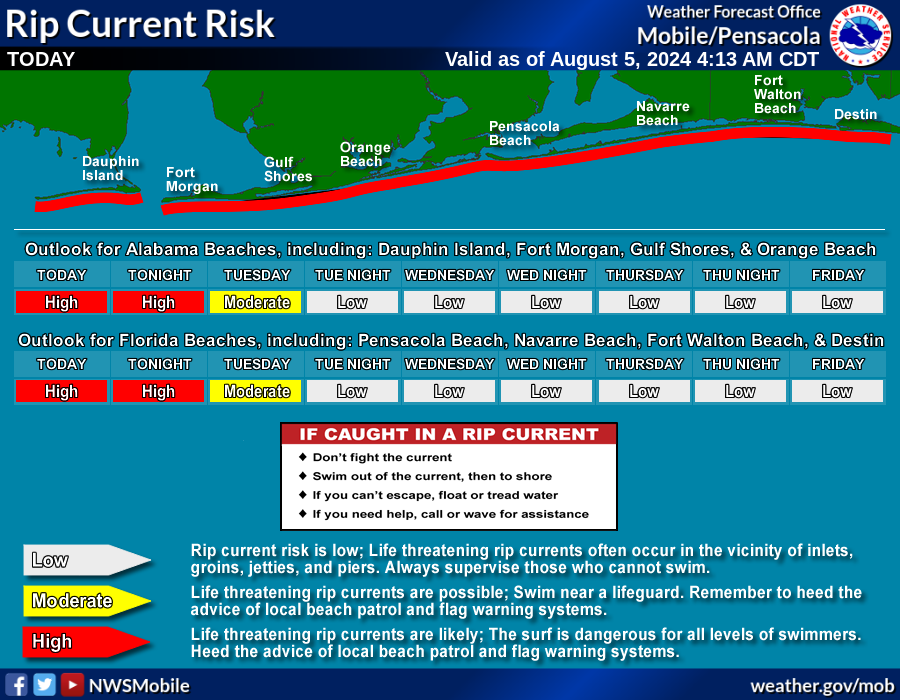
Alabama Impacts:
The main impact will be for the Alabama beaches, as an increased swell brings in a high rip current risk.
Category: ALL POSTS, Severe Weather
About the Author (Author Profile)
Owner of Tornado Talk. Radio broadcast meteorologist with The Storm Report. WeatherBrains Panelist. B.S. Meteorology from Penn State University.Subscribe
If you enjoyed this article, subscribe to receive more just like it.


