1030 CDT: The Latest On Debby
Debby is now back to tropical storm status. It has been gradually weakening over land and max sustained winds have slipped to 70 mph. Here are the other stats as of the 10am CDT update from the NHC:
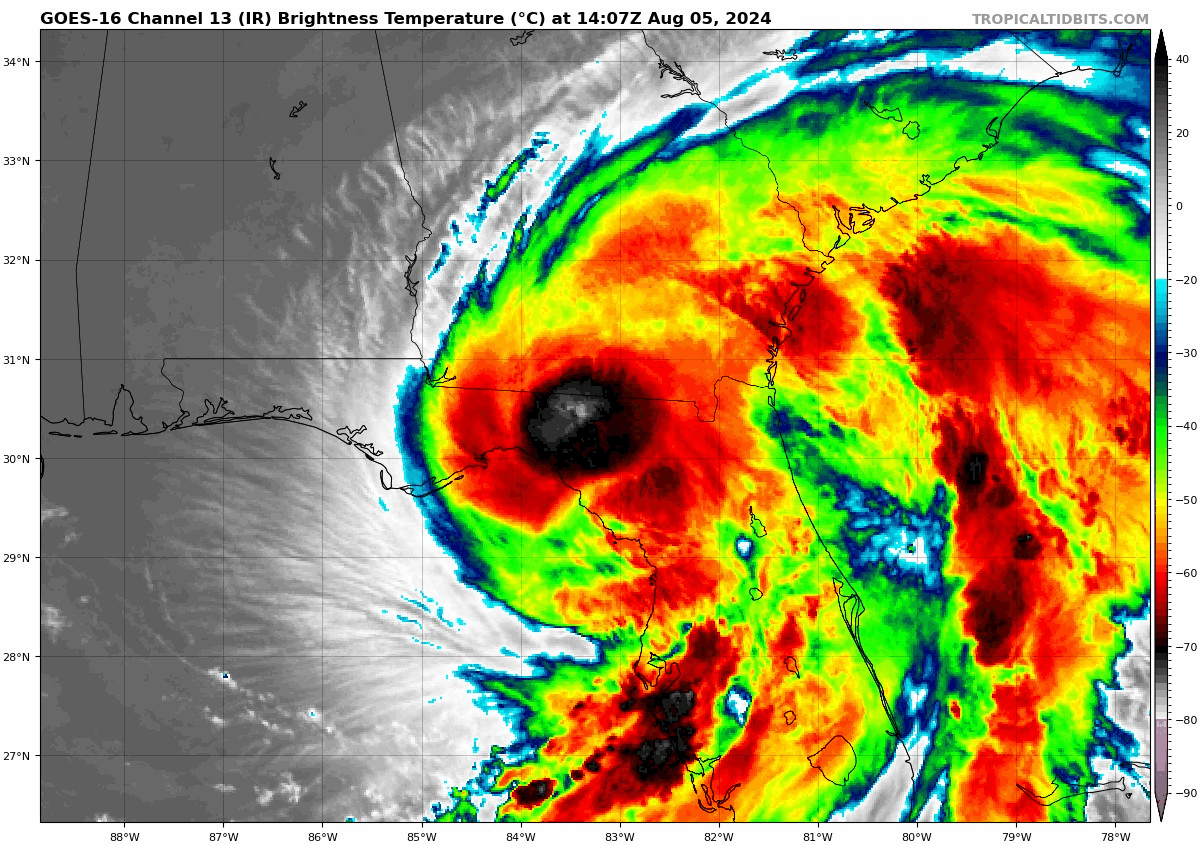
LOCATION…30.2N 83.2W
ABOUT 35 MI…55 KM W OF LAKE CITY FLORIDA
ABOUT 120 MI…190 KM S OF VALDOSTA GEORGIA
MAXIMUM SUSTAINED WINDS…70 MPH…110 KM/H
PRESENT MOVEMENT…NNE OR 30 DEGREES AT 8 MPH…13 KM/H
MINIMUM CENTRAL PRESSURE…983 MB…29.03 INCHES
As anticipated, Debby is slowing down with the movement down from 10 mph to 8 mph with this update. There is really nothing in place to steer this system, so the southeast will be dealing with it most of the week. The forecast is for Debby to remain as a tropical storm over the next few days and may drift back out into the Atlantic for a spell before moving back over land. By Friday and Saturday, a mid-level ridge is expected to the northeast of Debby and should pull it north. You can see in the path graphic below that by Saturday AM, the center is projected to be in Eastern VA.
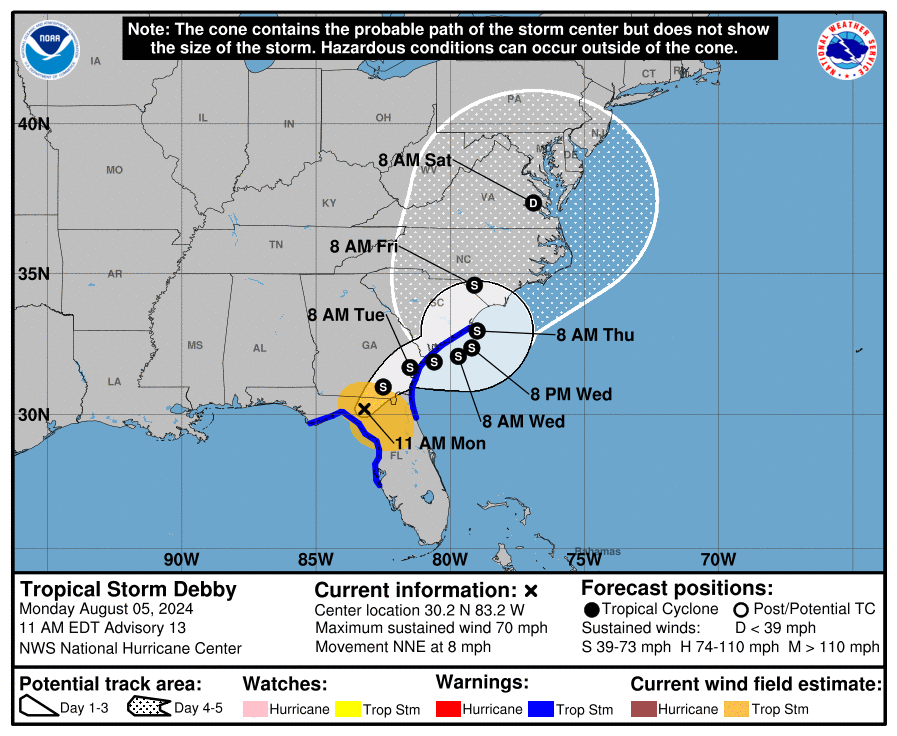
The focus over the next few days will be the potential for catastrophic flooding across portions of FL, GA and SC. But heads up to you in North Carolina and Virginia, some of this tropical moisture is heading your way. Be weather ready.
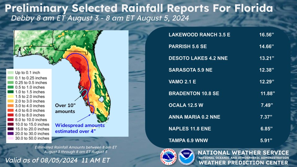
The Weather Prediction Center posted a list of some of the rainfall report out of Florida due to Debby! Over 16 inches of rain at Lakewood Ranch. A variety of rain totals in and around Sarasota. Officially at the airport, 9.52 inches of rain fell in a 24-hour period (as of midnight EDT-more has fallen since then). That is a new monthly record, breaking the old record of 8.12 inches set on August 26, 2017.
About the Author (Author Profile)
Owner of Tornado Talk. Radio broadcast meteorologist with The Storm Report. WeatherBrains Panelist. B.S. Meteorology from Penn State University.Subscribe
If you enjoyed this article, subscribe to receive more just like it.


