Debby Continues to Slow Down, But May Strengthen Again Over the Atlantic
Digging through the latest big advisory from The National Hurricane Center on Debby. Not a good deal of changes with the thinking on the future of the storm this week. Dangerous situation for portions of the southeast. Let’s look at what is currently happening and the future of Debby.
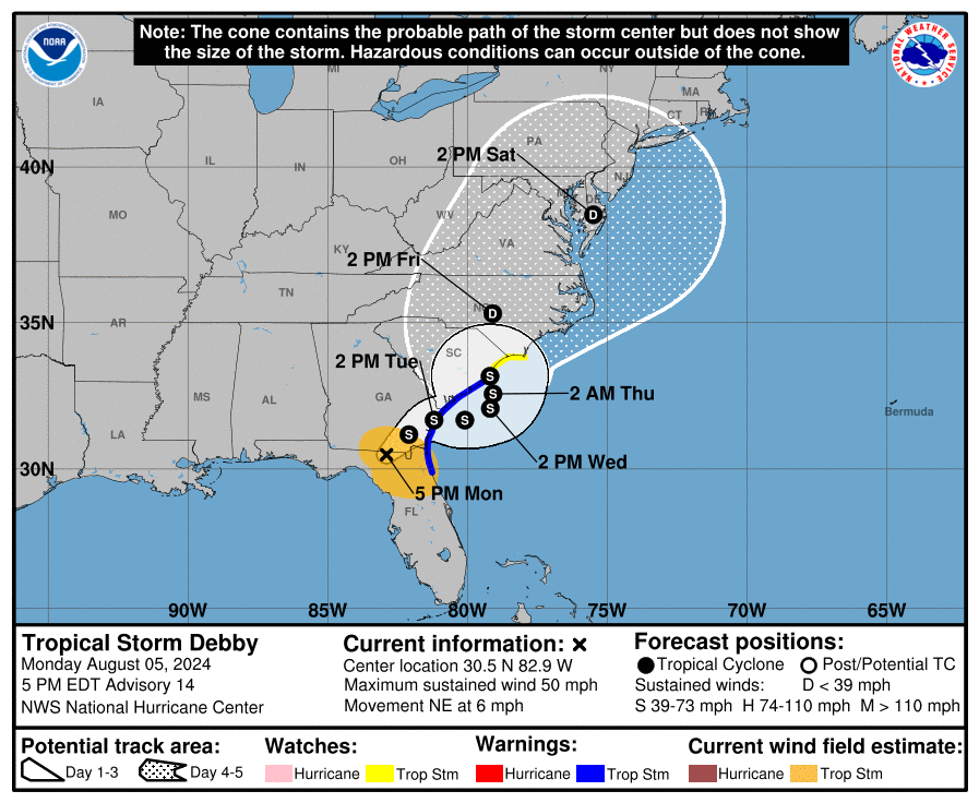
Here are the latest stats at the 4pm CDT update:
LOCATION…30.5N 82.9W
ABOUT 30 MI…50 KM SE OF VALDOSTA GEORGIA
MAXIMUM SUSTAINED WINDS…50 MPH…85 KM/H
PRESENT MOVEMENT…NE OR 35 DEGREES AT 6 MPH…9 KM/H
MINIMUM CENTRAL PRESSURE…994 MB…29.36 INCHES
The max winds have continued to decrease as Debby slows over land, moving at only 6 mph. The center is near the Florida/Georgia line now. The storm will crawl across southeastern GA and is projected to move out into the Atlantic late Tuesday. Here, the storm will have a window of opportunity to intensify. The forecast calls for winds to peak at 60 mph over the very warm Atlantic waters. Another landfall in South Carolina is projected late Wednesday night/early Thursday then a faster movement to the north and northeast will come and by Saturday afternoon, Debby will be in the Mid-Atlantic region.
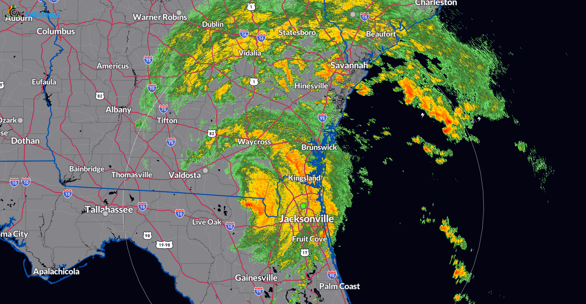
All of this is a nightmare scenario for portions of the southeast with some areas picking up 1-2 FEET of rain on already saturated grounds this week. Just through this afternoon, across parts of south GA into coastal Carolina, 2-4 inches of rain has fallen. Per the climate report for North Charleston, 2.88 inches of rain has fallen, a record for the date.
A Flash Flood Emergency continues for portions of North Florida through this evening. Suwannee County has received anywhere from 10-15 inches of rain. The Lake City area was also pummeled with torrential rain – between 6-12 inches has fallen.
About the Author (Author Profile)
Owner of Tornado Talk. Radio broadcast meteorologist with The Storm Report. WeatherBrains Panelist. B.S. Meteorology from Penn State University.Subscribe
If you enjoyed this article, subscribe to receive more just like it.


