Wednesday AM Update: Debby Off the South Carolina Coast…
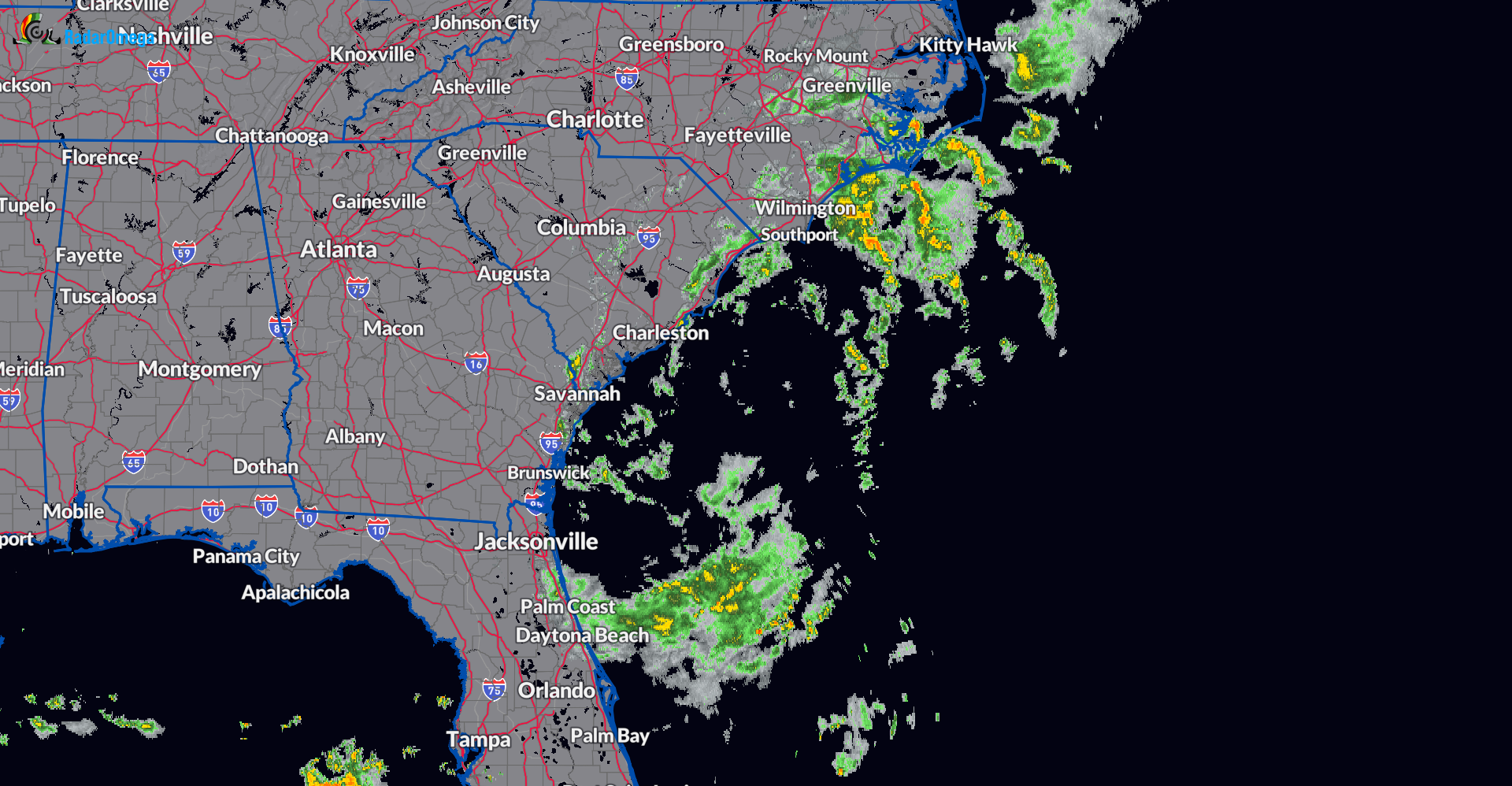
Good morning! It’s another day of watching Debby. The storm is hanging out off the South Carolina Coast. There has been some drier air pulling into the system and that has helped to limit some of the convective bands. As of 730am CDT, the strongest bands are moving into Coastal North Carolina. There is also some healthy rain on the south end of the circulation, offshore the northeast Florida coast.
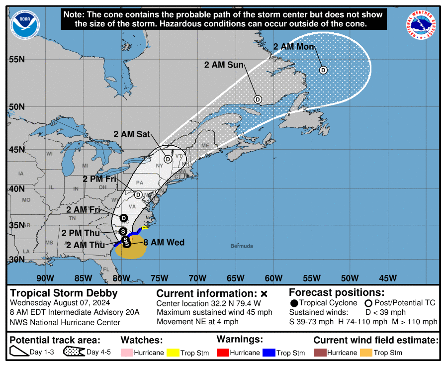
As long as the center of Debby remains over the extremely warm Atlantic waters, there is at least a small opportunity for strengthening, but not by much. Max winds right now near the broad center is 45 mph. The NHC forecast calls for winds to move up to maybe 50 mph before Debby turns back toward the SC Coast and moves inland. This should happen tonight.
The main weather story continues to be any persistent rain bands setting up to draw in very heavy rain in a short amount of time, aggravating flooding. This will not just be the case across the Carolinas, but eventually further north along the path of Debbie through the Virginias, into the Mid-Atlantic and the Northeast.
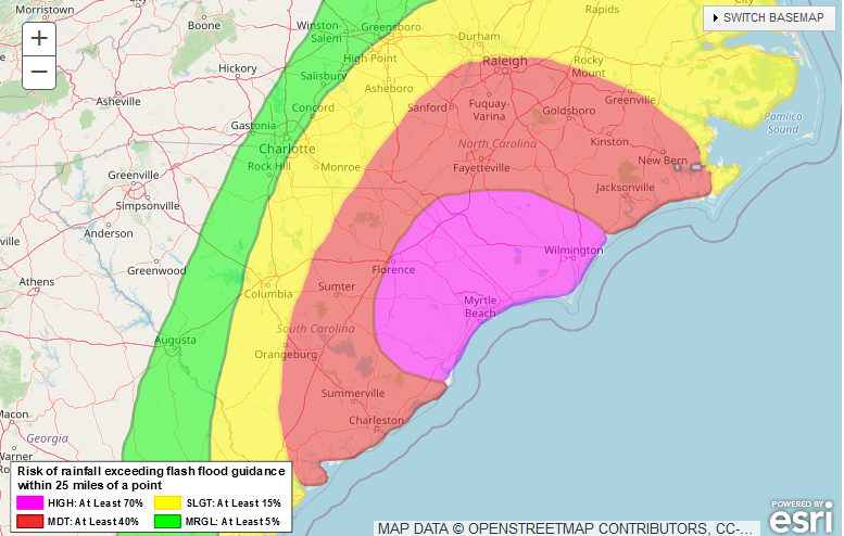
The Weather Prediction Center Excessive Rainfall Forecast for today has a high risk of rainfall exceeding flash flood guidance within 25 miles of a point encompassing parts of the Carolinas. Florence and Myrtle Beach (SC) as well as Lumberton and Wilmington (NC) all in this risk today.
About the Author (Author Profile)
Owner of Tornado Talk. Radio broadcast meteorologist with The Storm Report. WeatherBrains Panelist. B.S. Meteorology from Penn State University.Subscribe
If you enjoyed this article, subscribe to receive more just like it.


