A Look at the Tropics: Debby and Something New?
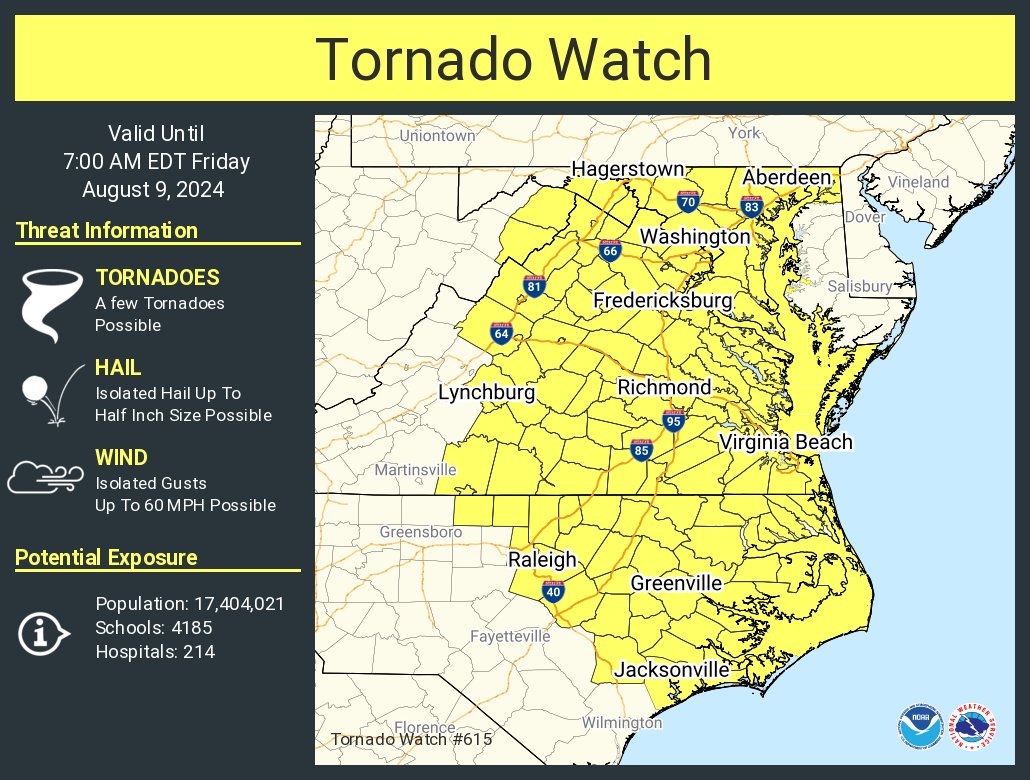
We are still talking about Debby on this Thursday evening….and we may have something new on the horizon. Let’s start with Debby. As of the 5pm EDT advisory from the National Hurricane Center, Debby was downgraded to a depression with max winds of 35 mph. This is the last advisory from the NHC on Debby, they have passed the reins to the Weather Prediction Center. No major changes with the main hazards over the next couple of days. Heavy rain, flooding and isolated tornadoes will continue to be a threat. Through the night, a tornado watch is in effect for DC to Richmond, Virginia Beach to Raleigh and Jacksonvile in North Carolina.
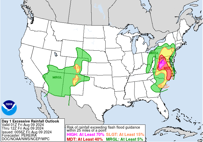
The latest Day 1 Excessive Rainfall Outlook from The Weather Prediction Center has a high risk for portions of Western Virginia and Eastern West Virgnia. Deep tropical moisture in combination with upslope flow will promote heavy rainfall rates.
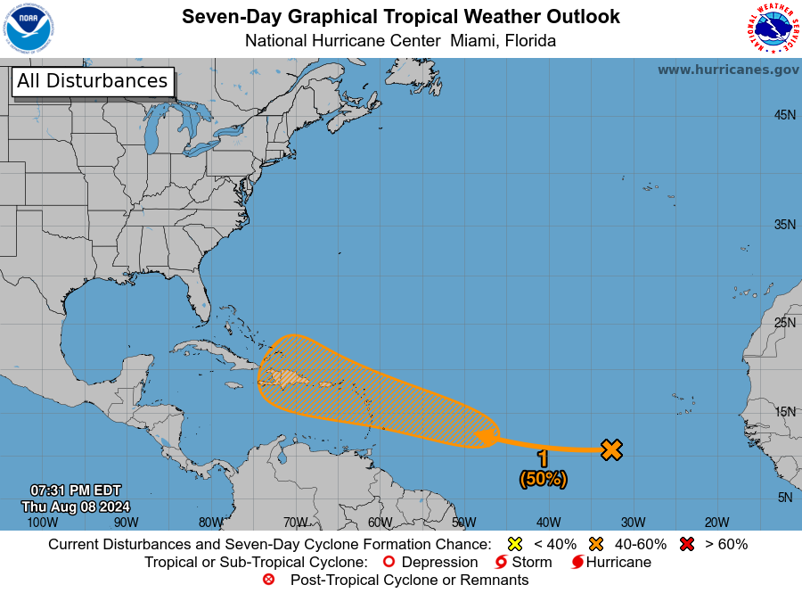
We have been keeping our eyes on a tropical wave several hundred miles WSW of the Cabo Verde Islands. There are disorganized showers/thunderstorms with it. The latest update from the NHC now shows a medium chance for tropical formation through 7 days. It is way too early to speculate where this might go, but certainly bears watching as it moves into a more conducive environment for development.
About the Author (Author Profile)
Owner of Tornado Talk. Radio broadcast meteorologist with The Storm Report. WeatherBrains Panelist. B.S. Meteorology from Penn State University.Subscribe
If you enjoyed this article, subscribe to receive more just like it.


