Isolated Showers Over East Alabama; Lower Humidity By The Weekend
RADAR CHECK: We note a few small, isolated showers over the eastern third of Alabama this afternoon; the rest of the state is dry. Clouds cover much of West Alabama, where temperatures are only in the 80s. Where the sun is out over the eastern and southern counties temperatures are in the low to mid 90s. Isolated showers will end this evening; lows will be in the 70s early tomorrow.
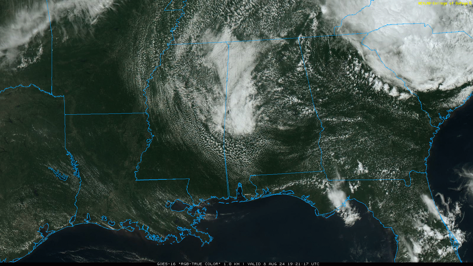
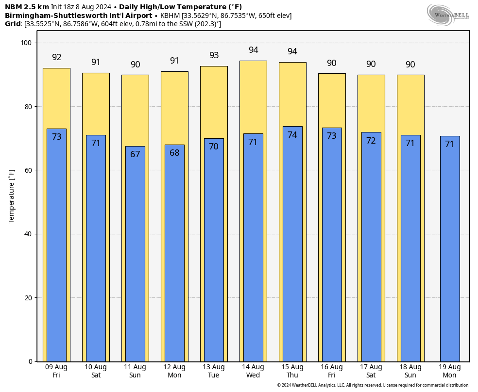
Tomorrow will be partly to mostly sunny with a high in the low 90s for most places; the chance of any one spot seeing a shower remains 10 percent or less.
We are forecasting an airmass change over the weekend as dry, continental air drops in from the north. Humidity levels will be lower Saturday and Sunday, nights will be cooler, and afternoon heat levels will come down a bit. Highs Saturday and Sunday will be in the 88-92 degree range, with lows in the 60s by daybreak Sunday.
NEXT WEEK: Generally dry weather continues Monday and Tuesday, but we will bring in a chance of scattered showers and thunderstorms over the latter half of the week as moisture levels begin to rise. Highs through the week will be generally in the low 90s, right at seasonal averages for mid-August. See the video briefing for maps, graphics, and more details.
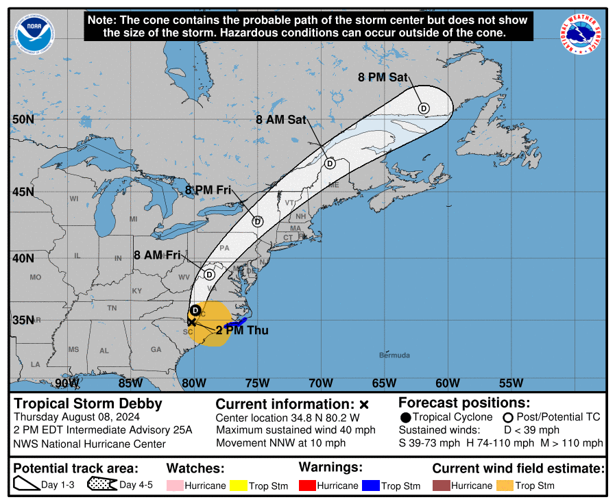
TROPICS: Tropical Storm Debby, with sustained winds of 40 mph, is about 100 miles southwest of Raleigh, NC this afternoon. The system will accelerate to the northeast tomorrow and over the weekend. The system will be in eastern Canada by Saturday.
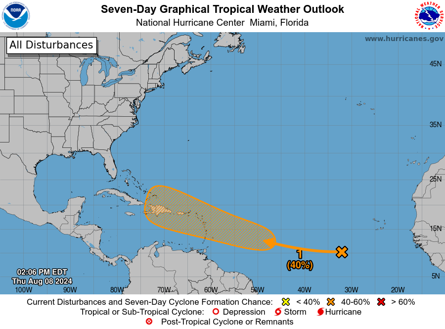
Elsewhere, a tropical wave located over the eastern tropical Atlantic is producing widespread disorganized showers and thunderstorms. Any development of the wave should be slow to occur during the next few days while it moves westward across the central tropical Atlantic. Conditions are expected to become more conducive for development early next week, and a tropical depression could form while it approaches the Lesser Antilles. The system is then forecast to move generally west-northwestward and could approach the Greater Antilles by the middle part of next week. NHC gives the system a 40 percent chance of development over the next seven days.
The upper air pattern forecast by global models suggests if a system does form, it will turn north before reaching the U.S. But, of course, this could easily change.
ON THIS DATE IN 2007: A tornado bounces across Staten Island and Brooklyn, New York, ripping off roofs and damaging dozens of buildings. The EF-2 twister hop-scotched through Brooklyn’s Bay Ridge and Sunset Park neighborhoods around 6:30 am.
Look for the next video briefing here by 6:00 a.m. tomorrow…
Category: Alabama's Weather, ALL POSTS, Weather Xtreme Videos
About the Author (Author Profile)
James Spann is one of the most recognized and trusted television meteorologists in the industry. He holds the AMS CCM designation and television seals from the AMS and NWA. He is a past winner of the Broadcast Meteorologist of the Year from both professional organizations.Subscribe
If you enjoyed this article, subscribe to receive more just like it.


