Lower Humidity Leads to a More Bearable Summer Weekend
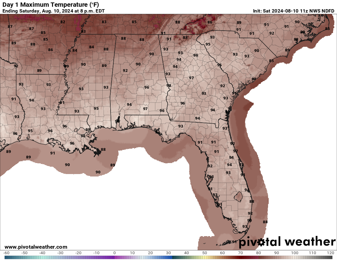
We have a surface boundary stalled out over the southeastern part of the state that is allowing for drier and slightly cooler air to drift into the area. Ridging will be building to our west, so our weather should remain quiet. Skies will be mainly sunny today with highs in the upper 80s to the mid 90s.
Sunday shall be just about the same as dry air continues to be pulled into the state. Skies will be mainly sunny with highs in the upper 80s to the upper 90s from northwest to southeast.
The weather will be unchanging on Monday as skies will be sunny with highs in the upper 80s to the upper 90s.
More humid air will begin to be advected into the state on Tuesday, which will allow for it to feel more muggy while the temperatures begin to increase. However, we stay dry with highs in the 90s.
Then the typical summer pattern returns to end out the work week. Wednesday will be hot, humid, with mostly sunny skies. There will be a slight chance for a few isolated showers and storms. Highs in the 90s.
Same story on Thursday. A few isolated to scattered afternoon showers and storm will be possible. Otherwise, it will be mostly sunny with highs in the mid to upper 90s.
And at the end of the forecast period on Friday, it will remain hot and humid, with the slight chance for a few scattered showers and storms during the afternoon. Highs in the 90s.
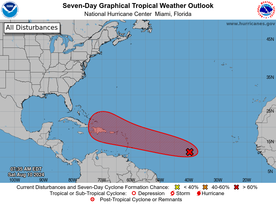
There’s a tropical wave making its way across the central Atlantic, positioned between the Cabo Verde Islands and the Lesser Antilles. Over the past day, we’ve seen a notable increase in shower and thunderstorm activity associated with this system. Over the next couple of days, this wave is expected to continue moving westward to west-northwestward. While development is currently gradual, conditions are predicted to become more favorable soon. By early to mid-next week, the system is likely to strengthen into a tropical depression as it nears the Lesser Antilles. Looking further ahead, the system will probably keep moving in the same general direction, potentially affecting parts of the Greater Antilles by the middle to later part of next week. At this point, there is a 30% chance of formation in the next 48 hours and an 80% chance over the next 7 days.
Category: Alabama's Weather, ALL POSTS, Tropical, Weather Xtreme Videos
About the Author (Author Profile)
Scott Martin is an operational meteorologist, professional graphic artist, musician, husband, and father. Not only is Scott a member of the National Weather Association, but he is also the Central Alabama Chapter of the NWA president. Scott is also the co-founder of Racecast Weather, which provides forecasts for many racing series across the USA. He also supplies forecasts for the BassMaster Elite Series events including the BassMaster Classic.Subscribe
If you enjoyed this article, subscribe to receive more just like it.


