Early Afternoon Update on 98L
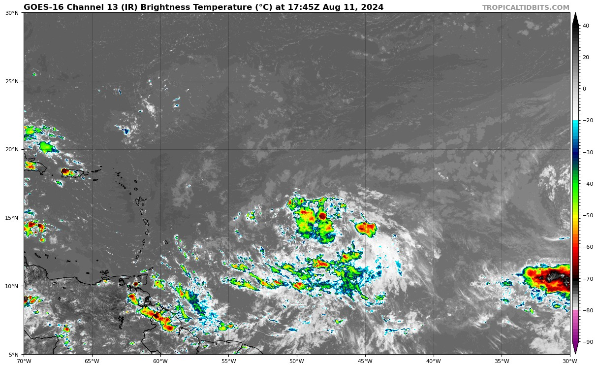
Invest 98L, currently located around 45W and 13N, approximately 1,020 miles east of the Windward Islands, is still disorganized, but gradually becoming more organized and is likely to develop into a tropical depression within the next couple of days. The National Hurricane Center (NHC) advises that this system should be closely monitored, particularly by residents in the northeastern Caribbean. Watches or warnings could be issued later today as the system continues its westward approach.
CURRENT CONDITIONS AND MODEL PROJECTIONS
Invest 98L remains disorganized this morning, but several model projections suggest significant development as it approaches the Leeward Islands. The HWRF model indicates that the system could pass over Guadeloupe on Tuesday night as a 65-70 mph tropical storm before undergoing rapid intensification, dropping from 987 MB to 945 MB and strengthening into a 105 mph Category 2 hurricane north of Puerto Rico by Wednesday.
The HMON model, in contrast, keeps the system as a tropical storm and tracks it north of the islands. Both the HAFS-A and HAFS-B models predict that the system will remain a tropical depression, passing near Anguilla on Tuesday afternoon. The GFS model suggests a path over Antigua and Barbuda as a tropical storm, with further strengthening as it moves near the Virgin Islands and north of Puerto Rico. The European model aligns closely with the GFS, with the European ensemble mean indicating a path near the Virgin Islands. Meanwhile, the GFS ensemble mean suggests a slightly more southerly track, taking the system south of the Virgin Islands and Puerto Rico, and closer to the Dominican Republic.
IMPACT ON THE CARIBBEAN
Residents of the Leeward Islands, including Guadeloupe, Antigua, Barbuda, and surrounding areas, should prepare for the possibility of tropical storm conditions starting Tuesday. Depending on the system’s development, the northeastern Caribbean, particularly Puerto Rico and the Virgin Islands, could face hurricane conditions by midweek. Wind gusts, heavy rainfall, and rough surf are expected, and preparations should be made accordingly.
IMPACT ON THE U.S. COASTLINE
As Invest 98L moves into the southwestern Atlantic, it is expected to generate significant swells that could reach the U.S. East Coast later next week, increasing the risk of rip currents along a large portion of the coastline. However, the latest global model runs from this morning suggest that the system is likely to remain east of both the U.S. and Atlantic Canada, as well as Bermuda. While the threat to the U.S. East Coast appears minimal at this time, we will continue to monitor the situation closely.
LONG-TERM OUTLOOK
The long-term trajectory of Invest 98L suggests a path that will likely stay well east of the U.S. East Coast and Bermuda. Continued monitoring is essential as the system progresses, especially for interests in the northeastern Caribbean.
About the Author (Author Profile)
Bill Murray is the President of The Weather Factory. He is the site's official weather historian and a weekend forecaster. He also anchors the site's severe weather coverage. Bill Murray is the proud holder of National Weather Association Digital Seal #0001 @wxhistorianSubscribe
If you enjoyed this article, subscribe to receive more just like it.


