New Severe Thunderstorm Warning for parts of DeKalb and Marshall Counties until 630pm CDT
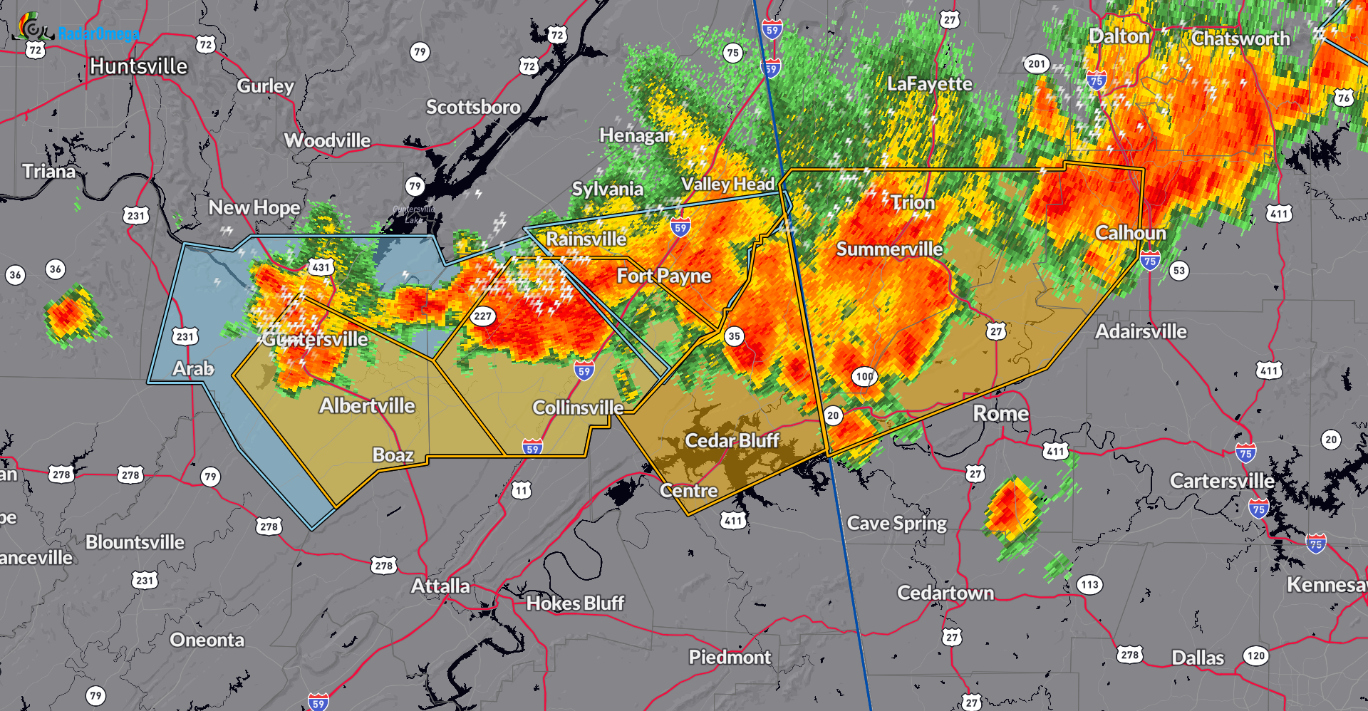
Strong to severe storms continue along a line from Guntersville to Rainsville to Fort Payne and across the Georgia line to Summerville and Calhoun. New severe thunderstorm warnings for all of Southern DeKalb and Southeastern Marshall Counties until 630pm CDT. There has been a history of trees downed and power outages with this line.
The National Weather Service in Huntsville Alabama has issued a
* Severe Thunderstorm Warning for…
Southern DeKalb County in northeastern Alabama…
* Until 630 PM CDT.
* At 559 PM CDT, a severe thunderstorm was located over Geraldine, or
11 miles southwest of Rainsville, moving southeast at 20 mph.
HAZARD…60 mph wind gusts.
SOURCE…Radar indicated.
IMPACT…Expect damage to roofs, siding, and trees.
* Locations impacted include…
Fort Payne, Rainsville, Crossville, Fyffe, Geraldine, Pine Ridge, Lakeview, Dog Town, Hopewell, and Collbran.
———-
The National Weather Service in Huntsville Alabama has issued a
* Severe Thunderstorm Warning for…
Southeastern Marshall County in northeastern Alabama…
Southwestern DeKalb County in northeastern Alabama…
* Until 630 PM CDT.
* At 602 PM CDT, a severe thunderstorm was located near Guntersville,
moving southeast at 20 mph.
HAZARD…60 mph wind gusts.
SOURCE…Radar indicated.
IMPACT…Expect damage to roofs, siding, and trees.
* Locations impacted include…
Albertville, Boaz, Guntersville, Douglas, McVille, High Point,
Horton, Arona, Hustleville, and Kilpatrick.
Category: Alabama's Weather, ALL POSTS, Severe Weather
About the Author (Author Profile)
Owner of Tornado Talk. Radio broadcast meteorologist with The Storm Report. WeatherBrains Panelist. B.S. Meteorology from Penn State University.Subscribe
If you enjoyed this article, subscribe to receive more just like it.


