9 O’clock Notes on Ernesto: Winds Gusting to Hurricane Force at Bermuda
The northern eyewall of Hurricane Ernesto is approaching Bermuda tonight. It is about 65 km or 40 miles south of the islands. Landfall should occur around 3-5 a.m.
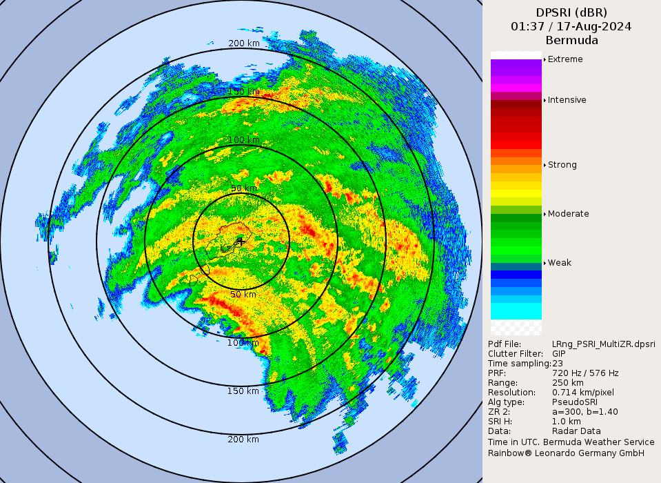
Here are the current conditions at L.F. Wade International Airport on Bermuda: at 10:55 PM, Bermuda continued to experience severe weather conditions due to Hurricane Ernesto. The temperature remained steady at 73°F with a matching dew point, resulting in 100% relative humidity. Winds from the east intensified, reaching a sustained speed of 52 mph with gusts up to 74 mph. Heavy rain and mist reduced visibility to just 1.12 miles. The cloud cover was significant, with broken clouds at 700 feet and overcast conditions at 4,200 feet. The sea level pressure dropped further to 998.98 mb, indicating the ongoing impact of the hurricane.
Maximum flight level winds on the last pass by the Air Force Hurricane Hunters were southeast at 93 knots, supporting an intensity of 96 mph. The 7 pm advisory carried a max wind of 100 mph. The Hurricane Hunters found a central pressure of 970 mb. Maximum SFMR surface wind gusts were estimated at 71 knots or 82 mph.
We will have a new advisory at 10 p.m. CDT.
About the Author (Author Profile)
Bill Murray is the President of The Weather Factory. He is the site's official weather historian and a weekend forecaster. He also anchors the site's severe weather coverage. Bill Murray is the proud holder of National Weather Association Digital Seal #0001 @wxhistorianSubscribe
If you enjoyed this article, subscribe to receive more just like it.


