Cancelled (712pm CDT) Severe Thunderstorm Warning for parts of Etowah and Cherokee Counties until 730pm CDT
Update: The warnings for Etowah and Cherokee Counties have been cancelled.
BMX cancels Severe Thunderstorm Warning for Cherokee, Etowah [AL] https://t.co/fQRt5Qr1aV pic.twitter.com/sr0Rll1zY7
— IEMBot BMX (@iembot_bmx) August 17, 2024
———-
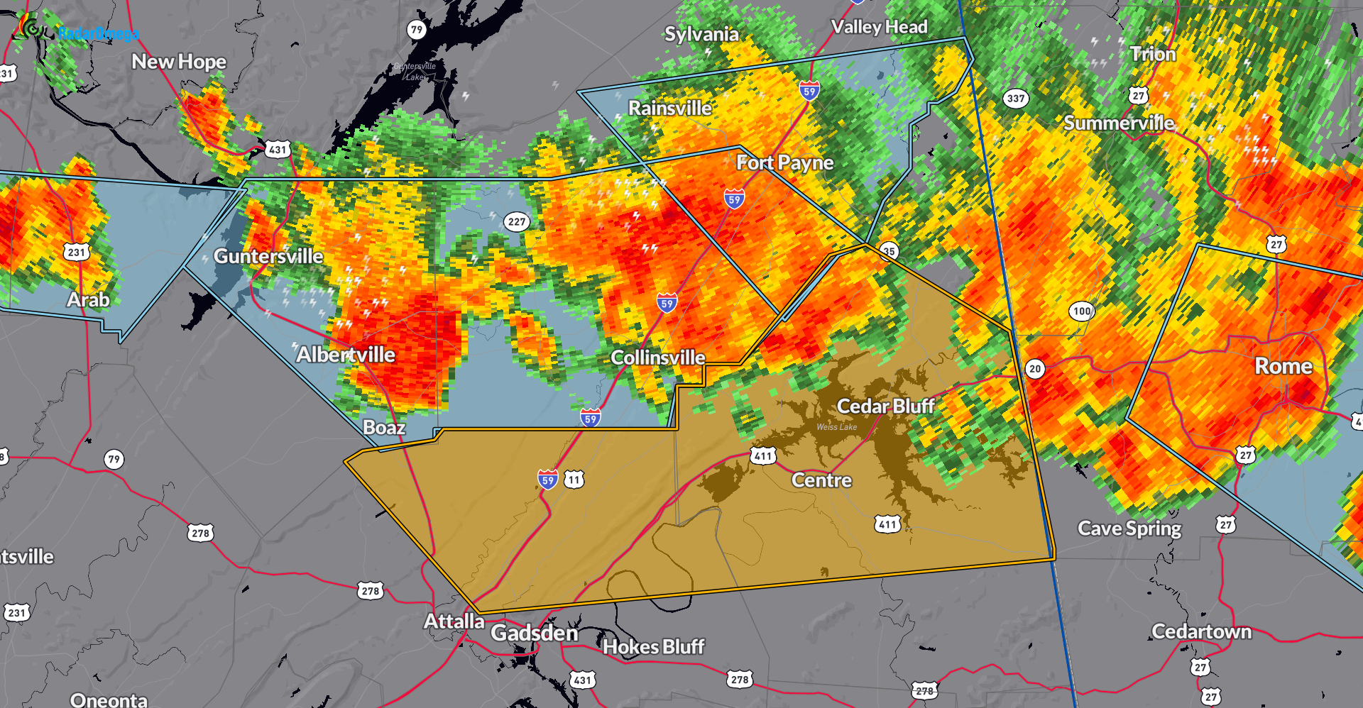
Line of storms with a history of bringing down trees and power lines still moving through parts of northeast Alabama. New warning for Northeastern Etowah and all of Cherokee County. 60 mph wind gusts possible, frequent cloud to ground lightning and very heavy rain with this line. Please stay indoors until this line clears your area.
———-
The National Weather Service in Birmingham has issued a
* Severe Thunderstorm Warning for…
Northeastern Etowah County in northeastern Alabama…
Cherokee County in northeastern Alabama…
* Until 730 PM CDT.
* At 627 PM CDT, severe thunderstorms were located along a line
extending from near Little River Canyon National Preserve to near
Crossville to Albertville, moving southeast at 30 mph.
HAZARD…60 mph wind gusts.
SOURCE…Radar indicated.
IMPACT…Expect damage to roofs, siding, and trees.
* Locations impacted include…
Gadsden, Centre, Cedar Bluff, Little River Canyon National
Preserve, Forney, Centre Municipal Airport, Sardis City, Leesburg,
Reece City, Sand Rock, Gaylesville, Tennala, Tabor Road, Cherokee
Rock Village, Cornwall Furnace Park, Eastern Weiss Lake, Ballplay,
Slackland, Western Weiss Lake, and Noccalula Falls.
Category: Alabama's Weather, ALL POSTS, Severe Weather
About the Author (Author Profile)
Owner of Tornado Talk. Radio broadcast meteorologist with The Storm Report. WeatherBrains Panelist. B.S. Meteorology from Penn State University.Subscribe
If you enjoyed this article, subscribe to receive more just like it.


