10am Tropics Update: Francine Steadily Heading Toward Louisiana; Something New To Watch in the Atlantic
The focus of this update will be on Francine but will highlight too something new brewing in the Atlantic!
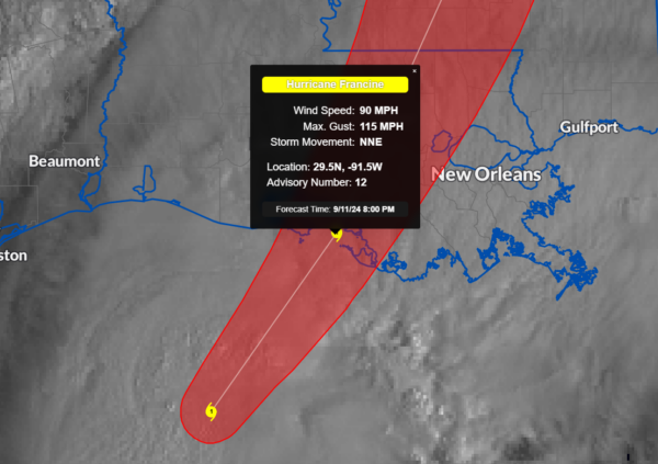
LOCATION…28.0N 92.7W
ABOUT 150 MI…240 KM SW OF MORGAN CITY LOUISIANA
ABOUT 210 MI…335 KM SW OF NEW ORLEANS LOUISIANA
MAXIMUM SUSTAINED WINDS…90 MPH…150 KM/H
PRESENT MOVEMENT…NE OR 40 DEGREES AT 13 MPH…20 KM/H
MINIMUM CENTRAL PRESSURE…976 MB…28.82 INCHES
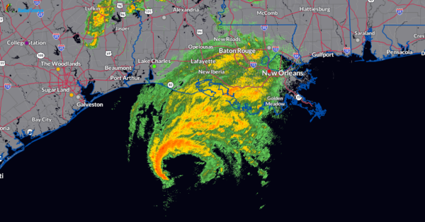
We continue to see an increase in the forward speed with this hurricane. Winds have been maintained at 90 mph and the pressure is holding. The hurricane hunters have been instrumental in giving us the latest on this storm as it is getting closer to the coast. Here is a radar snapshot as of 1004am CT. Copious amounts of tropical moisture already over southern LA with more on the way! Some of the rainfall rates could exceed 1-3 inches/hour!
Due to shear and drier air entraining into the system, little change in strength is currently forecast. We should have a Cat 1 hurricane crossing the Louisiana Coast this evening near St. Mary Parish.
No changes in the key messages: Life-threatening surge for the LA and MS coastline expected, a tornado risk, flooding rains and tropical storm to hurricane gusts coming in as well.
One advisory change for Alabama: The Storm Surge watch for the Alabama coast, including Mobile bay, has been changed to a Coastal Flood Warning.
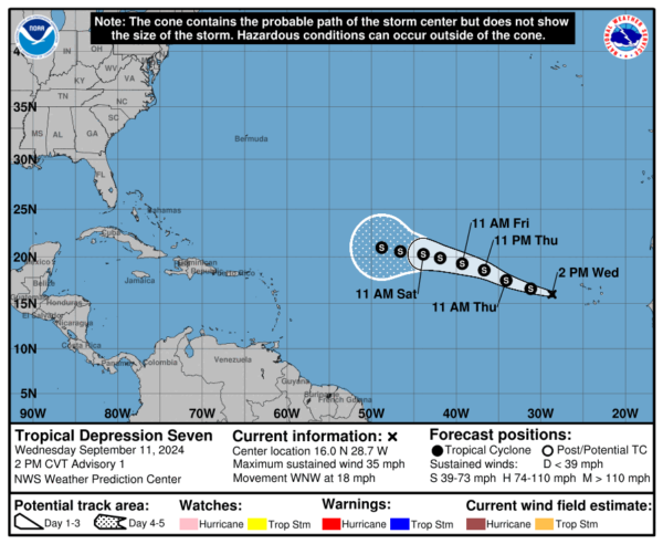
Tropical Depression #7 has formed in the eastern Atlantic. Here are the stats on that:
LOCATION…16.0N 28.7W
ABOUT 310 MI…500 KM W OF THE CABO VERDE ISLANDS
MAXIMUM SUSTAINED WINDS…35 MPH…55 KM/H
PRESENT MOVEMENT…WNW OR 285 DEGREES AT 18 MPH…30 KM/H
MINIMUM CENTRAL PRESSURE…1007 MB…29.74 INCHES
Some strengthening is forecast with this over the next 48 hours and could become a Tropical Storm. The name would be Gordon.’


