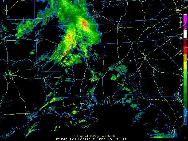
Showers Showing Up Over South Central Alabama
It has been a beautiful Sunday across Central Alabama. Highs from the hourly observations today included 68F at Birmingham and Calera, 69F at Anniston and 70F at Tuscaloosa. Montgomery also reached 70F.
Showers continue over South Central Alabama this afternoon in the area of ascending air ahead of low pressure to the west of the state.
Showers extend from Knoxville in northern Greene County to near Centreville to Billingsley.
Some heavier showers were over Marengo and Wilcox Counties, moving into Dallas and Perry Counties.
Other Showers were over South Alabama from Greenville down to Florala.
Everything is moving northeast at about 30 mph.
To the west, showers were increasing over Central and Northern Mississippi. These will reach western Alabama early this evening.
Heavier storms were over eastern Arkansas, about 40 miles west of Memphis. Further south, the activity is more isolated, but storms were increasing south of Alexandria. This activity has a chance to become strong to severe later this afternoon and tonight as it moves into Southwestern Mississippi.
Heavier activity will move into Alabama later tonight, mainly after midnight with a good chance of rain and the possibility of a little thunder. No severe weather is expected across Alabama.
Category: Uncategorized


