Update 1146 pm

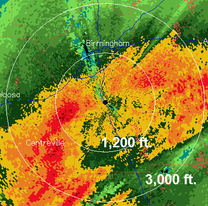
BMX radar at 0.5 degrees elevation angle

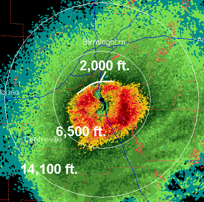
BMX radar at 3.4 degrees elevation angle
The two radar images above show what normally looks like very heavy precipitation. But, especially in the higher elevation scan, one can see that the higher radar returns are in a circle around the radar. When snow melts as it falls, the water-covered ice shows up very well on radar, producing the high returns just below the melting level. So, from the above picture, it looks like the snow is melting around 2,000 feet above the ground over BHM. The snow will continue to cool the atmosphere as it falls, and a few snow flakes may mix in at times, but it looks like the initial area of precipitation will end before temperatures near the ground get cold enough to have snow accumulation occur.
As the upper-level low moves across Alabama Tuesday, another area of precipitation will develop and move across central Alabama. It will continue to cool the atmosphere, so snow is possible Tuesday, but right now it looks doubtful that the precipitation will be heavy enough to produce accumulating snow in most areas, and any that does accumulate should not cause travel problems, and should melt quickly. The exception would be the higher elevations of east Alabama.
The travel problems could occur Tuesday night and Wednesday morning, when temperatures drop into the 20s and water on roads turns to ice. We had this occur with a system earlier this winter, with numerous car accidents.
Category: Uncategorized


