Midday Nowcast: Widespread Rain on the Way for our Tuesday
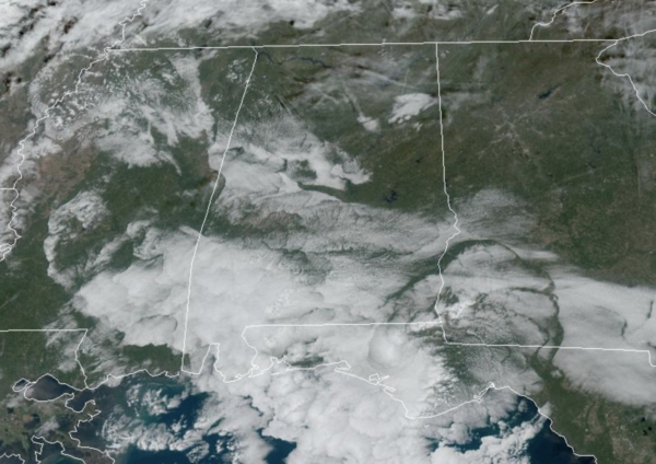
Dry today, but rain and storms return to Alabama tomorrow. For the rest of today, expect afternoon highs in the 70s with increasing clouds already ahead of our next storm system approaching from the west. Tonight will be mainly cloudy and rain is possible late, expect lows in the 60s.
BIRMINGHAM ALMANAC: For November 18th, the average high for Birmingham is 64° and the average low is 42°. The record high is 82° set in 1930, while the record low is 20° set in 1959. We average 0.14” of precipitation on this date, and the record value is 1.80” set in 2015.
ACROSS THE USA: Heavy rainfall, thunderstorms, and gusty winds are expected across the Central Plains into the Mid Missouri Valley. Widespread precipitation and heavy mountain snow will continue across the Northwest. Severe thunderstorms are expected this afternoon and evening from parts of east Texas into Louisiana. Heavy rainfall is likely tonight across eastern Louisiana and southern Mississippi.
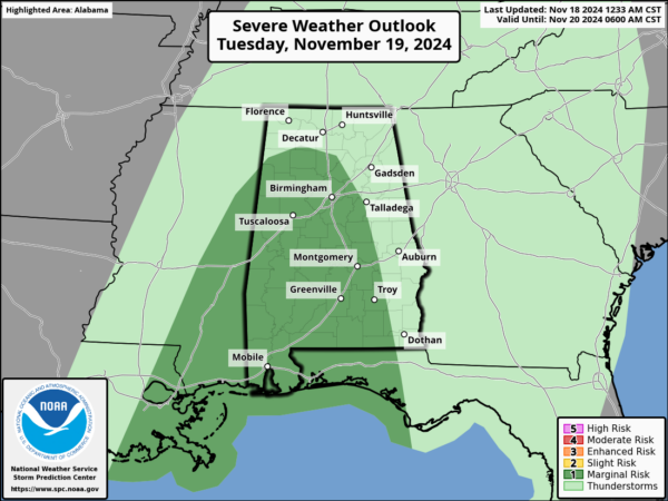
WET AND STORMY TUESDAY: Rain becomes widespread across Alabama tomorrow and we could see a few stronger storms mixed in, but the air will be fairly stable and the threat is very low. The main threat will be gusty winds, but a brief, isolated tornado can’t be ruled out across the southwest corner of the state. The SPC has a majority of the state in a low end “marginal risk” (level 1/5) of severe thunderstorms tomorrow.
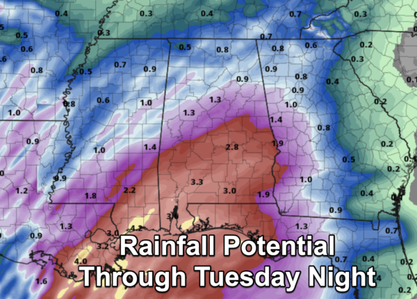
As far as rainfall totals, a nice soaking rain is expected due to the tropical moisture which is associated with the remnants of Sara. For North and Central Alabama rainfall amounts of an inch are expected, while rain amounts in the 2-3 inch range for the southern half of the state.
FEELING LIKE WINTER: The coldest air so far this season arrives Thursday as highs drop into the 50s over the northern half of the state with a brisk north wind. The air will be dry, so expect sunny days, with clear cold nights. Lows will be in the 30s over much of the state by Friday morning. Coldest morning will likely come early Saturday when a freeze is likely for much of North/Central Alabama, mid 30s are likely down into the southern counties along with widespread frost. Expect frost and freeze alerts to be issued later this week.
WEEKEND & BEYOND: Highs remain in the 50s across the northern half of the state Saturday, then rising into the 60s Sunday, it will remain dry with tons of sunshine both days. As we roll into the week of Thanksgiving, for now the weather looks dry Monday and Tuesday, followed by a few waves of rain and possible thunderstorms over the latter half of the week. Highs will be generally in the 60s.
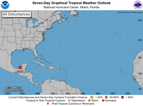
IN THE TROPICS: Sara has dissipated over the Yucatan and it no longer a system. The rest of the Atlantic is quiet with no tropical development expected the next seven days.
WORLD TEMPERATURE EXTREMES: Over the last 24 hours, the highest observation outside the U.S. was 109.8F at Vioolsdrif, South Africa. The lowest observation was -65.2F at Dome A, Antarctica.
CONTIGUOUS TEMPERATURE EXTREMES: Over the last 24 hours, the highest observation was 94F at La Puerta, TX. The lowest observation was 3F at Grand Lake, CO.
Category: Alabama's Weather, ALL POSTS, Social Media
About the Author (Author Profile)
Macon, Georgia Television Chief Meteorologist, Birmingham native, and long time Contributor on AlabamaWX. Stormchaser. I did not choose Weather, it chose Me. College Football Fanatic. @Ryan_StinnetSubscribe
If you enjoyed this article, subscribe to receive more just like it.


