Midday Nowcast: Mild Final Day of 2024; Colder Weather to Start 2025
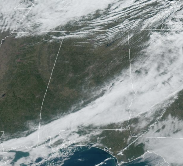
FINAL HOURS OF 2024: Morning clouds have given way to afternoon sunshine across much of Alabama today. Temperatures remain mild with highs today in the low to mid 60s. Ringing in the New Year tonight, expect a few clouds with temperatures falling through the 40s. By first thing tomorrow morning, we will see lows in the 30s.
BIRMINGHAM ALMANAC: For December 31st, the average high for Birmingham is 55° and the average low is 36°. The record high is 79° set in 1951, while the record low is 9° set in 1983. We average 0.16” of precipitation on this date and the record value is 1.70” set in 1973.
HELLO 2025: Behind the front, the New Year will start off colder with a downward temperature trend. Expect dry, sunny, and colder weather for tomorrow through Friday. Highs the next three days will be in the low to mid 50s, while overnight lows will be in the upper 20s and lower 30s.
THE ALABAMA WEEKEND: Saturday will be colder and dry with a high in the upper 40s for our northern counties, while low to mid 50s are expected for the southern counties. Clouds will increase Saturday night, and rain will likely move into the state during the day Sunday. Rain will be widespread Sunday night, but should be ending early Monday. A few thunderstorms could be involved, but for now the air looks too stable for any risk of severe storms. Some stronger storms are likely along the Gulf Coast.
ARCTIC BLAST ON THE WAY: Not much change in the forecast for now as the overall weather pattern for next week becomes very cold as the Arctic floodgates open up and we are likely to see cross polar flow, which will likely lead to our coldest weather in a few years. Highs in the 30s for the northern half of Alabama, with lows potentially in the teens by midweek. We could see a surface low in the Gulf of Mexico, and with cold air in place, this could increase our chance of the “S” word for portions of Alabama. This is entirely possible because this is the set-up we look for to produce snow in the Deep South. As James said this morning, all the players are on the field, but that doesn’t mean it will happen and this remains way too early to call.
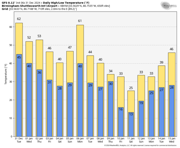
Once this wave of energy passes, the counter-clockwise flow on the backside of the low will pull much colder air down into the Deep South. When looking at model output data for the January 10-12 time frame, lows COULD fall into the single digits over North Alabama, and highs COULD remain below freezing during the afternoons as well. We are all need to be prepared to deal with a couple of week stretch of very cold weather across Alabama. Typically, the mid to late part of January is the coldest period of the year climatologically for Alabama.
WORLD TEMPERATURE EXTREMES: Over the last 24 hours, the highest observation outside the U.S. was 110.8F at Julia Creek, Australia. The lowest observation was -67.4F at Ojmjakon, Russia.
CONTIGUOUS TEMPERATURE EXTREMES: Over the last 24 hours, the highest observation was 99F at Faith Ranch, TX. The lowest observation was -28F at Peter Sinks, UT.
Category: Alabama's Weather, ALL POSTS, Social Media
About the Author (Author Profile)
Macon, Georgia Television Chief Meteorologist, Birmingham native, and long time Contributor on AlabamaWX. Stormchaser. I did not choose Weather, it chose Me. College Football Fanatic. @Ryan_StinnetSubscribe
If you enjoyed this article, subscribe to receive more just like it.


