Cold, Dry Weather Through Thursday; Wintry Precipitation For North AL Friday Morning
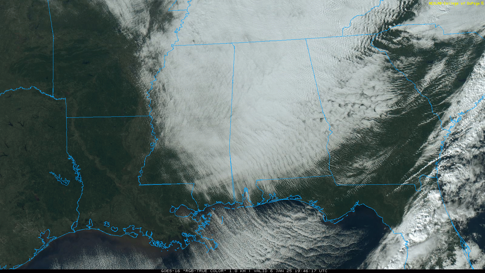
COLD: Snow flurries and showers have ended across Alabama this afternoon, but clouds linger over most of the state. It is a cold, windy afternoon with temperatures ranging from the upper 20s over the northern counties to around 40 degrees near Dothan. Look for clearing tonight with a low in the 20s tomorrow morning; colder spots could visit the teens.
The weather will be cold and dry tomorrow through Thursday with highs in the 35-45 degree range; lows will be mostly in the 20s, but teens are likely over North Alabama early Thursday.
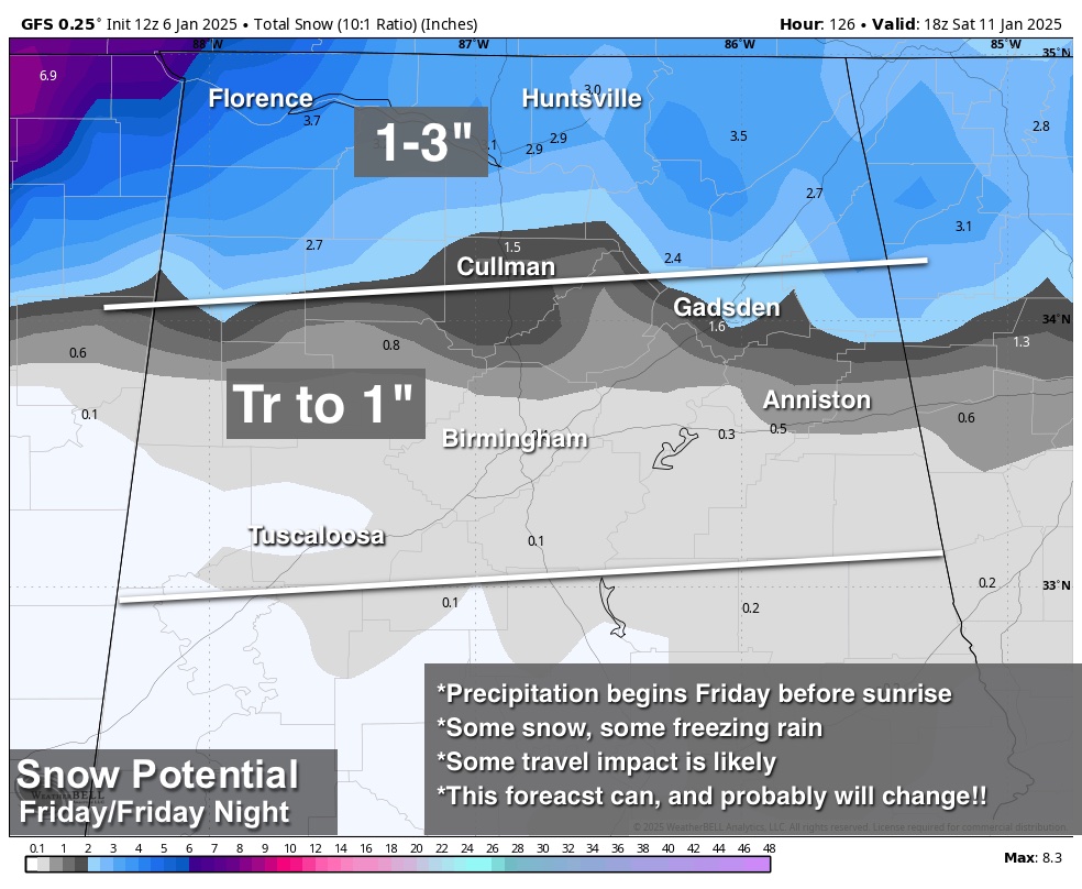
WINTER STORM POTENTIAL: We can now focus on the storm system that has potential to bring wintry precipitation to parts of the Deep South Friday. Here are the highlights as a surface low forms along the Louisiana coast.
*A mix of snow, freezing rain, and possibly some sleet will begin after midnight Thursday night (pre-dawn Friday). Temperatures will be in the 27-32 degree range over the northern half of the state, and some travel impact very possible, if not likely Friday morning.
*For now the greatest threat of icy travel is along and north of a line from Eutaw to Centreville to Sylacauga to Roanoke.
*As temperatures warm, precipitation will change to a cold rain Friday afternoon, although some snow or freezing rain could continue much of the day over the Tennessee Valley/far North Alabama (especially north of the Tennessee River).
*Snow potential for the Tennessee Valley for now is 1-3 inches with lighter amounts to the south (a trace to 1 inch down to I-20). Keep in mind there should be more freezing rain than snow around the I-20 corridor most likely.
*Precipitation ends Friday night, but we should see snow flurries or snow showers on Saturday on the back side of the departing storm system (much like what we experienced today).
*Please understand this forecast is very preliminary, and will probably change as we get closer to the event.
The weather will be dry with temperatures below average from Sunday through the first half next week. See the video briefing for maps, graphics, and more details.
ON THIS DATE IN 1886: The “Great Blizzard of 1886” struck the Midwest with high winds, subzero temperatures, and heavy snowfall. These conditions caused as many as 100 deaths, and 80% of the cattle in Kansas perished.
ON THIS DATE IN 1996: A severe nor’easter paralyzed the East Coast from January 6 to the 8. In Washington D.C., this storm is also known as the “Great Furlough Storm” because it occurred during the 1996 federal government shutdown. Snowfall amounts from this event include 47 inches in Big Meadows, Virginia; 30.7″ in Philadelphia; 27.8″ in Newark; 24.6″ at the Dulles International Airport; 24.2″ in Trenton; 24″ in Providence; 22.5″ in Baltimore; 18.2″ in Boston; 17.1″ in D.C.; and 9.6″ in Pittsburgh.
ON THIS DATE IN 2017: Much of Central Alabama received a mixed bag of wintry weather. This weather ranged from freezing rain to sleet to snow. The heaviest accumulations of sleet and snow occurred mainly near and south the Interstate 20 corridor. The highest amounts were observed in Tuscaloosa and Jefferson Counties, where up to 1.5 inches of sleet and snow fell.
Look for the next video briefing here by 6:00 a.m. tomorrow…
Category: Alabama's Weather, ALL POSTS, Weather Xtreme Videos
About the Author (Author Profile)
James Spann is one of the most recognized and trusted television meteorologists in the industry. He holds the AMS CCM designation and television seals from the AMS and NWA. He is a past winner of the Broadcast Meteorologist of the Year from both professional organizations.Subscribe
If you enjoyed this article, subscribe to receive more just like it.


