Mesoscale Discussion Issued Across South Alabama For Moderate To Heavy Snow This Afternoon
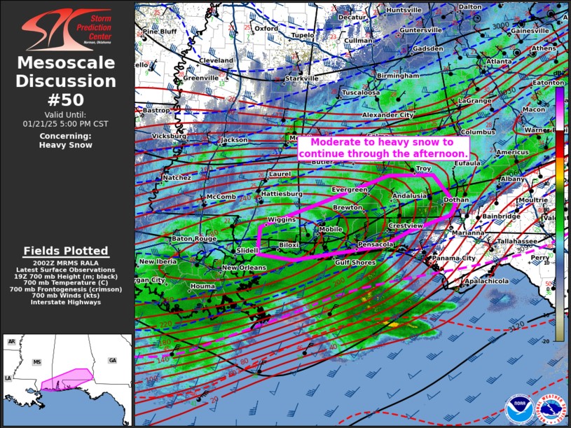
Many of us think of the Storm Prediction Center as meteorologists who only forecast severe weather. But in fact, they also forecast significant winter storms and heavy snow. Currently, they have outlined southern Alabama in a mesoscale discussion showing the area with the most widespread moderate to heavy snow which is expected to continue throughout the afternoon.
Here are the details from SPC:
DISCUSSION...A broad area of snow continues to shift east and
   northeast into portions of southern Alabama and the Florida
   Panhandle from Louisiana/southern Mississippi. Occasional sleet and
   freezing rain reports have occurred across the coast, but the main
   precipitation type has become snow area wide. Enhanced upper-level
   flow and 925-850 mb frontegenetic forcing are aiding in moderate to
   heavy snow production across these regions. Heavy snow observations
   have been reported from Gulfport, MS to Mobile, AL and into portions
   of southeastern Alabama over the last hour with visibility dropping
   to 1/4-1/2 mile. Guidance suggests snowfall rates may occasionally
   approach 1"/hr across southern Alabama near the Florida state line
   over the next 1-3 hours before tapering off later this evening as
   upper-level support shifts northward.
Category: Alabama's Weather, ALL POSTS, Social Media
About the Author (Author Profile)
Jack is a junior at Mississippi State University studying meteorology. He has several years of forecasting experience through a local group of forecasters in Maryland where he resides. Jack plans to become a broadcast meteorologist after graduation.Subscribe
If you enjoyed this article, subscribe to receive more just like it.


