Midday Nowcast: Rain Ending, Clouds Lingering
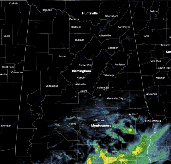
RAIN ENDING: Most of the rain has moved out of North/Central Alabama, with lingering showers across southeastern sections of the state. We do note, there remains some light drizzle and mist, which may not be showing up on the radar, and it is keeping it rather damp and dreary at the midday hours. Highs today are in the low to mid 50s, right where they should be this time of year.

Tonight, the sky will clear as drier air returns to Alabama. Lows tonight will fall into the upper 20s and lower 30s.
BIRMINGHAM ALMANAC: For January 27th, the average high for Birmingham is 55° and the average low is 35°. The record high is 76° set in 1944, while the record low is 1° set in 1940. We average 0.16” of precipitation on this date and the record value is 2.05” set in 1962.
ACROSS THE USA: A storm continues to produce rain and higher-elevation snow over parts of central/southern California through Monday afternoon. This system is also bringing Elevated fire weather conditions over parts of Southwest. Lake-effect snow is expected downwind from the Great Lakes, especially Lake Ontario. A significant winter storm and atmospheric river continue to impact Alaska.
TUESDAY/WEDNESDAY: Tomorrow will be a mostly sunny day with highs in the upper 50s and lower 60s. On Wednesday, highs in the 60s are likely statewide with a mix of sun and clouds. Lows Tuesday night and Wednesday night will be in the 40s.
END OF WEEK: Thursday will be dry and mild with a high in the 60s, but clouds will increase by afternoon, and rain will move into the state Thursday night. Rain will continue into Friday, especially during the morning hours… some thunder is possible but severe storms are not expected. Rain amounts will be in the 1/2 to 1 inch range for most of the state.
WONDERFUL WEEKEND WEATHER: A great weekend of weather is ahead for North/Central Alabama with mostly sunny mild days and clear cool nights; expect highs in the 60s and lows in the 40s. Some places across South Alabama could touch 70° Sunday. The dry and very pleasant weather continues for the first half of the week,
WORLD TEMPERATURE EXTREMES: Over the last 24 hours, the highest observation outside the U.S. was 115.3F at Marree Airport, Australia. The lowest observation was -65.6F at Delyankir, Russia.
CONTIGUOUS TEMPERATURE EXTREMES: Over the last 24 hours, the highest observation was 85F at La Puerta, TX. The lowest observation was -32F at Peter Sinks, UT.
Category: Alabama's Weather, ALL POSTS, Social Media
About the Author (Author Profile)
Macon, Georgia Television Chief Meteorologist, Birmingham native, and long time Contributor on AlabamaWX. Stormchaser. I did not choose Weather, it chose Me. College Football Fanatic. @Ryan_StinnetSubscribe
If you enjoyed this article, subscribe to receive more just like it.


