Radar, Temperature, And Snow Forecast Update
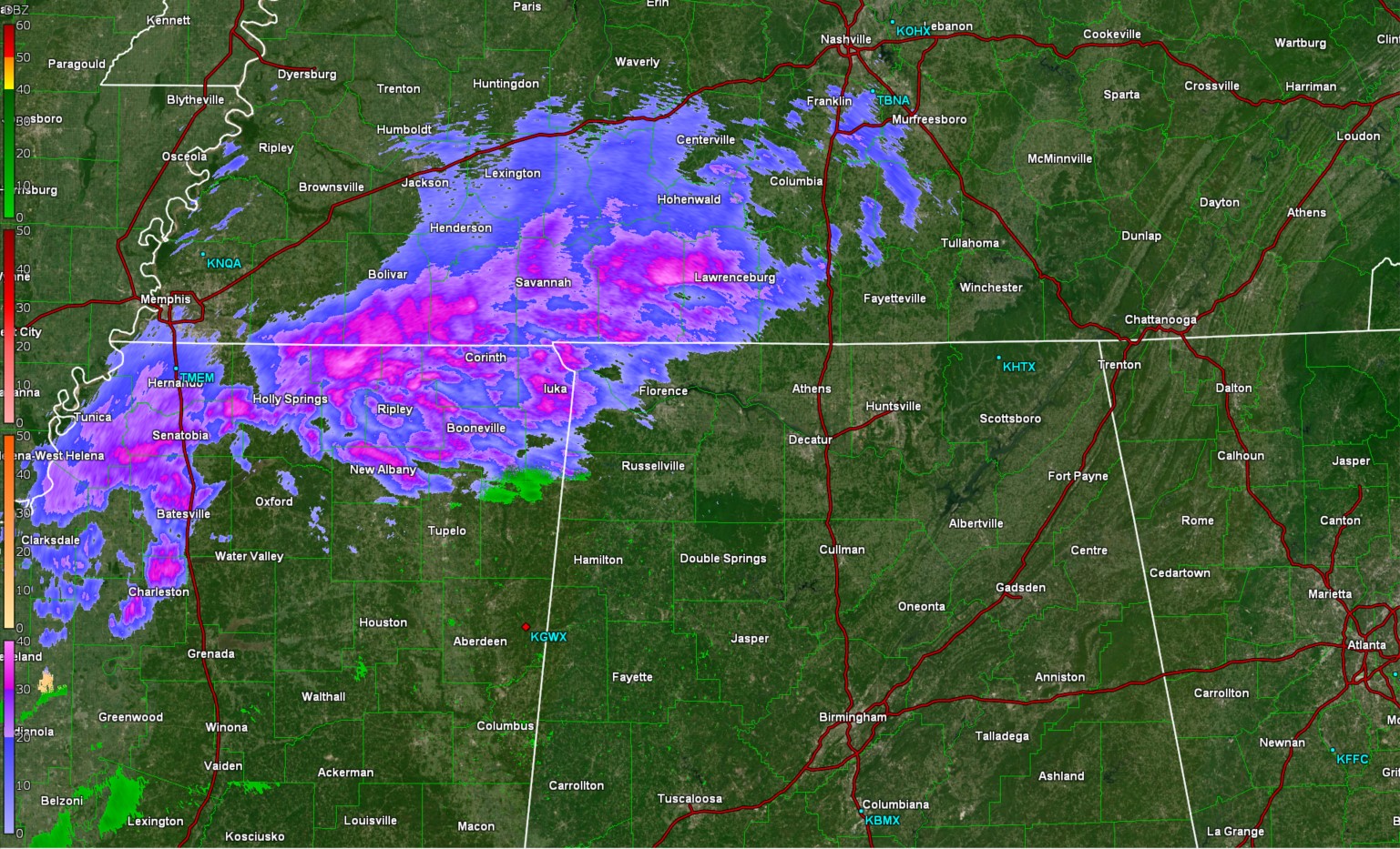
As of 11:00PM, it would appear based on the radar out of Columbus Mississippi that some light wintry precipitation is falling over the northwest corner of Alabama. The air is still fairly dry, so some of this may be evaporating before reaching the surface, but its not out of the question that some of this is making it to the surface in the form of light snow or sleet. This precipitation will overspread extreme northern Alabama overnight tonight.
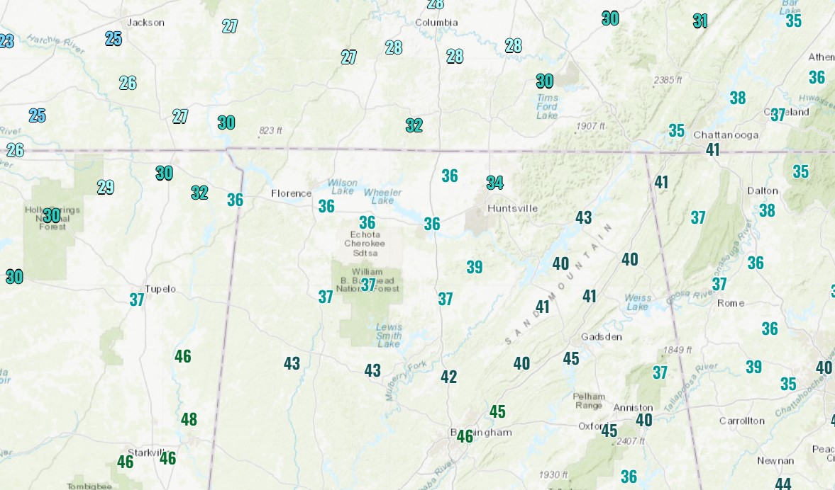
Temperatures are still well above freezing across the area, so its likely that anything that’s falling now is not sticking. However, the colder air is not that far away, with upper 20s already in central TN which has supported several inches of snow accumulation. So, the colder air is coming and will allow for light accumulations tonight into tomorrow morning.
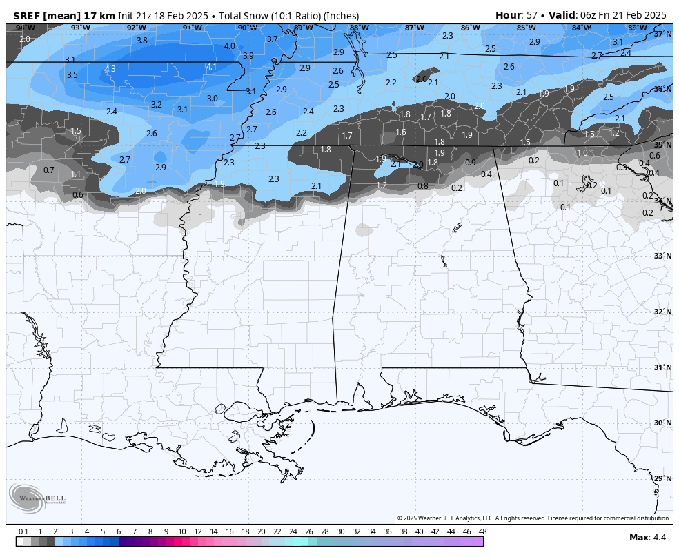
The forecast for snow accumulations remains largely unchanged. Any accumulation is likely to be confined to the far northern part of the state, where a coating-2″ could fall. This could lead to some travel impacts once the temps drop, so please check out the post prior to this which discusses a few winter driving safety tips!
Category: Alabama's Weather, ALL POSTS, Social Media, Winter Weather
About the Author (Author Profile)
Jack is a junior at Mississippi State University studying meteorology. He has several years of forecasting experience through a local group of forecasters in Maryland where he resides. Jack plans to become a broadcast meteorologist after graduation.Subscribe
If you enjoyed this article, subscribe to receive more just like it.


