Alabama Weather Update: Wintry Precipitation over North Mississippi Moving into North Alabama
A powerful Arctic high is located over southern Saskatchewan early on this Wednesday morning. The clockwise flow around this sprawling anticyclone is transporting extremely cold air southward, all the way into South Texas!
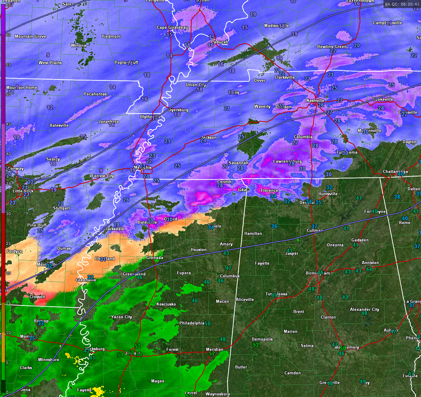
Winds are gusting to 35 mph at Blytheville, AR, Pine Bluff, AR, and Greenville, MS.
Here are current temperatures:
10F at St. Louis
15F at Paducah IL
18F at Dyersburg TN
24F at Memphis International
28F at Corinth MS with light snow
and 34F at Florence here in Alabama
A strong upper trough is swinging eastward as well, and it has spun up a surface low along the Texas coast. This little surface low is spreading moisture along the Gulf Coast. There are even lightning strikes tonight from the Central Louisiana Coast to the New Orleans area with this dynamic system.
Further north, a mix of precipitation is associated with the trough as it moves eastward. Moderate to heavy snow is falling across Kentucky, southern Indiana, southern Illinois, southeastern Missouri, and Arkansas.
There is light unknown precipitation at Greenville, MS, right now, probably sleet and freezing rain, with a temperature of 32F.
It is 30F at Oxford MS. Radar returns in that area are just beginning to reach the ground probably as the column is still overcoming dry air and the evaporating precipitation is moistening the atmosphere.
Radar shows moderate to heavy precipitation in Northwest Alabama’s Colbert and Lauderdale Counties with 34F at Muscle Shoals Airport this hour with a dewpoint of 23F showing there is still dry air to overcome, so the precip is not yet reaching the ground.
Drew Richards reports light freezing rain in Florence with 31F now.
The precipitation will probably begin as sleet and freezing rain. Sleet with help in that it will not produce the glaze of ice we feared.
Haleyville is reporting 36F. Their wetbulb reading is 30F, showing what the air temp will be when the evaporating precip saturates the atmosphere. It will definitely be cold enough for show in the winter weather advisory area of North and North Central Alabama.
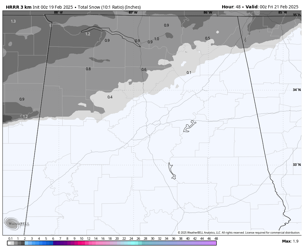
There are latest snow totals over next 48 hours off the HRRR…
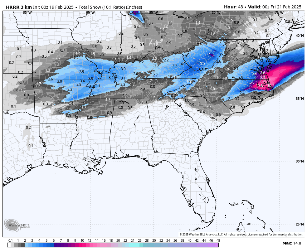
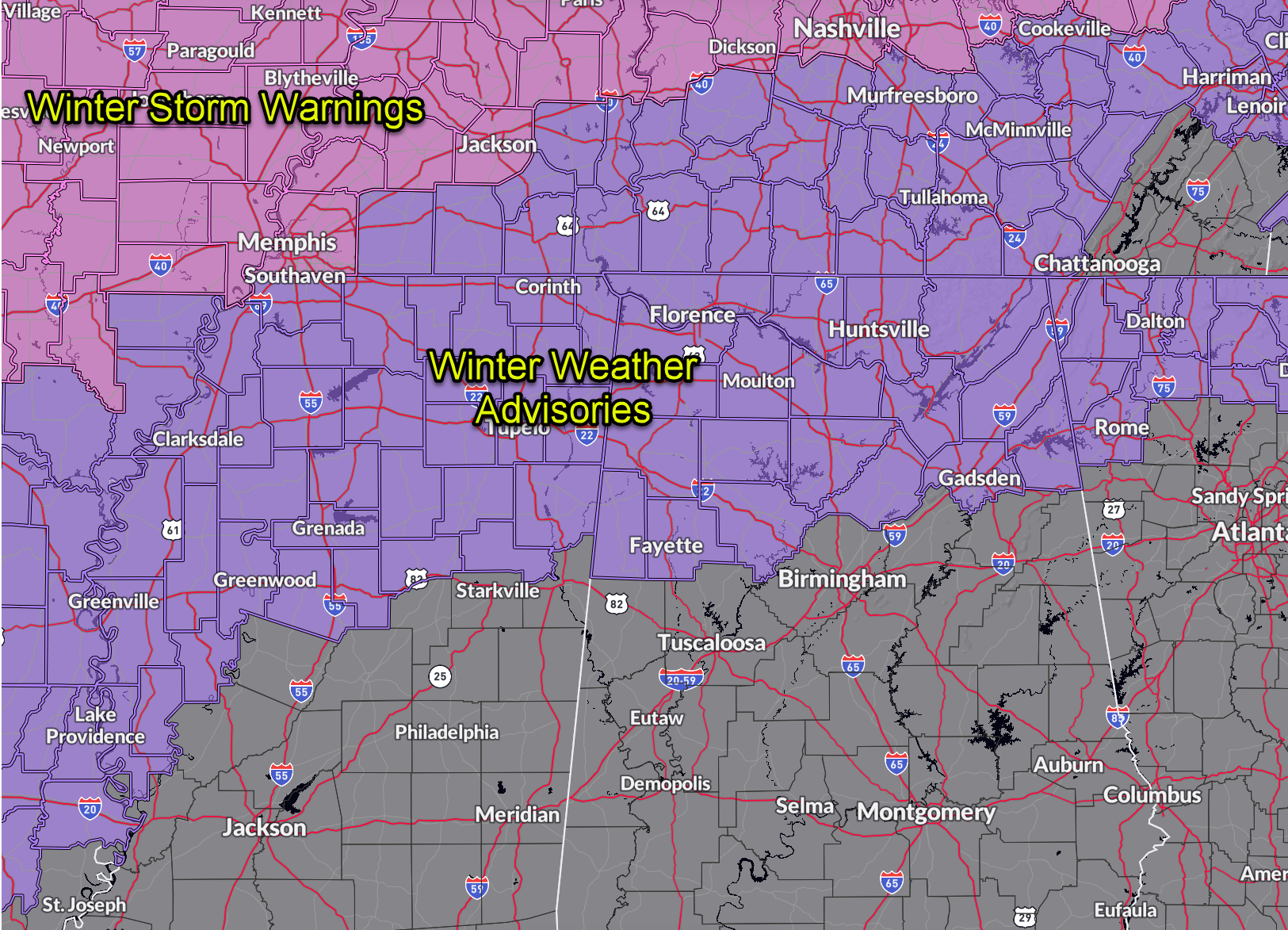
So, not much change in our thinking tonight. Light accumulations of snow over Northwest Alabama and well as the Tennessee Valley.
Still, there could be some local surprises, so everyone in the winter weather advisory areas should check conditions early this morning before venturing out.
We will have the latest here on the blog through the overnight hours into the morning.
Category: Alabama's Weather, ALL POSTS, Social Media, Winter Weather
About the Author (Author Profile)
Bill Murray is the President of The Weather Factory. He is the site's official weather historian and a weekend forecaster. He also anchors the site's severe weather coverage. Bill Murray is the proud holder of National Weather Association Digital Seal #0001 @wxhistorianSubscribe
If you enjoyed this article, subscribe to receive more just like it.


