Severe Thunderstorm Warning Issued for Northwestern AL Counties
A severe thunderstorm warning has been issued including the following Alabama counties: Lauderdale, Colbert, and Franklin. It is in effect until 5pm.
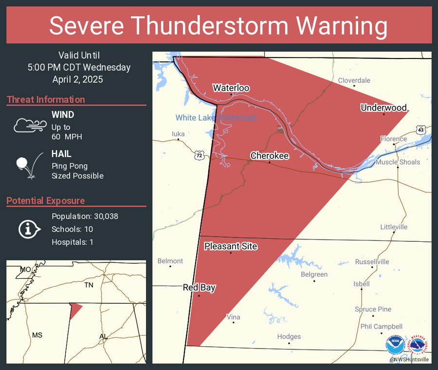
Large hail and damaging winds are expected with this storm. Please take this warning seriously! Here is the full messaging from the NWS:
The National Weather Service in Huntsville Alabama has issued a

* Severe Thunderstorm Warning for...
  Western Lauderdale County in northwestern Alabama...
  Western Colbert County in northwestern Alabama...
  Northwestern Franklin County in northwestern Alabama...

* Until 500 PM CDT.

* At 402 PM CDT, a severe thunderstorm was located near Sandy
  Springs, or 9 miles west of Red Bay, moving northeast at 45 mph.

  HAZARD...Ping pong ball size hail and 60 mph wind gusts.

  SOURCE...Radar indicated.

  IMPACT...People and animals outdoors will be injured. Expect hail
           damage to roofs, siding, windows, and vehicles. Expect
           wind damage to roofs, siding, and trees.

* Locations impacted include...
  Malone, Posey Loop, Allsboro, Riverton, Wright, Oakland, Waterloo,
  Red Rock, Pride Landing, and Underwood-Petersville.

PRECAUTIONARY/PREPAREDNESS ACTIONS...

For your protection move to an interior room on the lowest floor of a
building.
Category: Alabama's Weather, ALL POSTS, Severe Weather, Social Media
About the Author (Author Profile)
Scott is a senior at Mississippi State University studying professional and broadcast meteorology.Subscribe
If you enjoyed this article, subscribe to receive more just like it.


