Midday Nowcast: Some Showers and Storms for Alabama
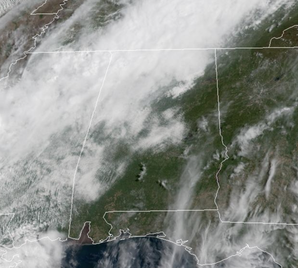
An approaching front from the northwest will stall over Northwest Alabama late today. It is bringing some rain and storms mainly the northern half of the state today, but it will not rain everywhere.
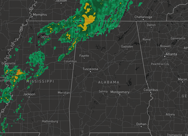
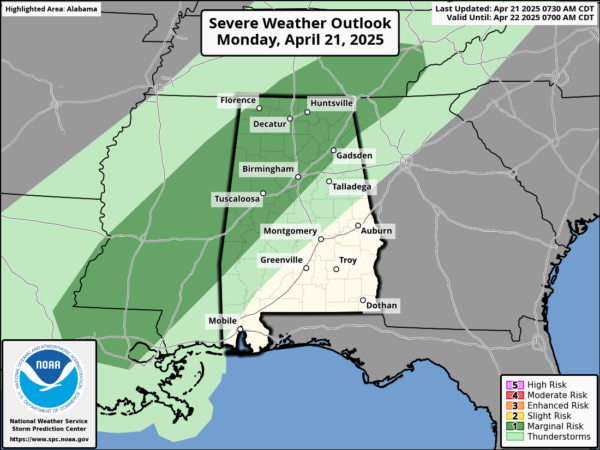
A few storms could be strong, and the SPC has much of North and West Alabama included in a “marginal risk” (level 1 of 5) of severe storms today, but the overall threat is very low with weak wind fields and lack of dynamic support. But a few storms could produce hail and gusty winds. Highs this afternoon are in the 80s.
BIRMINGHAM ALMANAC: For April 21st, the average high for Birmingham is 76° and the average low is 54°. The record high is 92° set in 1987, while the record low is 31° set in 1953. We average 0.16” of precipitation on this date and the record value is 1.70” set in 1928.
ACROSS THE USA: A storm system shifting across the Great Lakes will bring light to moderate snow over parts of region today. Further south, scattered showers and thunderstorms are expected along and ahead of a cold front from Michigan to east Texas. Gusty winds and dry conditions will produce elevated to critical fire weather over the central High Plains today. Red Flag Warnings have been issued.
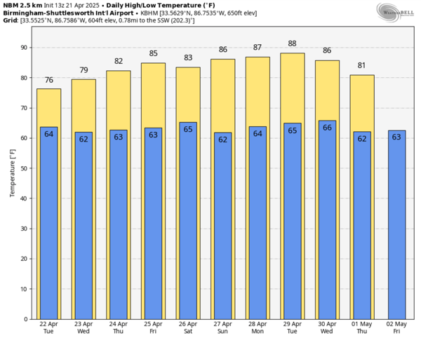
TOMORROW: With the stalled front in place, we will continue to mention the chance of showers and thunderstorms statewide, but the higher rain coverage will remain over the northern counties. Due to clouds and showers, highs tomorrow will hold in the 70s.
REST OF WEEK: The front begins to life northward by midweek and showers and storms become fewer in number with only isolated showers and storms possible on a daily basis. Most of these will occur during the afternoon and evening hours, peak heating of the day, but the chance of any spot seeing rain is less than 20 percent. It will remain warm with temperatures staying above average with highs well into the 80s, and low will be in those soothing 60s. The overall pattern doesn’t change as we roll into the weekend.
RACE WEEKEND: The weather will be warm and mostly dry at Talladega Friday through Sunday. The chance of an afternoon shower is small (20 percent or less), and highs will be in the 80s. Great weather for all the race weekend actives.
WORLD TEMPERATURE EXTREMES: Over the last 24 hours, the highest observation outside the U.S. was 114.1F at Chandrapur, India. The lowest observation was -102.3F at Vostok, Antarctica.
CONTIGUOUS TEMPERATURE EXTREMES: Over the last 24 hours, the highest observation was 93F at Death Valley, CA. The lowest observation was 14F at Angel Fire, NM.
Category: Alabama's Weather, ALL POSTS, Social Media
About the Author (Author Profile)
Macon, Georgia Television Chief Meteorologist, Birmingham native, and long time Contributor on AlabamaWX. Stormchaser. I did not choose Weather, it chose Me. College Football Fanatic. @Ryan_StinnetSubscribe
If you enjoyed this article, subscribe to receive more just like it.


