A Few Showers/Storms Around Through Wednesday; Afternoons Stay Warm
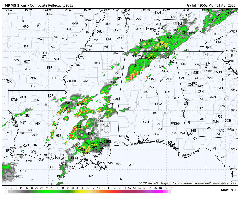
RADAR CHECK: We have scattered showers and thunderstorms across the northern half of Alabama at mid-afternoon, but much of the state is enjoying a partly sunny, warm day with temperatures in the 80s. Showers and storms are most numerous in a broad band from Huntsville to Fayette; they are moving eastward. Showers will fade after sunset, but some rain will remain possible through the night in scattered spots.
REST OF THE WEEK: We will mention the chance of showers and thunderstorms statewide tomorrow as the stalled front stays in place. Higher rain coverage will remain over the northern counties, and some spots will miss the rain completely due to the scattered nature of the showers. Highs drop into the 70s due to cloud cover.
Then, showers become fewer in number over the latter half of the week as the front lifts northward and dissipates. By the time we get to Friday and the weekend most of Alabama will be simply warm and dry with only isolated afternoon showers over the northern third of the state. Temperatures will stay above average with highs in the 80s… lows will be in the 60s.
LONG RANGE: The ridge will likely hold into early May, meaning little if any change of organized severe storms, and highs holding in the 80s. But keep in mind Alabama’s tornado season runs through May, and there is still time for the pattern to break down. We typically get one last set of cool mornings before the long, hot, humid summer settles in. See the video briefing for maps, graphics, and more details.
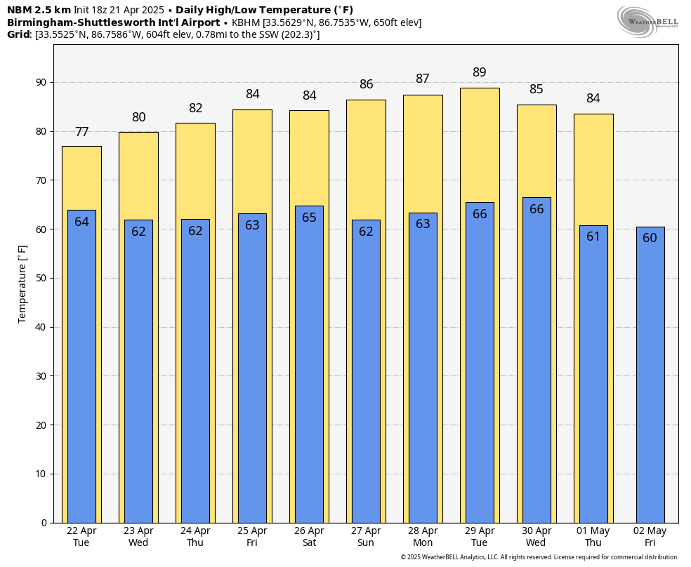
RACE WEEKEND: The weather will be warm and mostly dry at Talladega Friday through Sunday. The chance of an afternoon shower is small (20 percent or less), and highs will be in the 80s.
ON THIS DATE IN 2004: Oklahoma City residents are accustomed to walking outside to find a blanket of white covering the ground. But not in late April on a day which started out with temperatures in the upper 70s. The layer of white was not snow, but rather hail, which fell in prodigious amounts as massive supercell thunderstorms pounded the Oklahoma City metro area. Traffic was snarled on area highways, including I-44, as cars could not drive on roads slick with the ice.
Look for the next video briefing here by 6:00 a.m. tomorrow…
Category: Alabama's Weather, ALL POSTS, Weather Xtreme Videos
About the Author (Author Profile)
James Spann is one of the most recognized and trusted television meteorologists in the industry. He holds the AMS CCM designation and television seals from the AMS and NWA. He is a past winner of the Broadcast Meteorologist of the Year from both professional organizations.Subscribe
If you enjoyed this article, subscribe to receive more just like it.


