Severe Thunderstorms Over Northwest Alabama With Damaging Winds and Hail
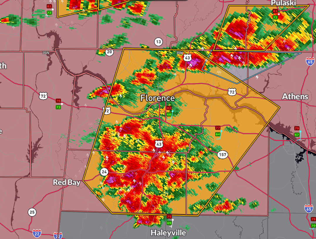
A cluster of severe thunderstorms is moving northeast at 30 mph across Colbert, Franklin, Lawrence, Lauderdale, and west central Limestone counties and will remain a threat until 1:15 PM. At 12:14 PM, radar indicated strong storms from near Tuscumbia to west of Moulton producing wind gusts up to 60 mph and quarter-size hail.
These storms are capable of damaging roofs, siding, trees, and vehicles, and frequent cloud-to-ground lightning is occurring. Areas in the path include Florence, Tuscumbia, Hatton, Oakland, North Courtland, and Posey Loop. Residents should seek shelter in a sturdy building and avoid windows until the storms have safely passed.
Category: Alabama's Weather, ALL POSTS, Severe Weather, Social Media
About the Author (Author Profile)
Bill Murray is the President of The Weather Factory. He is the site's official weather historian and a weekend forecaster. He also anchors the site's severe weather coverage. Bill Murray is the proud holder of National Weather Association Digital Seal #0001 @wxhistorianSubscribe
If you enjoyed this article, subscribe to receive more just like it.


