Severe T-Storm Warning for Jackson Co. Until 5PM
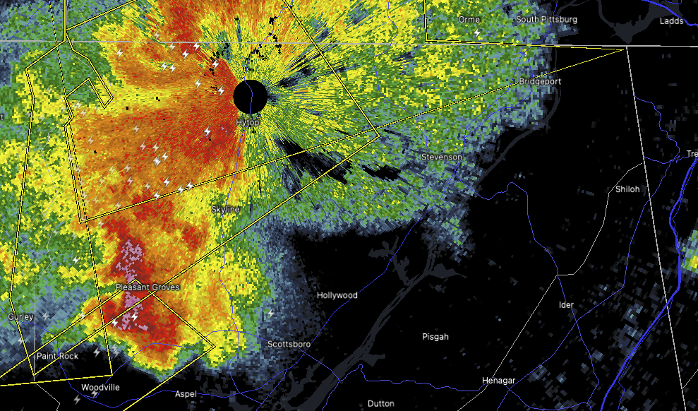
We’ve got yet another storm flaring up this afternoon, and this one is prompting a severe thunderstorm warning for parts of northwestern Jackson County in Alabama and southeastern Franklin County just across the line in Tennessee.
This warning is in effect until 4:30 PM, and as of 3:55 PM, the storm was located about 8 miles north of Skyline — or roughly 18 miles south of Winchester, Tennessee — moving northeast at a brisk 40 miles per hour.
This storm is packing 60 mile per hour wind gusts and is also producing penny-size hail. While that hail isn’t especially large, it can still cause minor damage, and those winds are strong enough to knock down tree limbs, damage roofs and siding, and blow around unsecured outdoor items.
If you’re in or near places like Bass, Francisco, Princeton, Jericho, Russell Cave National Monument, Estillfork, Hytop, Anderson, or Sherwood, go ahead and move to a safe place now. The best protection is an interior room on the lowest level of a sturdy building.
We’ll keep an eye on this storm and bring you updates as needed. Stay weather aware and take these warnings seriously.
Category: Alabama's Weather, ALL POSTS, Severe Weather, Social Media
About the Author (Author Profile)
Scott Martin is an operational meteorologist, professional graphic artist, musician, husband, and father. Not only is Scott a member of the National Weather Association, but he is also the Central Alabama Chapter of the NWA president. Scott is also the co-founder of Racecast Weather, which provides forecasts for many racing series across the USA. He also supplies forecasts for the BassMaster Elite Series events including the BassMaster Classic.Subscribe
If you enjoyed this article, subscribe to receive more just like it.


