Severe T-Storm Warning for Pickens, Tuscaloosa Co. Until 5PM
We’ve got a line of strong storms working their way into west central Alabama this afternoon, and the National Weather Service in Birmingham has issued a severe thunderstorm warning that includes parts of Pickens and Tuscaloosa counties.
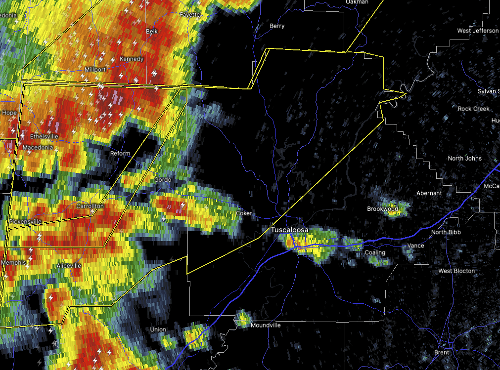
This warning is in effect until 5:00 PM. As of 3:58 PM, radar was tracking a line of severe thunderstorms stretching from near Bankston to Reform and down toward Mashulaville, all pushing east at about 45 miles per hour.
These storms are capable of producing wind gusts up to 60 miles per hour along with quarter-size hail. That’s more than enough to cause damage to cars, trees, and vulnerable structures like roofs and siding.
If you’re in or around Aliceville, Northport, Lake Tuscaloosa, Moores Bridge, Windham Springs, Samantha, or any of the smaller communities like Wiley, Echola, or Memphis, Alabama — now’s the time to head to your safe place. That means the lowest floor of a sturdy home, away from windows.
We’re watching this closely and will bring you more updates as needed. Be sure to stay weather alert and ready to act.
Category: Alabama's Weather, ALL POSTS, Severe Weather, Social Media
About the Author (Author Profile)
Scott Martin is an operational meteorologist, professional graphic artist, musician, husband, and father. Not only is Scott a member of the National Weather Association, but he is also the Central Alabama Chapter of the NWA president. Scott is also the co-founder of Racecast Weather, which provides forecasts for many racing series across the USA. He also supplies forecasts for the BassMaster Elite Series events including the BassMaster Classic.Subscribe
If you enjoyed this article, subscribe to receive more just like it.


