Severe T-Storm Warning for Fayette, Walker, Winston Co. Until 5:45PM
The National Weather Service in Birmingham has issued a Severe Thunderstorm Warning for Walker County in central Alabama, eastern Winston County in northwestern Alabama, and eastern Fayette County in west-central Alabama until 5:45 PM CDT.
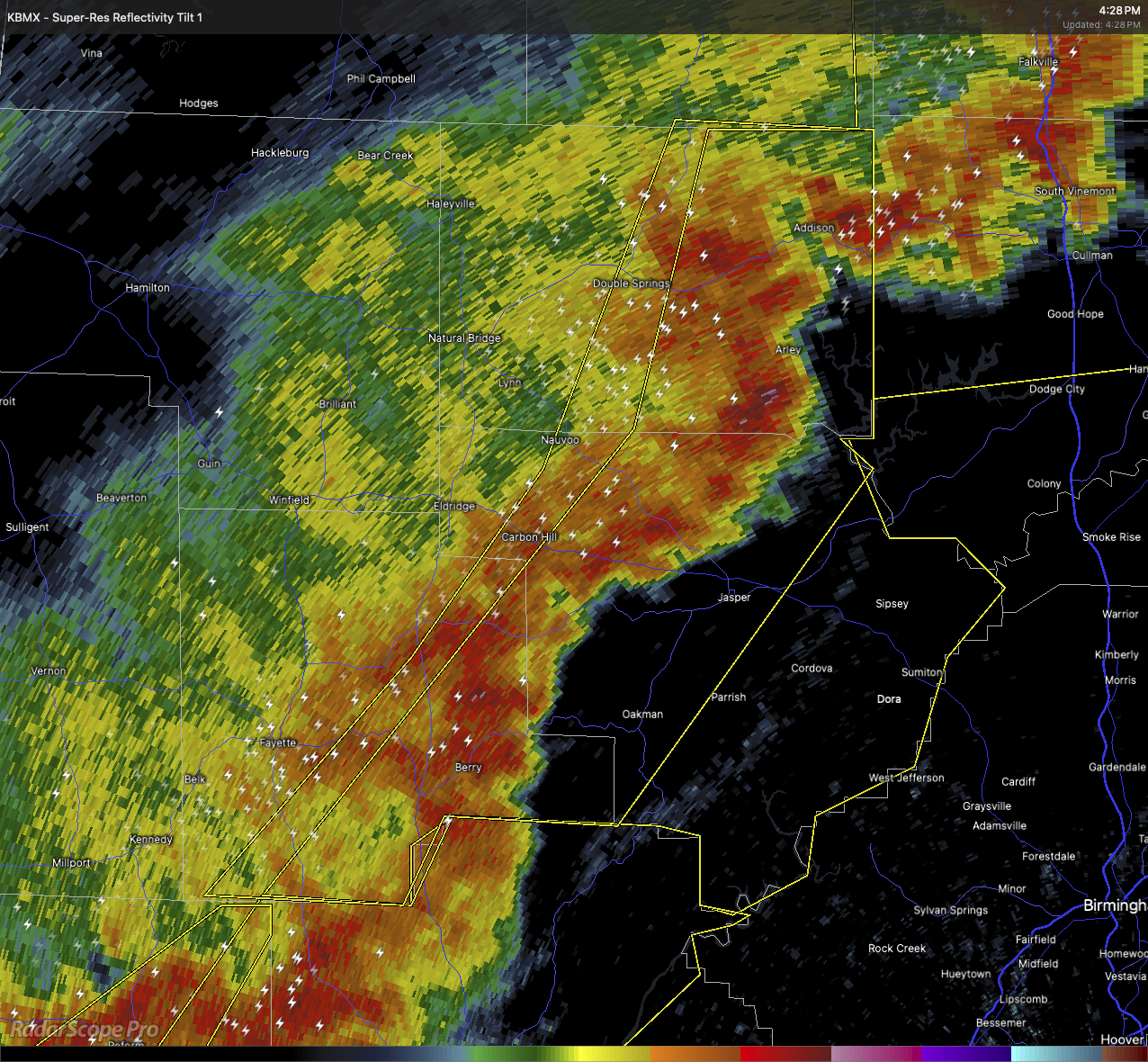
At 4:26 PM, severe thunderstorms were detected along a line extending from near Inmanfield to Curry to 7 miles south of Bankston, moving east at 40 miles per hour. The storm is producing wind gusts up to 60 miles per hour and quarter-sized hail.
Radar indicates that these conditions are likely to cause hail damage to vehicles and wind damage to roofs, siding, and trees.
Affected locations include Curry, Gorgas Steam Plant, Camp McDowell, Mill Branch, Sumiton, Nesmith, Winston County Airport, Cane Creek, Bull Branch, Brushy Lake, Coon Creek, Poplar Springs, Powellville, Corona, Battle Branch, Hidden Cove Campground, Townley, Black Pond, Boley Springs, and Addison Town Hall.
For your safety, move to an interior room on the lowest floor of a building.
Category: Alabama's Weather, ALL POSTS, Severe Weather, Social Media
About the Author (Author Profile)
Scott Martin is an operational meteorologist, professional graphic artist, musician, husband, and father. Not only is Scott a member of the National Weather Association, but he is also the Central Alabama Chapter of the NWA president. Scott is also the co-founder of Racecast Weather, which provides forecasts for many racing series across the USA. He also supplies forecasts for the BassMaster Elite Series events including the BassMaster Classic.Subscribe
If you enjoyed this article, subscribe to receive more just like it.


