Severe T-Storm Warning for DeKalb, Jackson, Madison, Marshall Co. Until 5:30PM
A severe thunderstorm warning has been issued for north central Marshall County, Jackson County, eastern Madison County, northeastern DeKalb County, and southern Franklin County in Middle Tennessee. This warning is in effect until 5:30 PM.
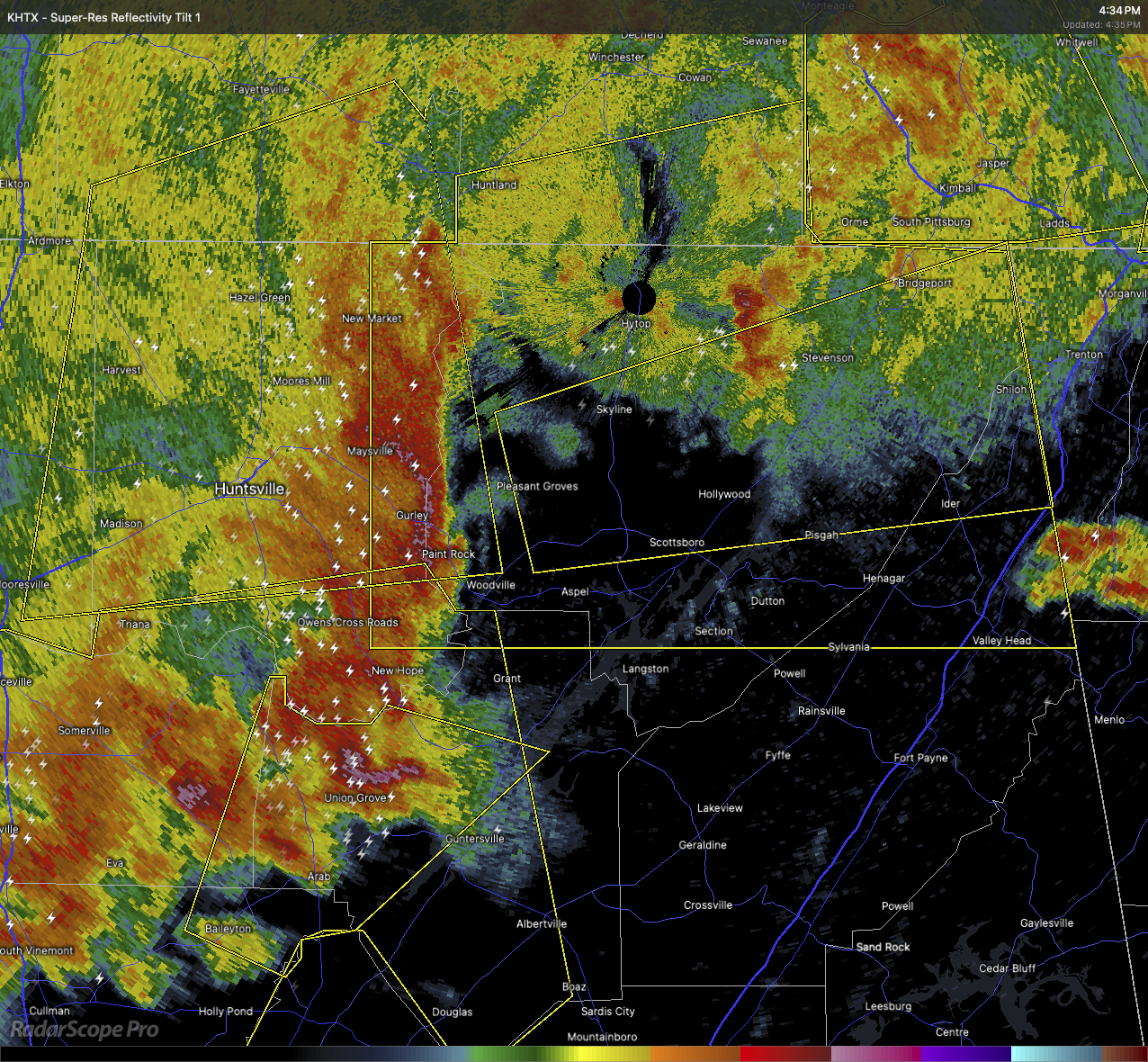
As of 4:34 PM, severe thunderstorms were located along a line extending from 6 miles northeast of New Market to near Owens Cross Roads, moving east at 40 miles per hour. These storms are producing 60 mile per hour wind gusts and quarter-size hail, which could cause damage to vehicles, roofs, siding, and trees.
If you’re in or near Lim Rock, Jericho, Huntland, Higdon, Ider, Larkin, Bridgeport, Francisco, Beans Creek, or Pisgah, take shelter in an interior room on the lowest floor of a sturdy building.
Stay weather-aware as this storm moves through, and be sure to take these warnings seriously.
Category: Alabama's Weather, ALL POSTS, Severe Weather, Social Media
About the Author (Author Profile)
Scott Martin is an operational meteorologist, professional graphic artist, musician, husband, and father. Not only is Scott a member of the National Weather Association, but he is also the Central Alabama Chapter of the NWA president. Scott is also the co-founder of Racecast Weather, which provides forecasts for many racing series across the USA. He also supplies forecasts for the BassMaster Elite Series events including the BassMaster Classic.Subscribe
If you enjoyed this article, subscribe to receive more just like it.


