Severe T-Storm Warning for Blount, Jefferson, Tuscaloosa Co. Until 6PM
The National Weather Service in Birmingham has issued a severe thunderstorm warning for Tuscaloosa, Blount, and Jefferson counties in central and west central Alabama. This warning is in effect until 6:00 PM.
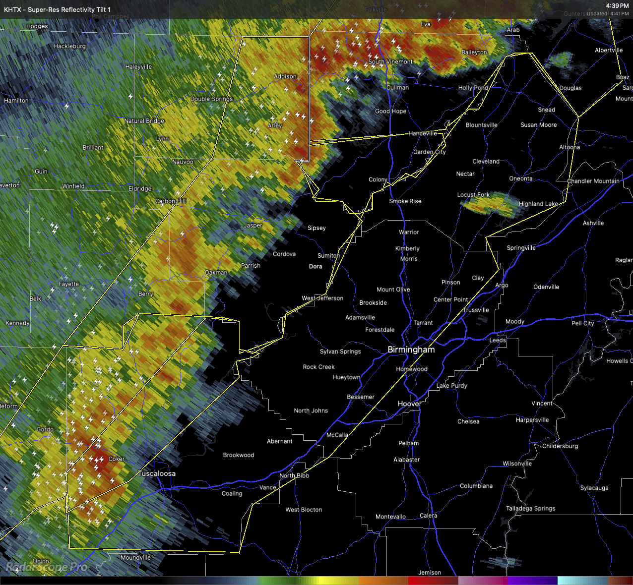
At 4:38 PM, radar showed a line of severe thunderstorms stretching from near Cullman to about 6 miles west of Bankhead Lock and Dam, down to Union. These storms are moving east at around 40 miles per hour. They’re capable of producing wind gusts up to 60 miles per hour and hail up to the size of quarters. That could mean damage to vehicles, as well as potential impacts to roofs, siding, and trees.
Folks in areas like Lake Tuscaloosa, Palmerdale, Englewood, Ralph, Northport, Smoke Rise, Samantha, Brookwood, Mulga, New Castle, Bangor, and parts of Tuscaloosa near McFarland Mall and the regional airport should go ahead and move to a sturdy structure. Be sure to stay away from windows and head to an interior room on the lowest floor of your home or building.
We’ll keep you updated as these storms continue to move through. Stay weather-aware.
Category: Alabama's Weather, ALL POSTS, Severe Weather, Social Media
About the Author (Author Profile)
Scott Martin is an operational meteorologist, professional graphic artist, musician, husband, and father. Not only is Scott a member of the National Weather Association, but he is also the Central Alabama Chapter of the NWA president. Scott is also the co-founder of Racecast Weather, which provides forecasts for many racing series across the USA. He also supplies forecasts for the BassMaster Elite Series events including the BassMaster Classic.Subscribe
If you enjoyed this article, subscribe to receive more just like it.


