Severe T-Storm Warning for DeKalb, Jackson, Marshall Co. Until 5:45PM
The National Weather Service in Huntsville has issued a severe thunderstorm warning for eastern Marshall County, south central Jackson County, and all of DeKalb County in northeastern Alabama. This warning remains in effect until 5:45 PM.
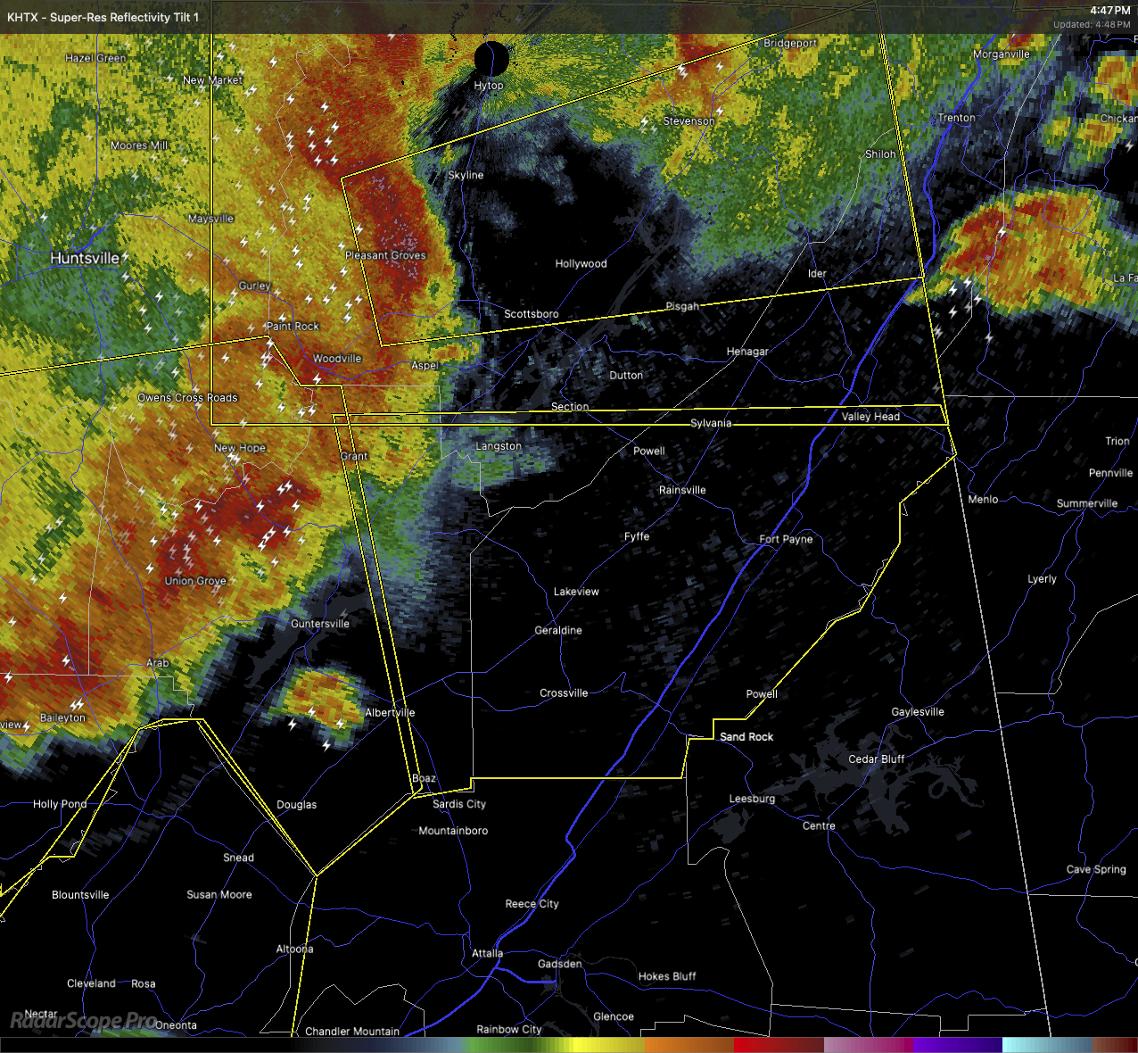
At 4:46 PM, a severe thunderstorm was located near Grant, about 10 miles northeast of Guntersville, and was moving east at 45 miles per hour. This storm is capable of producing wind gusts up to 60 miles per hour and hail up to the size of quarters. Those kinds of winds and hail can certainly cause damage to vehicles, roofs, siding, and trees.
Areas in the path of this storm include Fort Payne, Fyffe, Rainsville, Skirum, Little River Canyon National Preserve, DeSoto State Park, Lake Guntersville State Park, Pine Ridge, Painter, and Peeks Corner. Folks in these locations should seek shelter in a sturdy structure, away from windows, and stay in an interior room on the lowest floor.
Keep an eye on the weather and be ready to take action quickly if conditions worsen.
Category: Alabama's Weather, ALL POSTS, Severe Weather, Social Media
About the Author (Author Profile)
Scott Martin is an operational meteorologist, professional graphic artist, musician, husband, and father. Not only is Scott a member of the National Weather Association, but he is also the Central Alabama Chapter of the NWA president. Scott is also the co-founder of Racecast Weather, which provides forecasts for many racing series across the USA. He also supplies forecasts for the BassMaster Elite Series events including the BassMaster Classic.Subscribe
If you enjoyed this article, subscribe to receive more just like it.


