Severe T-Storm Warning for DeKalb, Jackson Co. Until 5:45PM
Severe thunderstorms continue to push across northeastern Alabama, and a warning is now in effect until 5:45 PM for eastern Jackson County and northeastern DeKalb County.
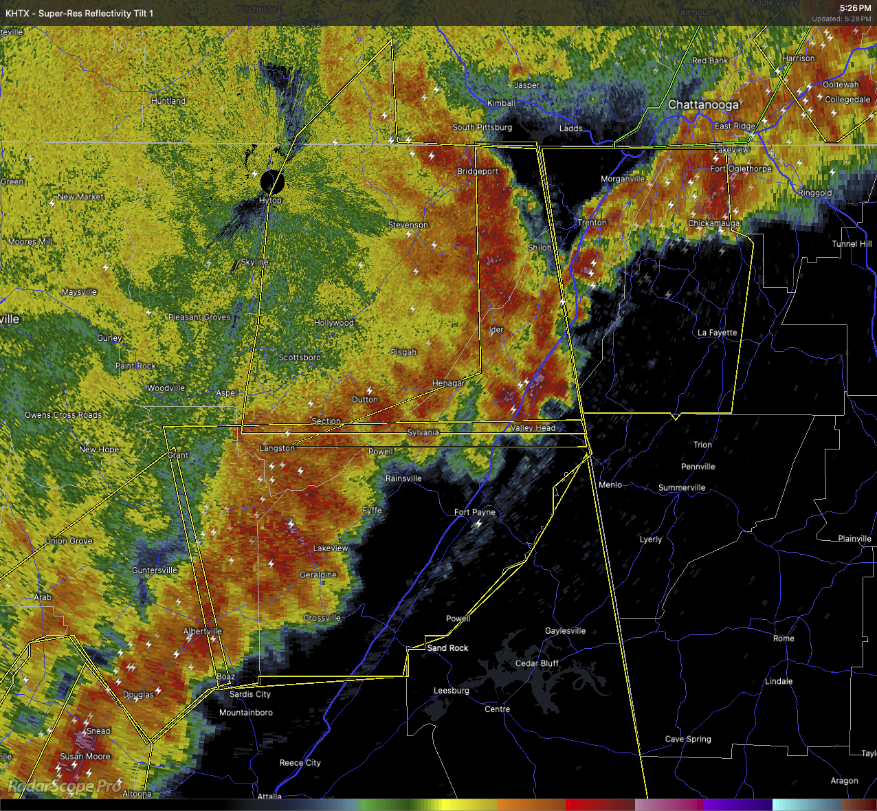
As of 5:26 PM, radar showed a line of storms extending from just northwest of Trenton to southeast of Ider to near Powell, moving quickly east at 50 miles per hour. These storms are capable of producing wind gusts up to 60 miles per hour and hail up to the size of quarters.
Areas likely to be impacted include Bridgeport, Mentone, Long Island, Higdon, Sulpher Springs, Valley Head, Ider, Sylvania, Henagar, and Hammondville. Reports out of Jackson County already indicate downed trees and powerlines, so this line of storms is doing damage.
If you’re in the path, get to shelter immediately—an interior room on the lowest floor of a sturdy building. Avoid windows and do not wait until you see the weather. These storms are moving fast and packing a punch.
Category: Alabama's Weather, ALL POSTS, Severe Weather, Social Media
About the Author (Author Profile)
Scott Martin is an operational meteorologist, professional graphic artist, musician, husband, and father. Not only is Scott a member of the National Weather Association, but he is also the Central Alabama Chapter of the NWA president. Scott is also the co-founder of Racecast Weather, which provides forecasts for many racing series across the USA. He also supplies forecasts for the BassMaster Elite Series events including the BassMaster Classic.Subscribe
If you enjoyed this article, subscribe to receive more just like it.


