Severe Thunderstorm Warning for Portions of Autauga, Elmore, Chilton, and Coosa Counties Until 6:00 PM CDT
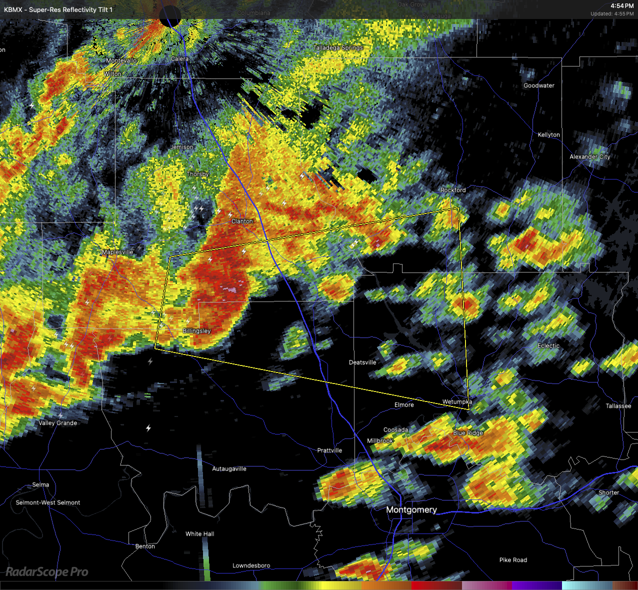
The National Weather Service in Birmingham has issued a Severe Thunderstorm Warning for northeastern Autauga County, northwestern Elmore County, southeastern Chilton County, and southwestern Coosa County, all in central and east central Alabama. At 4:53 PM CDT, a severe thunderstorm was located near Billingsley, or about 9 miles south of Clanton, moving east at 35 miles per hour. This storm is capable of producing wind gusts up to 60 miles per hour and quarter-size hail.
These hazards may result in damage to vehicles, roofs, siding, and trees. Locations in the path of this storm include Wetumpka, Holtville, Deatsville, Titus, Jordan Dam, Mitchell Dam, Jordan Lake, Wallsboro, Weoka Mills, Verbena, Cooper, Billingsley, and nearby communities.
Torrential rainfall is occurring and could lead to flash flooding. Large hail and frequent cloud-to-ground lightning are also occurring with this storm. For your safety, move to an interior room on the lowest floor of a sturdy building. Avoid windows and do not drive through flooded roadways. If you can hear thunder, you are close enough to be struck by lightning—take shelter indoors immediately.
Category: Alabama's Weather, ALL POSTS, Severe Weather, Social Media
About the Author (Author Profile)
Scott Martin is an operational meteorologist, professional graphic artist, musician, husband, and father. Not only is Scott a member of the National Weather Association, but he is also the Central Alabama Chapter of the NWA president. Scott is also the co-founder of Racecast Weather, which provides forecasts for many racing series across the USA. He also supplies forecasts for the BassMaster Elite Series events including the BassMaster Classic.Subscribe
If you enjoyed this article, subscribe to receive more just like it.


