Severe Thunderstorm Warning for Northern Elmore, Southwestern Tallapoosa, and Southeastern Coosa Counties Until 6:30 PM CDT
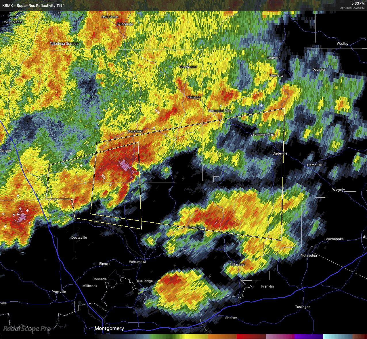
At 5:32 PM CDT, the National Weather Service in Birmingham issued a Severe Thunderstorm Warning for northern Elmore County, southwestern Tallapoosa County, and southeastern Coosa County in east central Alabama. A severe thunderstorm was located over Speed, or about 9 miles west of Equality, moving east at 30 mph.
This storm is capable of producing wind gusts up to 60 mph and hail up to the size of quarters. Radar indicated the threat. Wind damage to roofs, siding, and trees is expected, along with possible hail damage to vehicles.
Locations in the path of this storm include Fishpond, Eclectic, Pentonville, Martin Dam, Cottage Grove, Central, Ray, Dadeville, Titus, Jacksons’ Gap, Dare Park, Welona, Ten Cedar Estates, Nixburg, Southern Lake Martin, Equality, Yates Reservoir, Speed, Eastern Lake Martin, and Susannah Crossing.
For your safety, move to an interior room on the lowest floor of a sturdy building. Avoid windows. If you observe severe weather, report it to your local law enforcement agency so it can be relayed to the National Weather Service in Birmingham.
This storm is also producing frequent cloud-to-ground lightning. Stay indoors. If you can hear thunder, you’re close enough to be struck by lightning.
Category: Alabama's Weather, ALL POSTS, Severe Weather, Social Media
About the Author (Author Profile)
Scott Martin is an operational meteorologist, professional graphic artist, musician, husband, and father. Not only is Scott a member of the National Weather Association, but he is also the Central Alabama Chapter of the NWA president. Scott is also the co-founder of Racecast Weather, which provides forecasts for many racing series across the USA. He also supplies forecasts for the BassMaster Elite Series events including the BassMaster Classic.Subscribe
If you enjoyed this article, subscribe to receive more just like it.


