Severe Thunderstorm Watch Issued for 17 Alabama Counties Until 10 PM CDT
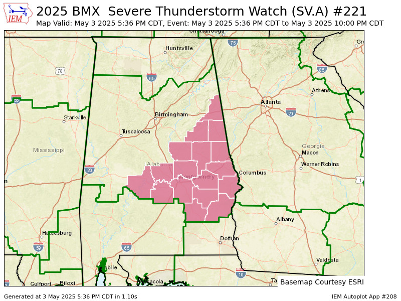
The National Weather Service in Birmingham has issued Severe Thunderstorm Watch 221, effective until 10 PM CDT this evening, Saturday, May 3, 2025. This watch includes 17 counties across central and east-central Alabama.
Counties included:
Autauga, Barbour, Bullock, Chambers, Clay, Cleburne, Coosa, Dallas, Elmore, Lee, Lowndes, Macon, Montgomery, Pike, Randolph, Russell, and Tallapoosa.
Cities impacted include:
Alexander City, Ashland, Auburn, Eufaula, Fort Deposit, Heflin, Lanett, Lineville, Lowndesboro, Millbrook, Montgomery, Opelika, Phenix City, Prattville, Roanoke, Rockford, Selma, Troy, Tuskegee, Union Springs, Valley, and Wetumpka.
Residents in these areas should stay weather-aware and be prepared to take shelter quickly if a warning is issued. Severe thunderstorms may produce damaging wind gusts, large hail, and dangerous lightning.
Category: Alabama's Weather, ALL POSTS, Severe Weather, Social Media
About the Author (Author Profile)
Scott Martin is an operational meteorologist, professional graphic artist, musician, husband, and father. Not only is Scott a member of the National Weather Association, but he is also the Central Alabama Chapter of the NWA president. Scott is also the co-founder of Racecast Weather, which provides forecasts for many racing series across the USA. He also supplies forecasts for the BassMaster Elite Series events including the BassMaster Classic.Subscribe
If you enjoyed this article, subscribe to receive more just like it.


