Severe Thunderstorm Warning for Autauga, Elmore, Northern Lowndes, and Northern Montgomery Counties Until 6:45 PM CDT
The National Weather Service in Birmingham has issued a Severe Thunderstorm Warning effective until 6:45 PM CDT for Autauga County in central Alabama, Elmore County in east central Alabama, as well as northern portions of Lowndes and Montgomery counties in south central Alabama.
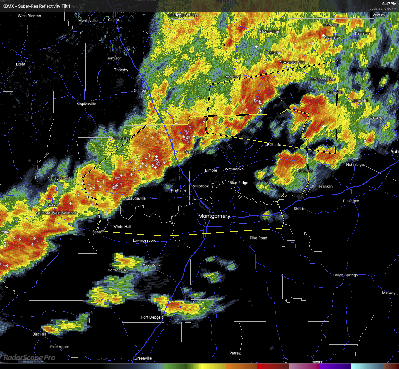
At 5:49 PM CDT, radar indicated a line of severe thunderstorms extending from near Marbury to Selmont-West Selmont, moving east at 35 mph. These storms are capable of producing wind gusts up to 60 mph and quarter-size hail.
Impacts:
Expect hail damage to vehicles. Wind damage to roofs, siding, and trees is also likely.
Locations in the path include:
Santuck, Auburn University in Montgomery, Millbrook, the Robert F. Henry Lock and Dam, Central, Tallassee, Autauga County Airport, Titus, Woodcrest, Wallsboro, Ten Cedar Estates, Waugh, Dexter, Lagoon Park, Yates Reservoir, Mulberry, Hunter, Marbury, Alabama State University, and Montgomery.
Safety Information:
Move to an interior room on the lowest floor of a sturdy building. Avoid windows. Large hail, damaging winds, and dangerous lightning are occurring with these storms. If you can hear thunder, you’re close enough to be struck.
Torrential rainfall may also cause flash flooding. Never drive through flooded roadways.
Category: Alabama's Weather, ALL POSTS, Severe Weather, Social Media
About the Author (Author Profile)
Scott Martin is an operational meteorologist, professional graphic artist, musician, husband, and father. Not only is Scott a member of the National Weather Association, but he is also the Central Alabama Chapter of the NWA president. Scott is also the co-founder of Racecast Weather, which provides forecasts for many racing series across the USA. He also supplies forecasts for the BassMaster Elite Series events including the BassMaster Classic.Subscribe
If you enjoyed this article, subscribe to receive more just like it.


